Wrights Range Rear, PE 
Select a photograph to view a photo gallery

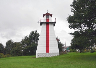

Photo Gallery
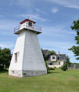

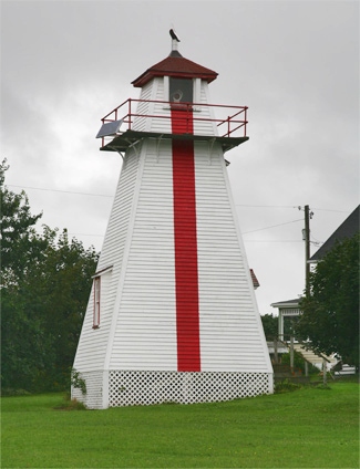

Photo Gallery
Photo Gallery
|
To enter Crapaud (Victoria) Harbour from the Strait of Northumberland, vessels should bring the two old lights (which will be known hereafter as Leards range, and which are both fixed white) into alignment and kept them in one on a north course until the lights of Wrights range are in alignment when they should follow this range N.W. ¼ N. until the red light on Palmers wharf is in alignment with the front light on Leards range. These two in one will lead in from the black buoy at the entrance to the dredged cut, to the wharfs, N. N. E., but strangers entering at night are advised to anchor in the road at this last described turning point near the black buoy, as they will be in good anchorage inside the shelter of Tryon shoals, while it is not safe to attempt the dredged cut at night.
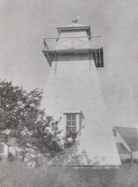
When first activated on June 15, 1894, the Wrights Range Front Light was located on the south side of Paul Bluff and consisted of a mast mounted atop a square tower having a shed roof. A triangular slatted beacon atop the mast housed a lantern that showed a fixed red light at an elevation of 9.2 metres (30 feet) above high water. The original Wrights Rear Range Light was located in the corner of an orchard on Charles L. Wrights farm, 45.7 metres (150 feet) south of his house. The structure for the rear light was a square, open-framed, wooden tower whose seaward face was slatted, painted white, and surmounted by a red lantern. The tower was 8.2 metres (27 feet) tall and displayed a fixed red catoptric light.
Charles L. Wright was appointed keeper of his namesake lights on June 14, 1894, was paid $20 for the land on which the rear light stood, and received an annual salary of $100. He served through 1935 and was succeeded by his son, Charles Evan Wright, who was keeper until 1959.
The present Wrights Front Rage Light, a white, square, pyramidal tower that stands 3.7 metres (12.1 feet) tall, replaced the original structure in 1903. A red light that produces a 0.5-second flash every second is displayed from a window near the top of the seaward face of this tower. The rear tower has been enclosed, is located 694.8 metres (2,280 feet) from the front range, and displays a two-second, red flash every four seconds. The Coast Guard deactivated Wrights Range in 2011. Note that the red range light on the rear tower has been removed.
Victoria Seaport Museum Inc. has submitted a petition for ownership of the lighthouse under the Parks Canada Heritage Lighthouse Program.
Keepers: Charles L. Wright (1894 1935), Charles Evan Wright (1935 1959), Edward H. Boswell (1959), Bryce Boswell (1959).
References