Sea Girt, NJ 


Select a photograph to view a photo gallery

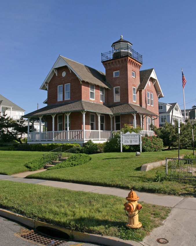
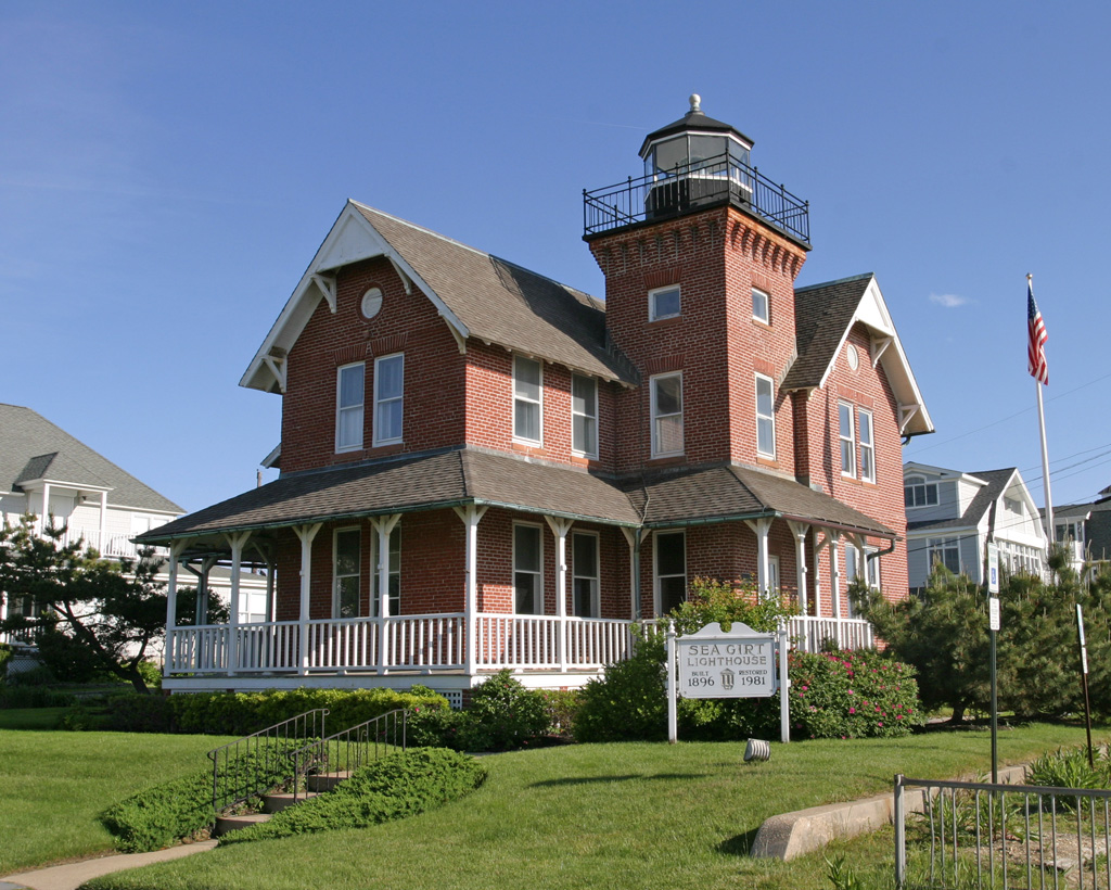
Photo Gallery
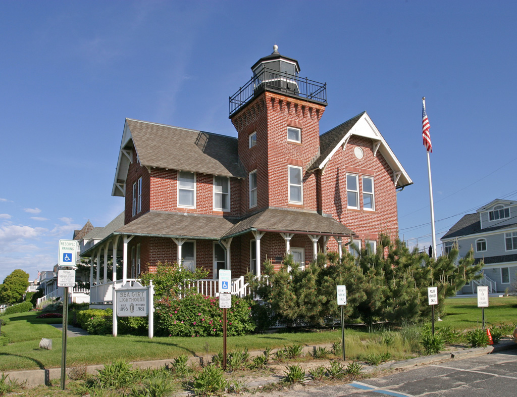


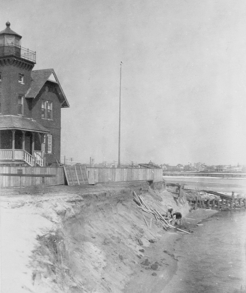


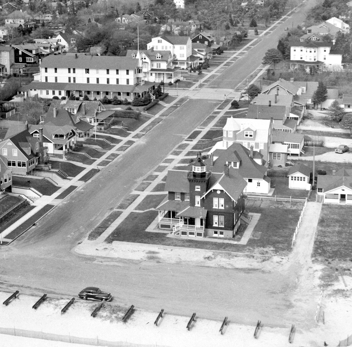
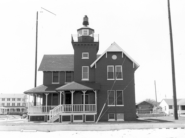

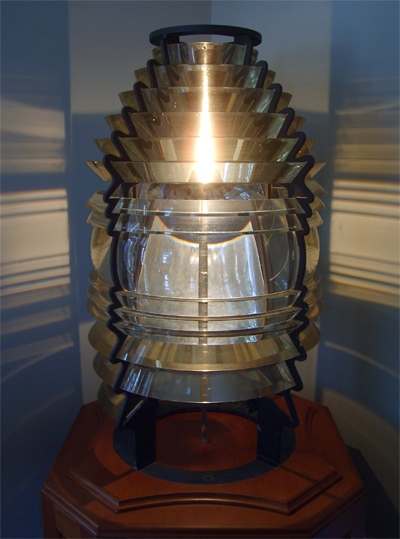
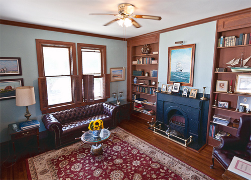
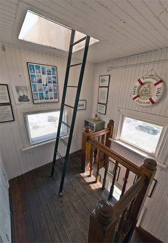

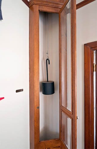
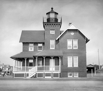
Photo Gallery
Photo Gallery
|
The distance between Barnegat and Navesink lights is 38 ¼ miles. In good weather, at the extreme limit of visibility of the lights, both can be in sight only when close in to the beach. In hazy weather there will practically be a dark space between them. In view of the immense quantity of commerce passing both ways in this vicinity, this dark space should be lighted and vessels off-shore should be enabled, when nearing the port of New York, to fix their positions by cross-bearings. These conditions can be had by establishing the proposed light. It is therefore recommended that a light be established at or near a point about midway between Barnegat and Navesink light-stations, and it is estimated that this can be done for $20,000 which amount it is recommended be appropriated for that purpose.
Situated nineteen miles south of Navesink and twenty-six miles north of Barnegat, Sea Girt was an ideal candidate. In addition, Manasquan (Squan) Inlet was considered the best harbor of refuge in the area, which further bolstered the need for a light. Congress agreed with the boards request and appropriated the necessary funds in 1889.
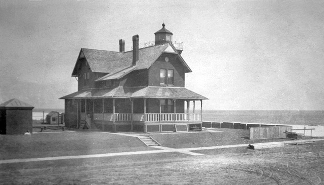
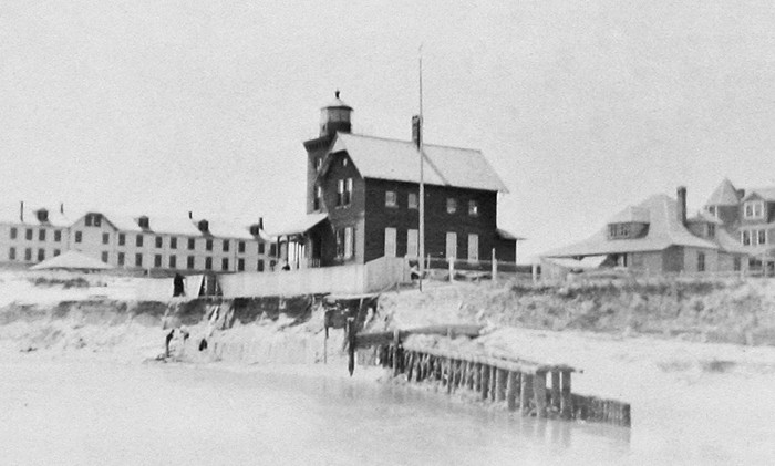
A site close to Manasquan Inlet was selected for the lighthouse, but before the transaction was closed the location was deemed unfit for the purpose. Acreage just south of Wreck Pond was examined next, and a deed for the property was signed on July 29, 1895. Work on Sea Girt Lighthouse, known as Squan Inlet Lighthouse until April 1897, was carried out over the next year. The dwelling was an L-shaped, redbrick Victorian structure with an attached tower that rose just above the roofline. A fourth-order Fresnel lens, crafted in France, was placed in the lantern room, and the light was activated on December 10, 1896. The revolving lens produced a flashing red light that filled the dark void between the lights of Navesink and Barnegat. Sea Girt Lighthouse would be the last lighthouse built on the Atlantic Coast to feature a tower and dwelling integrated into one structure. Besides a residence, the keeper was provided a well, a windmill, and an oil house.
The first keeper assigned to Sea Girt was Abraham Wolf, described by a later keeper as a convivial soul. This attribute served him well during the Civil War, when, as a Union officer, he would don a grey uniform, and with his best imitation of a southern drawl would go undercover amongst captured Confederate soldiers to learn of the enemys positions and battle plans. Keeper Wolf had previously been in charge of Absecon Lighthouse for twenty-three years and retired at Sea Girt in 1902.
|
By 1906, Sea Girt Inlet, the point at which Wreck Pond met the Atlantic, had migrated south and threatened the northeast corner of the lighthouse reservation. Sand bags were stored at the lighthouse in case temporary revetments had to be made, and in 1907, a short pile jetty was built to protect the station. Matters became more dire in 1915, and additional protection work was built at a cost of $4,771.
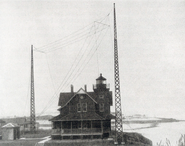
In May 1921, Sea Girt Lighthouse became the first shore-based station to be outfitted with towers for transmitting a radio signal. The beacon at Sea Girt functioned as part of a network that included the Fire Island and Ambrose Lightships. Francis Collins described this navigational radio system, a precursor of Loran and GPS, in his book Sentinels Along Our Coast:
The system of radio signals is surprisingly simple. They are flashed far out to sea from three stations in the vicinity of the entrance to New York Harbor, each being distinctive so that it can be instantly identified. One of the sending stations is aboard the Ambrose Light-ship directly before the entrance of the harbor. A second station is located at Sea Girt on the New Jersey coast, about thirty miles to the south. The third station is aboard the Fire Island Light-ship, about thirty miles east of the Ambrose Light-ship, off the south shore of Long Island. The signals thrown out from Sea Girt have a range of two hundred miles, while the other two stations can be clearly heard forty miles away. Even the speediest liners therefore can pick up the radio signals several hours sail from the harbor entrance. The radio compass signals are distinctive, so that they cannot by any chance be confused with the sending of other shore or ship stations. The Ambrose Channel Light-ship sends out a series of signal dashes continuously for twenty seconds, and then remains silent for twenty seconds. The signal of the Fire Island Light-ship station is a series of double dashes continued for twenty-five seconds, followed by a silence of the same duration. The Sea Girt station throws out a series of triple dashes, for sixty seconds, and then remains silent for six minutes. By listening in on these three signals it is possible to lay the ships course with amazing accuracy. The new system has the great advantage of being both simple and inexpensive.
The Lighthouse Service clearly stated the advantages of the radio signals: This system should give to the navigator for the first time a means of taking in a fog, or time of low visibility, accurate bearings of invisible lighthouses and light vessels, which he may use in locating or steering his vessels, and he should be able to do this independently as he uses his magnetic compass for bearings on visible objects. When developed and its use extended, radio fog signals and the radio compass will probably be the greatest advance made in a long period in affording protection to vessels in fog and should be the means of avoiding some of the serious marine disasters now due to inability to hear or locate a fog signal under unfavorable conditions.
|
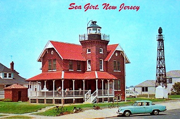
A modern beacon was placed atop the lantern room following the war and served as the light until it was replaced by a light shown from a metal tower erected on the stations lawn in 1955. Not wanting to pay for maintenance of the structure, the Coast Guard offered the lighthouse to the State of New Jersey. When the state declined, the Borough Council of Sea Girt informed the General Services Administration of their interest in the property, and Sea Girt Lighthouse was sold to the borough on August 10, 1956 for $11,000. Over the next two decades, the lighthouse served as the Sea Girt Library and a meeting place for various clubs and organizations.
After years of heavy use, the lighthouse was in need of costly repairs. The borough council considered selling the property rather than fund the necessary work, but concerned citizens convinced the council to retain the historic lighthouse. In 1981, Sea Girt Lighthouse Citizens Committee Inc. was formed and granted a twenty-five year lease for the cost of $1 per year.
The committee succeeded in raising funds to restore the attractive lighthouse, and it continues to serve not just as an historic attraction, but as a multi-purpose center for the community. Tours are offered to the public on Sundays. School children take educational field trips to the lighthouse, and during an average month, over twenty different events are held at the lighthouse. In 2002, a fourth-order Fresnel lens formerly used in Crowdy Head Lighthouse in Australia was purchased on eBay for $20,000 and is now on display at Sea Girt Lighthouse. The committees untiring efforts have been rewarded with an extension of their lease through 2056.
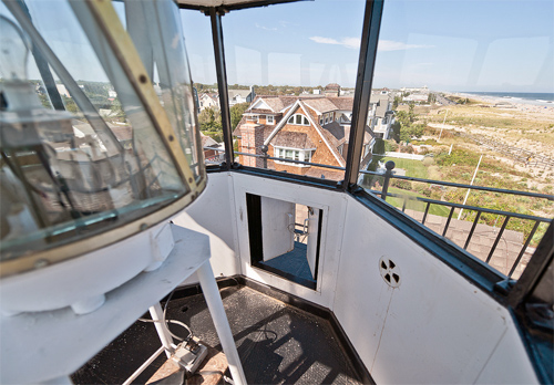
Here are a few contributed interior views of the lighthouse: living room, watch room, lantern room, weight shaft.
Keepers: Abraham G. Wolf (1896 1902), Abram L. Yates (1902 1910), Harriet W. Yates (1910), John L. Hawkey (1910 1917), William H. H. Lake, Jr. (1917 1931), George J. Thomas (1931 1941).
References


