Chambly Basin Range, PQ 
Select a photograph to view a photo gallery
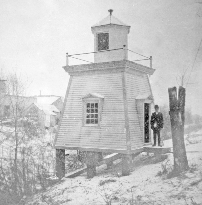

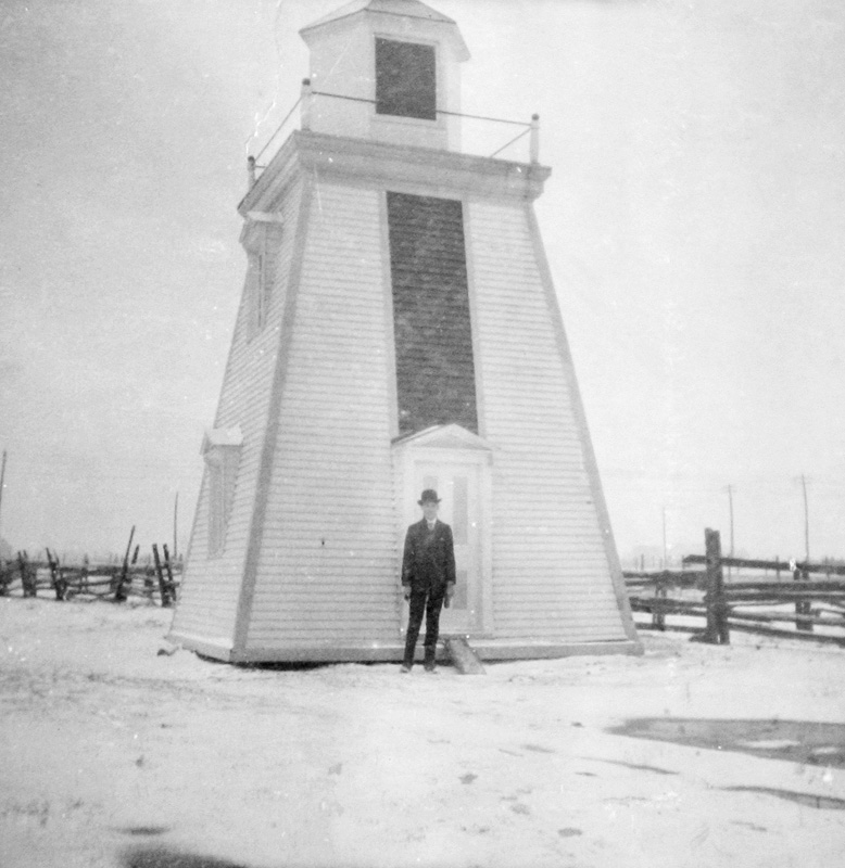
Photo Gallery

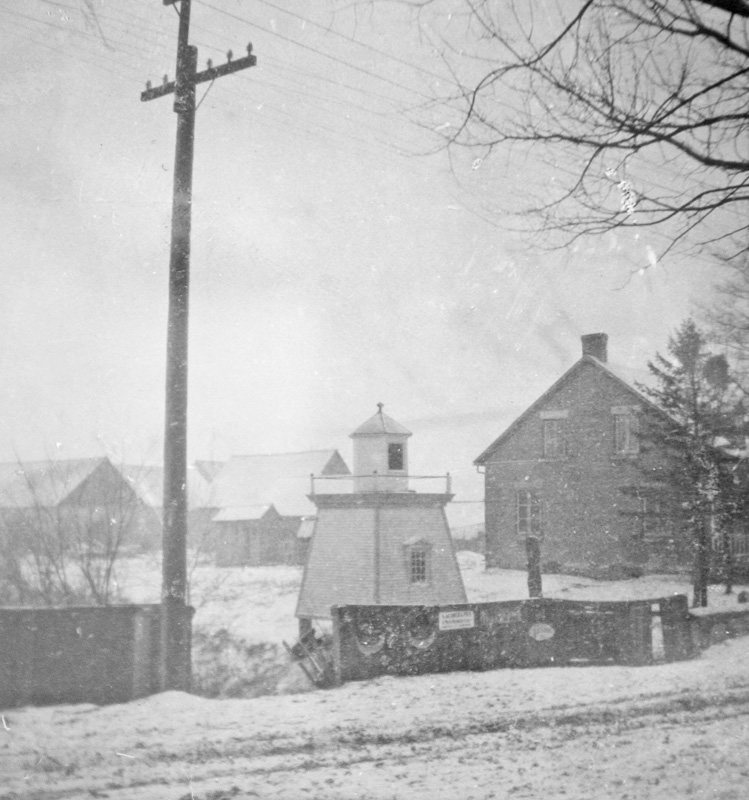

Photo Gallery
Photo Gallery
In 1884, the Annual Report of the Minister of Railways and Canals noted that five lighthouses had been built: One of them was on the end of the pier at the lower entrance to the canal, and the others were range lights, two at Chambly Canton and two at the village of Chambly Basin.
At the time the range lights were built, Chambly Basin was a village on the west side of the northern entrance to Chambly Canal, and Chambly Canton, located just one mile away, was situated on the east side of the canal, between Chambly Canal and Richelieu River.
Land for the range lights at Chambly Canton was acquired from Joseph Malo and included land that ensured the view of the range lights could be maintained.
The Department of Railways and Canals operated these two sets of range lighthouses until the Department of Marine assumed responsibility for them in 1907. At that time, Joseph de Senneville was keeper of Chambly Basin Range and Joseph Savage was keeper of Chambly Canton Range.
Notice of the change in responsibility for the lights was published in a Notice to Mariners in 1907 along with the following description of the Chambly Basin Range Lights:
Chambly Basin Range The front lighthouse stands at the southwestern end of Chambly Basin, 265 feet back from the shore.Mariners were told that in going up the river Chambly Canton Range should be brought in one at St. Matthias, and kept on to the intersection of their alignment with that of Chambly Basin Range, which leads to the Canal Entrance, which was indicated by a wharf light, a light on a poled, at Chambly.The lighthouse is a wooden building, square in plan, with sloping sides, surmounted by a hexagonal wooden lantern, the whole painted white. The height of the building from its base to the top of the ventilator on the lantern is 20 feet.
The light is a fixed red light, and should be visible 2 miles in the line of range. The illuminating apparatus is catoptric.
The back lighthouse stands 363 feet S. 39° 38 W. from the front one. It is a wooden building, square in plan, with sloping sides, painted white with a black vertical stripe on the side facing the alignment, and is surmounted by a hexagonal wooden lantern painted white. The building is 26 feet high from its base to the top of the ventilator on the lantern.
The light is a fixed red light, and should be visible 2 miles in the line of range. The illuminating apparatus is catoptric.
In 1921, Chambly Basin Front Range Light was reconstructed.
In 2021, only a small light on the approach wharf marked the northern entrance to Chambly Canal from Chambly Basin.
Keepers: Joseph de Senneville (1907 1916), D. Lajeunesse (1916 at least 1923).
References