Oak Point Range, PQ 
Select a photograph to view a photo gallery

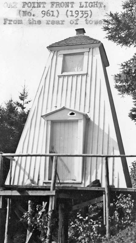
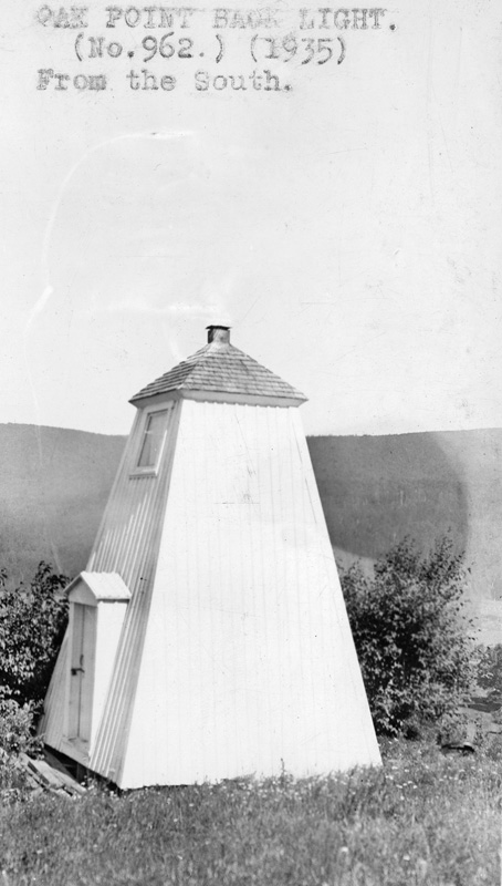
Photo Gallery
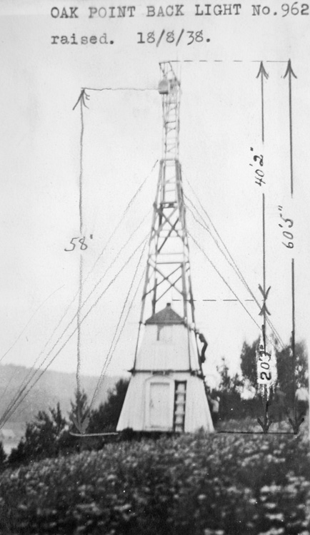


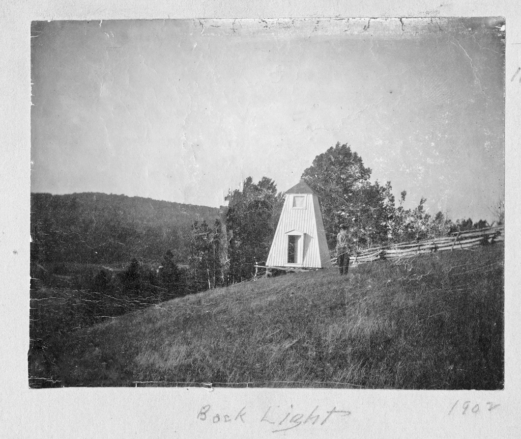
Photo Gallery
Photo Gallery
In 1880, beacon lights were established at Oak Point on the northern side of Restigouche River and Matthew Geraghty was appointed their keeper at an annual salary of $100. Peter Naduux of Dalhousie received a $762 contract to erect six small, square towers, twenty-two feet in height along Restigouche River in 1879. Two of the towers, which displayed fixed white catoptric lights, were placed at Campbellton, two at Dalhousie, and two at Oak Point. Oak Point Range Lights were in operation for nearly a decade before the Department of Marine decided to discontinue them from November 1, 1889.
After the lights had been out of service for just over a decade, the following Notice to Mariners advertised the reestablishment of the lights to accommodate an increase of shipping using Restigouche River:
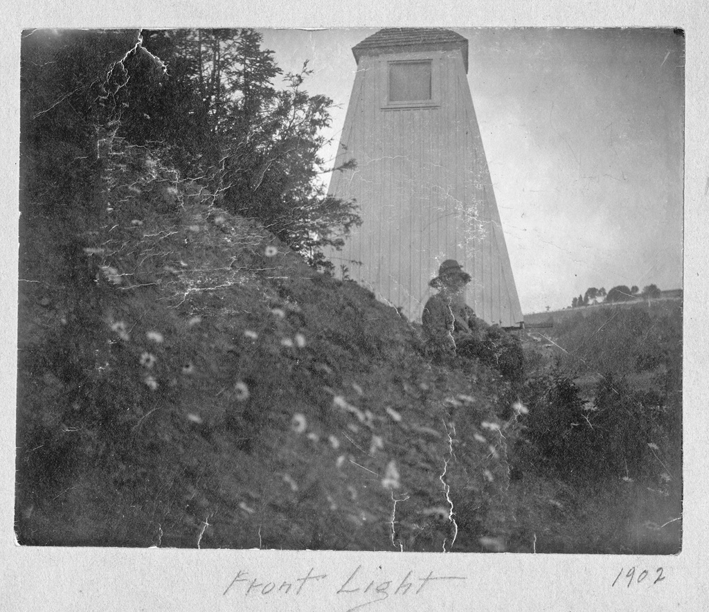
The range lights formerly maintained on Oak point, Restigouche river, below Campbellton, in the County of Bonaventure and Province of Quebec, have been re-established by the Government of Canada. They were put in operation on the 30th June, 1900.H. Chamberlain was hired as keeper of Oak Point Range Lights in 1900, and he served through 1905. Caroline Chamberlain then cared for the lights for a year before Thomas Harper took charge of them in 1907.They are fixed white catoptric lights, shown from white square wooden towers with sloping sides, each 22 feet high from its base to the ventilator on the lantern.
The front tower stands on Oak point, near its west extremity.
The light is elevated 52 feet above high water mark, and should be visible 12 miles, in and over a small arc on each side of, the line of range.
The back range tower stands on the hill, 2231 feet N. 68° 30 E. from the front light. The light is elevated 121 feet above high water mark, and should be visible the same distance over the same arc.
The two lights in one, bearing N. 68° 30 E. lead from the intersection with the alignment of the Campbellton range on the south or New Brunswick side of the river, diagonally across the river to the channel on the north or Quebec side. At a point distant 3 ½ cables from the front light the range is opened on the port hand, and an easterly course shaped through the north channel to natural deep water.
The proposed channel across the middle ground, marked by the range, is partly dredged, and the ruling depth on it is 11 feet a low, or 21 feet at high, water ordinary spring tides. It is intended to increase this depth 6 feet, by dredging.
In 1938, a metal superstructure was mounted atop the rear wooden tower to increase the focal plane of its light to sixty feet above the ground and 160 feet above the river. In 1950, a red, square, steel, skeletal tower with a slatted daymark replaced the structure used to display the rear light. This new tower stood sixty-eight feet tall and gave the rear light a focal plane of 168 feet above the river. Light Lists show the range was active until at least 2005, but there are no longer range lights on Oak Point.
Keepers: Matthew Gerraghty (1880 1889), H. Chamberlain (1900 1905), Caroline Chamberlain (1906), Thomas Harper (1907 at least 1923).
References