Simard Range, PQ 
Select a photograph to view a photo gallery
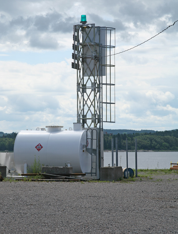

Photo Gallery

Photo Gallery
Photo Gallery
The Saguenay River is roughly 180 metres deep in its lower section, but ninety kilometers above the St. Lawrence, it rapidly contracts and assumes the typical character of a river, with mud banks and shoals of large boulders. Just above this point of contraction is the City of Saguenay, known earlier as Chicoutimi, which around the turn of the nineteenth century was home to paper mills that produced 100,000 tons of wood pulp annually. During this period, the Saguenay River was used not only by vessels laden with lumber products but also by the Richelieu and Ontario Navigation Companys passenger steamers, which called at Chicoutimi several times a week during the summer.
To help mariners locate the entrance to the Saguenay River, a lighthouse was erected in 1872 on Lark Islet, situated just off the southern side of the rivers mouth. The following year, the government provided five pairs of range lights to mark the turn in the river just below Chicoutimi. The Quebec firm of Price Brothers and Company, which owned the lumber operations in Chicoutimi, maintained these lights until the government hired keepers for them in 1875. These lights originally appeared as 1st Range through 5th Range in the List of Lights, but they were later given the following official names: Poste-Saint-Martin (front, rear), Rivière Valin (front, rear), Savard Range (replaced by Simard Range in 1912), Rivière du Caribou, and Rivière-du-Moulin (front in 1906, rear in 1906). These five range lights remain active today, though modern towers are now in use.
In 1875, a pair of range lights was established on Pointe Noire (Black Point), the southern point at the entrance to the Saguenay River. The range lights on Pointe Noire are still active but are now displayed from modern towers. Pointe Noire is located within the Saguenay St. Lawrence Marine Park and is home to the Pointe-Noire Interpretation and Observation Centre, where visitors can use telescopes to identify marine animals and bird life in the area.
The next light to be erected to guide traffic on the Saguenay River was at Grosse Roche, roughly twenty kilometres above the mouth of the river. This square dwelling with a square tower centered atop its hipped roof was built in 1906. Grosse Roche Lighthouse was built on a spot of land six feet above high water mark and thirty feet from the rivers edge, and stood thirty-five feet tall from its base to the ventilator atop its lantern room. A fixed white light from a sixth-order Fresnel lens was displayed at a focal plane of thirty-six feet and was visible for ten kilometres upstream and downstream.
The final manned lighthouse to be built on the Saguenay River was at Cap à lEst, a critical turn thirty-one kilometres below Saguenay, where Ha! Ha! Bay branches off from the river. Built in 1909, Cap à lEst Lighthouse is a thirty-three-foot-tall, octagonal, reinforced-concrete tower surmounted by an octagonal lantern. The construction was performed by days labour under the supervision of H de Haan at a cost of $2,636.16. A sixth-order Fresnel lens initially beamed forth a fixed white light under the care of G. Sergerie, its first and only keeper. In 1917, Aga equipment was installed in the lighthouse, changing the characteristic of the light to a white flash every three-and-a-half seconds and allowing for the automation of the light. Today, the light has a signature of a flash every five seconds.
Of the many once-manned lights that have guided mariners along the Saguenay River, Cap à lEst Lighthouse is the only one that hasnt been replaced by a modern tower. The Canadian Coast Guard services the light by helicopter using a landing pad adjacent to the lighthouse.
The following description of Savards Range is from a 1908 edition of The Gulf and River St. Lawrence
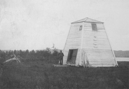
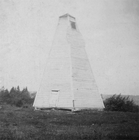
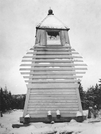
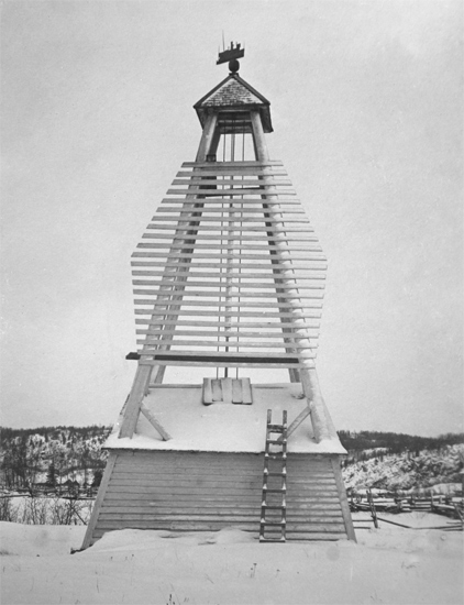
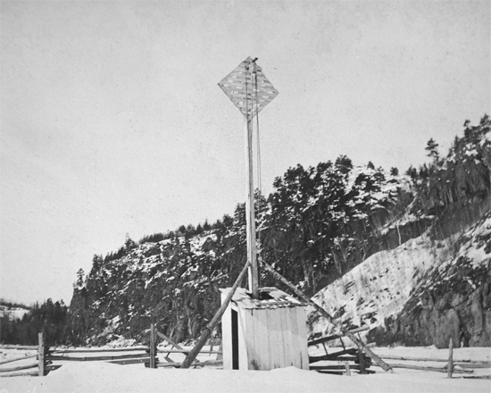
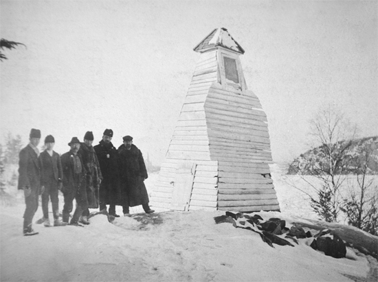
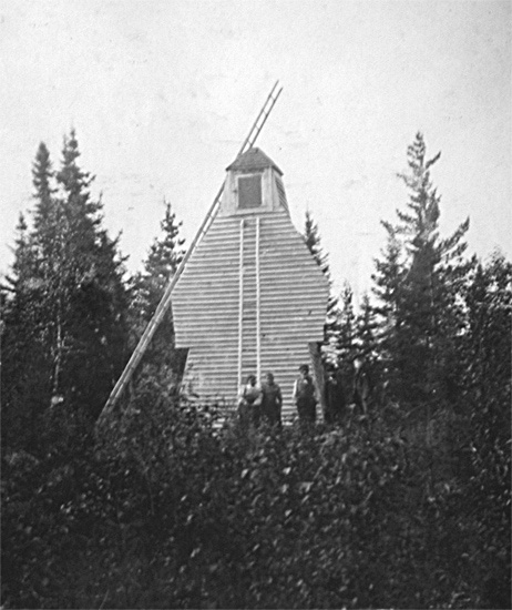
The front light is fixed white, exhibited from a square white tower 17 feet high, with diamond day mark facing line of range, situated on the northern bank of the Saguenay, east of the Caribou river. The light is 16 feet above above high water and is visible in clear weather a distance of 8 miles.In 1912, Savards Range, which was located about 1/3 mile below Caribou River was discontinued as was Caribou Range, located 1/6 mile above Caribou River. Caribou River ( Rivière du Caribou) Range was reestablished about 1/10 th of a mile below Caribou River. At the same time, Simard Range was established ½ mile above Caribou River. Simard Front Range Light was originally exhibited from an enclosed wooden tower, square in plan, with sloping sides and surmounted by a square lantern. The tower measured twenty-seven feet tall from its base to the top of the ventilator on its lantern. The rear light was originally exhibited from a skeletal tower, square in plan, with sloping sides and surmounted by a square lantern. This tower stood thirty-six feet tall and was located on the north side of the public road, 750 feet from the front range light along a bear of 258°. Simard Range Lights led mariners up the river from their intersection with Caribou River Rant to the intersection of their alignment with that of Rivière du Moulin Range.The back light is fixed white, exhibited from a square white tower 31 feet high, with an irregular beacon attached, situated 292°, 490 feet from the front tower. The light is 39 feet above high waer, and visible in clear weather a distance of 11 miles.
The lights in line 292° lead along the northern part of the channel to intersection with Caribou River range.
Stanislas Menier of Bagotville, Quebec was paid $1,232.50 to construct the wooden tower used for the front light. E. & H. Simard were paid $130.75 for the purchase and surveying of the sites for the range lights.
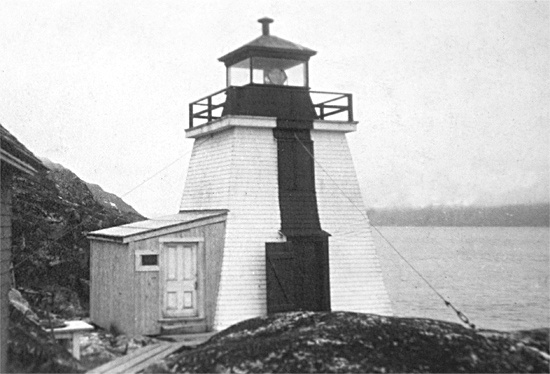
By 1951, an aluminum-colored square skeletal tower had replaced the wooden tower for displaying the front light of Simard Range. In 2021, square, skeletal towers were displaying fixed green lights at Simard Range.
Keepers:
References