Baskins Wharf, ON 
Select a photograph to view a photo gallery
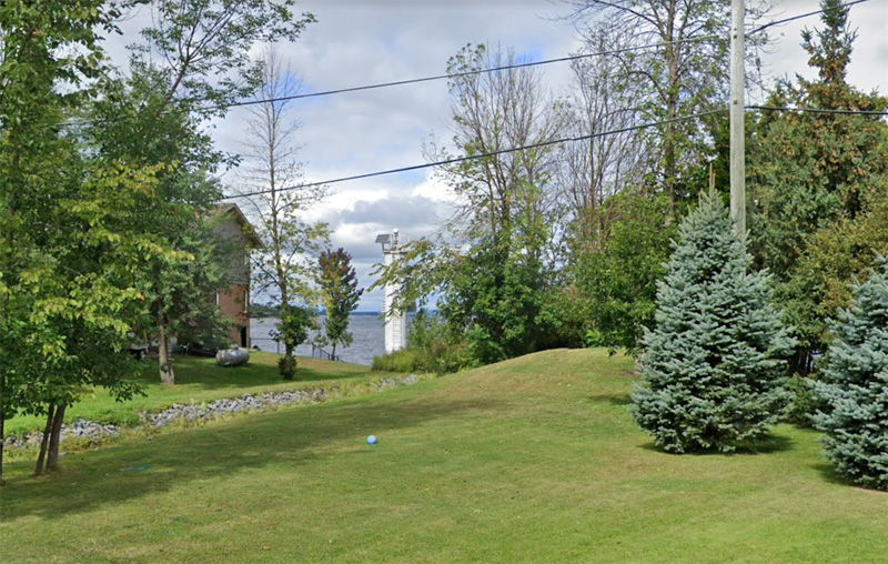
Photo Gallery


Photo Gallery
Photo Gallery
In 1883, the Department of Marine established a light on Aylmer Island, Baskins Wharf, and Buckoms Point on Lac Deschênes along with three other places along the Upper Ottawa River as noted in the departments annual report for that year:
Six new lighthouses on the Upper Ottawa River, at the following points, via.: At Aylmer Island, in Lake des Chenes; Baskins Wharf, Lake des Chenes, about 12 miles above Aylmer; Buckoms Point, in the same Lake, about 16 miles farther up the Ottawa; Morrisons Island or Hawleys Island, about 3 miles below Pembroke, and McQuestions Point, on the south shore of the Deep River, about 25 miles above Pembroke. In each case a fixed white light is shown from a small dioptric lantern, hoisted to the top of a mast, having a small shed at its base.William Baskin was appointed the first keeper of the lights at Baskins Wharf in 1883. Silas Sullivan took charge of the lights from Baskin in 1896 and served until his death in 1920. Mary Jane Sullivan looked after the lights for a few months following her husbands death until T.A. Campbell was appointed keeper in 1921.
During the service of Silas Sullivan, enclosed towers replaced the original mast lights at Baksins Wharf. The following description of the new lights appeared in the Annual Report of the Department of Marine for 1903:
Towers have been erected at this Ottawa river station to replace the masts from which lights were previously exhibited. The masts have been removed and the lights were shown from the new towers on the opening of navigation in 1903.Baskins Wharf Range Lights in range led through the deepest channel over Constance Shoal.The front tower stands 60 feet back from the waters edge, and is a wooden building, square in plan, with sloping sides, painted white. The height of the tower from base to vane is 26 feet. The light is elevated 30 feet above high water mark, and should be visible 6 miles in the line of range, and across the lake at right angles to the line of range. The illuminating apparatus is a pressed glass lens. The illuminant is acetylene.
The back range tower stands 1/3 mile S.E. from the front tower. It is a similar building. The height of the tower from base to vane is 31 feet. The light is elevated 50 feet above high water mark, and should be visible 6 miles in the line of range. The illuminating apparatus is catoptric. The illuminant is acetylene.
This work was done by days labour under the superintendency of Mr. Madore, at a cost of $1,154.43.
In 1966, circular metal structures replaced the wooden lighthouses used at Baskins Wharf. The modern range at this location was known as Baskins Beach Range, and white cylindrical towers were used on the range to display fixed white lights. Both towers had an orange, triangular daymark and a black, vertical stripe. This set of range lights no longer exists.
Keepers: William Baskin (1883 1896), Silas Sullivan (1896 1920), Mary Jane Sullivan (1920 1921), T.A. Campbell (1921 at least 1923).
References