Brighton Range, ON 
Select a photograph to view a photo gallery

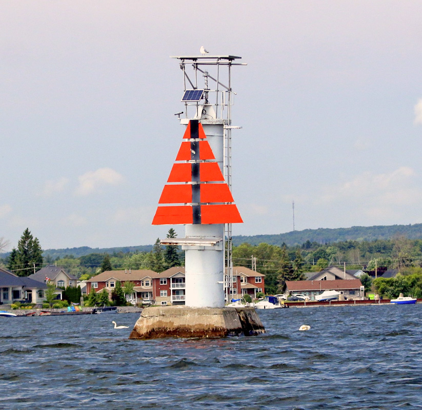

Photo Gallery
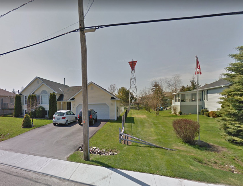

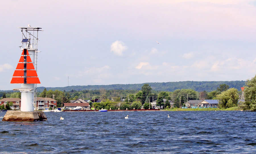
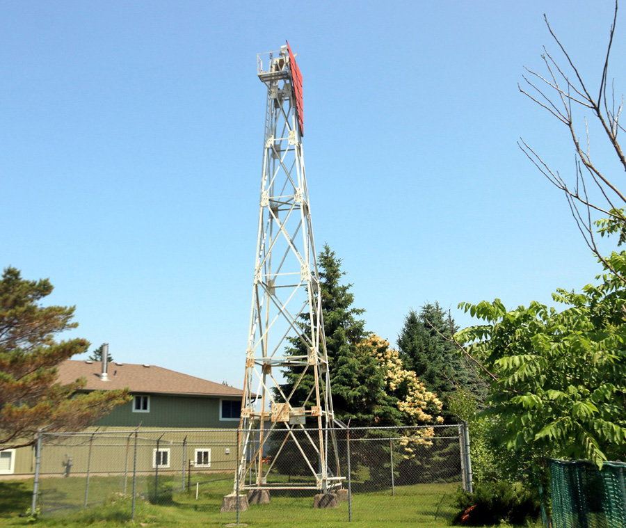
Photo Gallery
Photo Gallery
Murray Canal has a length of eight kilometres (five miles), a width of eighty feet on the bottom, and when it opened in 1890, it had a depth of twelve-and-a-half feet. At each end of the canal, cribwork piers were built out on both sides, and a system of lighted beacons and buoys marked the approaches. During the first ten weeks Murray Canal was open, 264 vessels passed through it.
Presquile Point Lighthouse was completed in 1840 at the tip of the L-shaped Presquile Peninsula to help mark the entrance to Presquile Bay, the only harbour of refuge between Kingston and Windsor. Even with this lighthouse, entering the bay was difficult due to shoals at its entrance. In 1851, range lights were built on the north side of the peninsula to help mariners to enter the bay. The front light of the range was located on Salt Point, and the rear light was situated near Calf Pasture Cove.
Between 1872 and 1875, A.E. Munson dredged a channel through Middle Ground Shoal at the entrance to Presquile Bay to create a new entrance channel that had a depth of eleven feet and a width of up to 220 feet. This new channel remained unmarked until 1878, when Roderick Cameron of Lancaster was contracted to build a new lighthouse in Presquile Harbour. This lighthouse was a square, pyramidal structure, built of wood, that stood twenty-two feet tall and was placed atop a crib near the edge Calf Pasture Shoal on the south side of the harbour. This new lighthouse was 3,525 feet northwest of the light on Salt Point and ranged with the light on Salt Point to mark the dredged channel at the entrance to the harbour. This new light was known as Calf Pasture Shoal Light or Presque Isle Harbour Light. The total cost for the new lighthouse was $2,193.
After the opening of Murray Canal in 1889, new lights were needed in Presquile Bay. Walter Alford of Belleville was awarded a $5,995 contract to place three range light buildings on piers in 1891. The lighthouse on Calf Pasture Shoal was relocated to an octagonal pier in fourteen feet of water that was located 1,100 feet from Brighton Wharf. This fixed-white light, known as Brighton Range Light No. 1 was elevated twenty-eight feet above the water and could be seen six miles along the range line. A second lighthouse, a square wooden tower that was forty-seven-feet tall, was placed on a pier in seven feet of water that was located 1,400 feet from Brighton Wharf. A fixed red light, known as Brighton Range Light No. 2, was displayed from this lighthouse and ranged with the lighthouse relocated from Calf Pasture Shoal to lead vessels through the dredged channel past Salt Point. (The lighthouse on Salt Point remained active through 1907 to help mark the old channel for entering Presquile Bay.) Brighton Range Light No. 1 served as the front light and Brighton Range Light No. 2 as the rear light of this range to mark the dredged channel past Salt Point.
The third lighthouse Walter Alford placed in operation in 1891 was a thirty-foot-tall, square, wooden tower that was placed atop an octagonal pier in fifteen feet of water, 3,920 feet east of Brighton Wharf. This fixed-white light, known as Brighton Range Light No. 3, ranged with Brighton Range Light No. 3 to guide mariners between Brighton and the entrance to Murray Canal. Hedley Simpson, who had been in charge of the range lights that include the light on Salt Point, was placed in charge of the new Brighton Range Lights.
In addition to the three Brighton Range Lights, the Department of Railways and Canals established the following six lights in 1891 that were then maintained by the superintendent of Murray Canal to mark this important passage:
In 1920, the wooden lighthouse relocated from Calf Pasture Shoal was destroyed, and a temporary light was subsequently displayed instead from Brighton Wharf. This temporary light was used until a pole light was put in place in 1933. A mast light replaced the wooden tower used at Brighton Range Light No. 2 in 1948. A circular, white, concrete tower with a red top replaced the wooden tower used at Brighton Range Light No. 3 around 1962.
In 2021, a flashing red light known as Brighton 3 was being displayed from a white cylindrical tower with a red upper portion at the location of Brighton Range Light No. 3. Brighton Range consisted of a flashing white front light displayed from a white, cylindrical tower having an orange triangular daymark and a black, vertical stripe and a fixed red rear light displayed from a white, skeletal tower with an orange triangular daymark and a black, vertical stripe. The front light is located just offshore from Lambton Street in Brighton, while the rear light is on the mainland near Presquile Landing Marina.
Keepers: Hedley V. Simpson (1891 1922), L. McDonald (1922), J. McLagan (1923 1924), H. Gunyon (1924 1927), James H. Grimes (1927 at least 1937).
References