Sailors Encampment Range, ON
Select a photograph to view a photo gallery

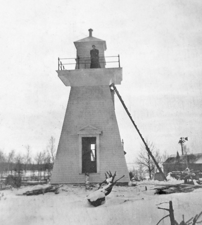

Photo Gallery
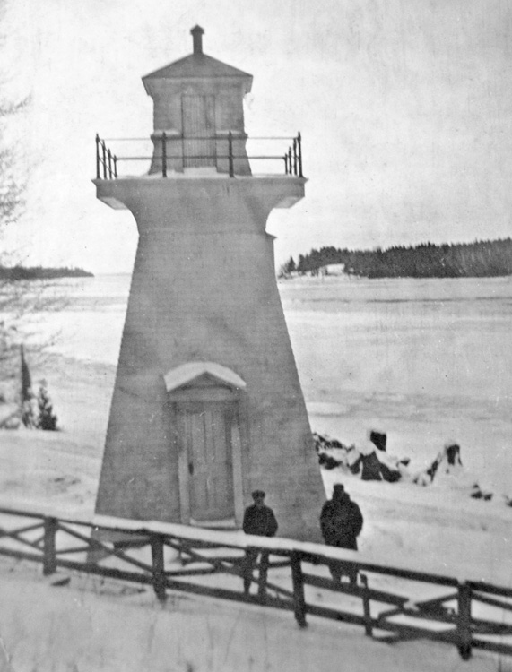

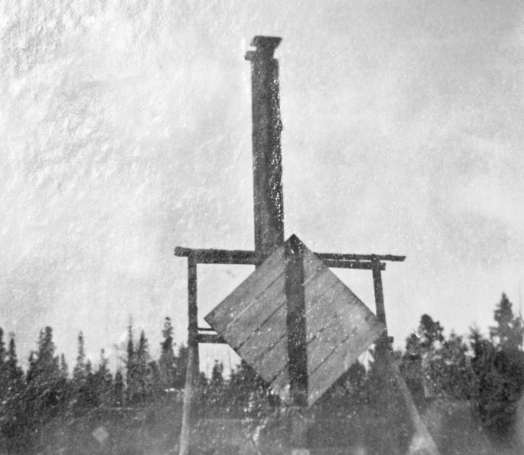
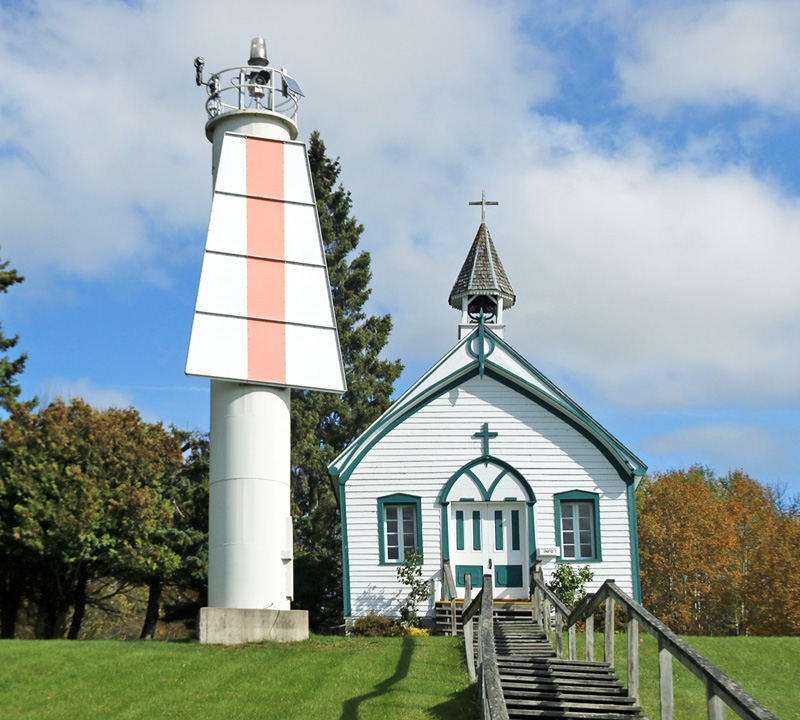


Photo Gallery
Photo Gallery
|
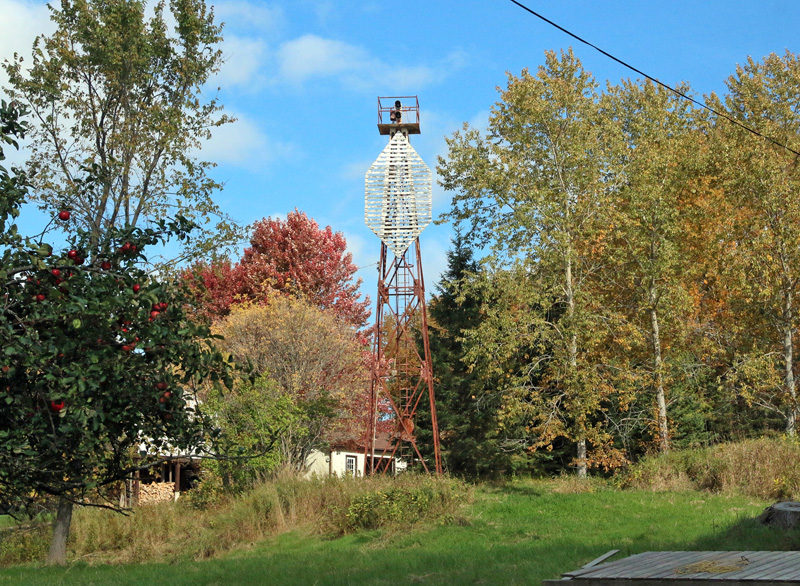
The front light of the new Sailors Encampment Range was located on the east side of the shore road and was shown from a lantern elevated fifty feet above the water on a mast. At the foot of the mast, which was seventeen feet high, was a diamond-shaped day beacon painted white with a vertical stripe through the middle of it. The back light was situated 648 feet from the front light and was shown from a twenty-two-foot-tall mast also with a diamond-shaped daymark at its base.
|
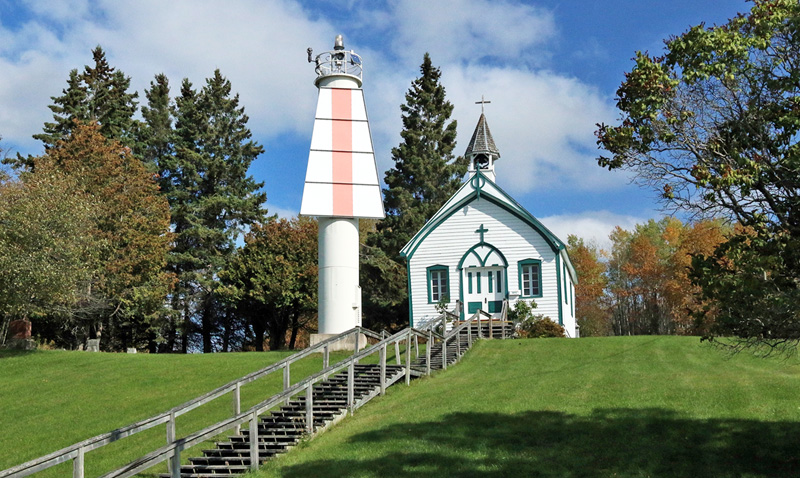
Sailors Encampment range pole lights on Rains Hill, St. Joseph Island, river St. Mary, will, on the opening of navigation in 1909, be replaced by lights shown from lighthouse towers, without further notice.In 1959, modern towers replaced the wooden ones, and changes to the range lights were made again in 1984/1985. For some time, at least in the 1960s, there was a Sailors Encampment West Range and a Sailors Encampment East Range. The west range was centered on the deep draft portion of the channel, while the east range marked the shallow draft portion of the channel. The ranges were separated by roughly 200 feet. A tower that served as the front light of the east range can be seen just east of the cylindrical tower from which the front light of Sailors Encampment Range is shown.The towers are enclosed wooden buildings, square in plan, with sloping sides, painted white, surmounted by square wooden lanterns. The sides of the lanterns are painted white, and the roofs red. Each tower is 33 feet high from its base to the top of the ventilator on the lantern. The lights are fixed white catoptric lights, and should be visible 5 miles in the line of range.
The front tower stands on the bank of the river, 85 feet forward in the line of range from the site of the old front pole light, and is distant 63 feet back from the waters edge in the line of range. The light is elevated 35 feet above the level of the river.
The back tower stands 807 feet N. 20° E. from the front tower. The light is elevated 83 feet above the level of the river.
Keepers A.M. Rains (1892 1924), Fred A. Gilbertson (1924), Harold Raines (1925 1946), Murray W. Smith (1946 1951).
References