Rochefort Point, NS 
Select a photograph to view a photo gallery
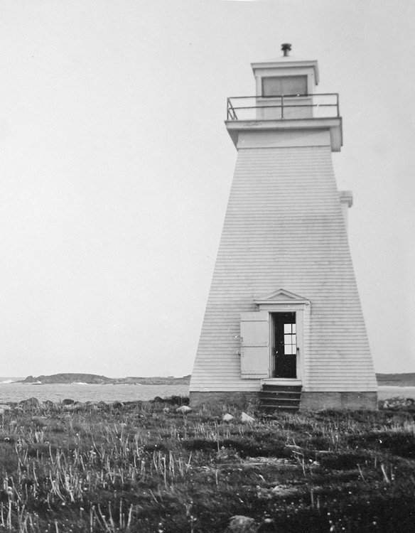

Photo Gallery

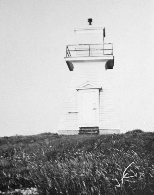

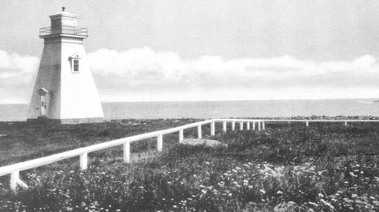
Photo Gallery
Photo Gallery
Lighthouse Point, where the stone tower stood, was located on the opposite side of the entrance to Louisbourg Harbour from where the French fortress stood. British Forces captured Lighthouse Point during sieges in 1745 and 1758 and used this strategic location to bombard the fortress. Louisbourg Lighthouse was damaged beyond repair in the 1758 siege and was abandoned by the British after they destroyed the fortifications at Louisbourg in 1760. The French ceded control of Île-Royale to the British in 1763, and Louisbourg remained a minor village for several decades.
In 1842, after Thomas Jost and merchants and shipowners residing near Sydney petitioned the provincial government, a new lighthouse was built at the entrance to Louisbourg Harbour. This building consisted of square, two-and-a-half-storey dwelling topped by a lantern room and was constructed under the direction of Samuel Crawford. The lighthouse rested on a massive cut-stone foundation constructed on bedrock and was painted white with black vertical stripes centered on its east, south, and west sides to serve as a daymark.
To better mark the harbour at Louisbourg, which was now a prosperous coal-shipping port, the Department of Marine established a pair of range lights in 1897 on the west shore of the harbour, just north of the former fortress. In 1923, a second set of range lights was built on the harbours western shore at Rochefort Point, a short distance east of the fortress, to guide vessels between the coal companys pier at Louisbourg Range.
The following description of Rochefort Point Range Lights appeared in the Nova Scotia Pilot:
Rochefort Point Range Lights.The front light is shown from a white square wooden tower 28 feet (8.5 m.) high, surmounted by a square wooden lantern situated on the northern side of the old French burying ground, about 325 yards from Rochefort Point.Rochefort Point Range Lights have been discontinued and removed.The rear light is shown from a white square wooden tower, 42 feet (12.8 m.) high, surmounted by a square wooden lantern situated 540 feet 190° 30' from the front light.
These lights in range lead from the coal companys pier to the intersection of their alignment with that of the Louisbourg range lights, which leads out of the harbor.
References