Cedar Point Range, MI 
Select a photograph to view a photo gallery
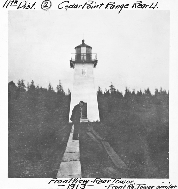

Photo Gallery

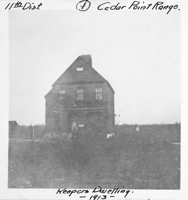

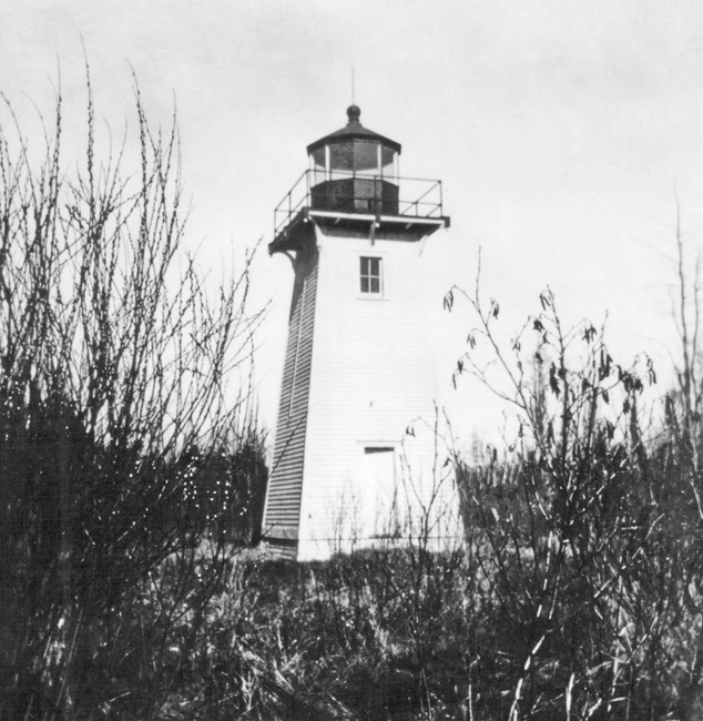
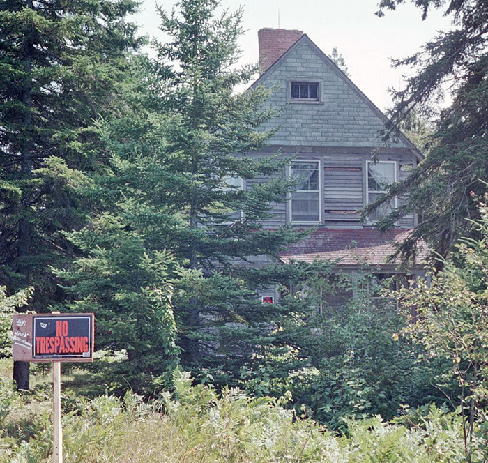
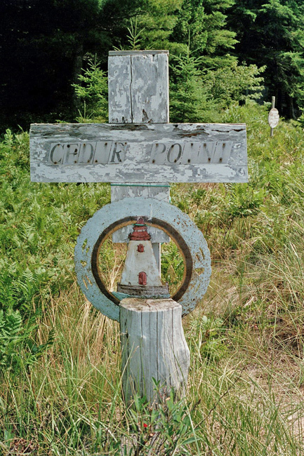
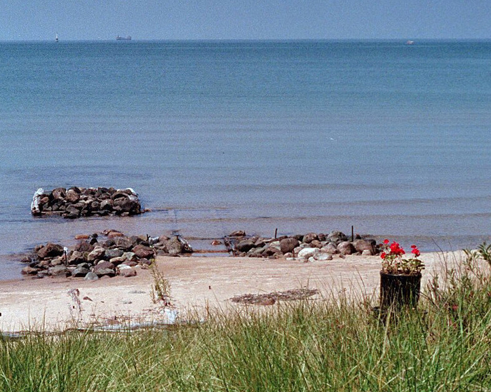
Photo Gallery
Photo Gallery
1886 Saint Marys River ranges, Saint Marys River, Michigan. Two sets of range lights are to be established with the appropriation of $12,000 made by the act of Congress approved March 3, 1885. One set is to be located nearly opposite Point aux Pins, Ontario, and the other near Round Island, Michigan. During the past year the sites were secured, plans and estimates were prepared, proposals were invited, and a contract was made for $8,450, providing for the completion of the work by October.
1887 Round Island, near entrance to St. Marys River, Michigan. When the St. Marys River ranges were lighted this light was discontinued and the illuminating apparatus was taken to Detroit and stored in the depot. The buildings and grounds are looked after by the keeper of the upper ranges and are in good order.
1888 St. Marys River, upper range, Lake Huron, Michigan.A gallery was built around the front tower to enable the keeper to remove the ice and snow from the glass, a new concrete floor was laid in the cellar of the dwelling, the drains were repaired, and some other necessary work was done. The low places around the dwelling were raised with earth filling; shallow trenches, from 1 to 3 feet wide and aggregating 1,500 feet in length, were dug to drain the grounds; a walk was laid from the landing-dock to the shore, and 140 feet of sidewalk were laid around the dwelling.
1890 1140. St. Marys River upper range-lights, St. Marys River, Michigan. The conditions in the vicinity of Round Island and Point Iroquois, St. Marys River, are unsatisfactory to navigators of these waters. Owing to the insufficient depth and the narrowness of the passage, which is but a quarter of a mile wide between the 11-foot shoals bordering the channel on the St. Marys River upper range, the greater number of vessels prefer to hold the lower range until they can change course in deep water westward of the shoals. In fact, the channel through the St. Marys River upper range was barely navigable until a cut had been dredged, which is now partly filled up, and with any sea a deep vessel can not use it. In addition to these obstructions, there are several others near to the 6-fathom contour between Round Island and Iroquois Point, which are brought out by drawing the 18-foot contour. The largest has but 14 feet on it. These are now insufficiently marked by buoys. An effective guide past all these is needed. The Board suggests that it be furnished by laying out a new range on shore. This can be done most economically by abandoning the present upper range and moving the buildings to the new line, after which the St. Marys River lower range should be shifted slightly to the southward to clear the 10-foot lump now marked by the red can buoy. The cost of doing this would be about $2,000. The Board recommends that an appropriation of that amount be made therefor.
1891 The following recommendation, which was made in the Boards last annual report, is renewed: (See 1890.)
1892 St. Marys River front and rear upper range, Michigan. Some 200 running feet of sidewalk, which were destroyed by fire in July, were renewed. The work was done by the keeper. The following recommendation, which was made in the Boards last two annual reports, is renewed: (See previous year.) This recommendation is renewed, except that the upper range should be shifted to the westward to range up White Fish Bay clear of all obstructions, when the lower range need not be moved. It is estimated that this can be done at a cost not to exceed $5,000, and it is recommended that an appropriation of this amount be made therefor. The amount called for in the foregoing paragraph was appropriated in the sundry civil appropriation act, which was approved on August 5, 1892. The changes in this range will now be made as soon as practicable.
1893 St. Marys River Upper Range Lights, Michigan.There was an appropriation made by the sundry civil appropriation act on August 5, 1892, of $5,000 for moving the St. Marys River Upper Range lights. When this appropriation was recommended by the Board the need of moving the range was evident. Matters, however, have since been changed. The dredged channel now marked by the upper range is to be completed early in the spring of 1894. This channel will be 300 feet wide with a depth of 21 feet, thus affording the most direct route into Lake Superior, and a route which will be used by most of the vessels navigating these waters. There is a good 18-foot channel to the westward of the shoal now marked by the red can buoy known as the Waiska Bay buoy and a black spar buoy, but with the completion of the 21-foot channel, which is already lighted by the upper range lights, the necessity for additional lights in that locality, or for any change in the present lights, is avoided.
It is therefore recommended that the $5,000 appropriated by the act approved August 5,1892, for moving the St. Marys River Upper Range lights be made available for completing the structures at Seul Choix Pointe light station, Michigan.
1894 St. Marys River upper range lights, Michigan.There was an appropriation made by the sundry civil appropriation act on August 5, 1892, of $5,000 for moving the St. Marys River upper range lights. When this appropriation was recommended by the Board the need of moving the range was evident. Matters, however, have since been changed. The dredged channel now marked by the upper range is to be completed early in the spring of 1894. This channel will be 300 feet wide with a depth of 21 feet, thus affording the most direct route into Lake Superior, and a route which will be used by most of the vessels navigating these waters. There is a good 18-foot channel to the westward of the shoal now marked by the red can buoy known as the Waiska Bay buoy and a black spar buoy, but with the completion of the 21-foot channel, which is already lighted by the upper range lights, the necessity for additional lights in that locality, or for any change in the present lights, is avoided.
It is therefore recommended that the $5,000 appropriated by the net approved August 5, 1892, for moving the St. Marys River upper range lights be made available for completing the structures at Seul Choix Pointe light station. Michigan.
Note.The following is an extract from the sundry civil appropriation act approved August 18, 1894:
For completing the structures at Seul Choix Pointe, Lake Michigan, Michigan, the appropriation by the act of August fifth, eighteen hundred and ninety-two, for moving Saint Marys River upper range lights, five thousand dollars is made available therefor.
The work at Seul Choix Pointe will be taken in hand at an early day.
1901 St. Marys River (upper range), Michigan.The boat landing was extended by building two new cribs, which were filled with stone and decked. The old cribs were refilled with stone and redecked, the outer crib was riprapped, and new boatways were built. Various repairs were made.
1907 St. Marys River Upper Range, Michigan.-A concrete oil house was built and various repairs were made.
1908 St. Marys River Upper Range Light-Station, located on the southerly shore of St. Marys River at Cedar Point, and about one mile ESE of Round Island, will be officially designated Cedar Point Range Light-Station.
1919 Cedar Point Range Lights, St. Marys River. Cedar Point Range Front Light was moved on October 19, 1919, to the northerly edge of Round Island and the rear light to the southerly edge of the Island, about 205 yards 120° from the front light. The front light is 50 feet above water and rear light 70 feet above water. Each light is fixed white of 2,500 candlepower, on a black, pyramidal skeleton structure, with white, slatted oval daymark.
1923 AIDS TO NAVIGATION, ST. MARYs River, MICH. Appropriation November 7, 1918, $80,000, for improving aids to navigation in the St. Marys. The following work which was attempted under this appropriation has been completed: Cedar Point Range: New steel towers with acetylene equipment erected on Round Island and station made nonattended. Reservation and dwelling sold.
1932 It appears Cedar Point Range was discontinued in 1932.
Keepers: Edward Chambers (1887 1889), Louis Metivier (1889 1902), Mrs. Donald E. Harrison (1902), Martin Nelson (1902 1904), William Sweet (1904 at least 1917).