Leclercville (St. Emmélie) Range, PQ 
Select a photograph to view a photo gallery


Photo Gallery
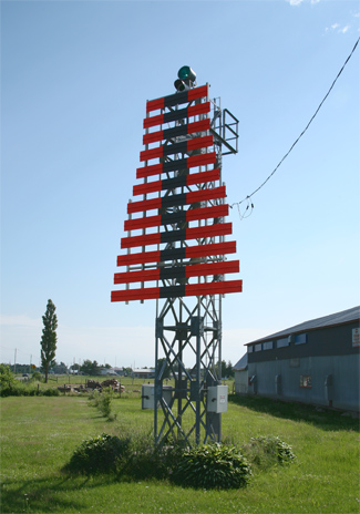
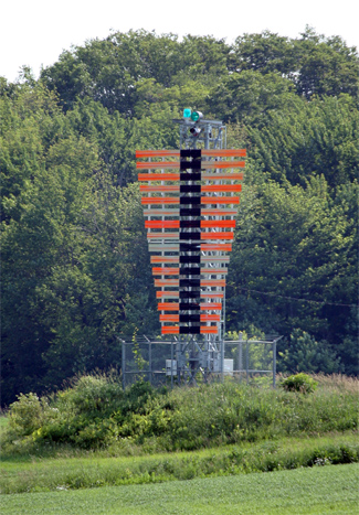


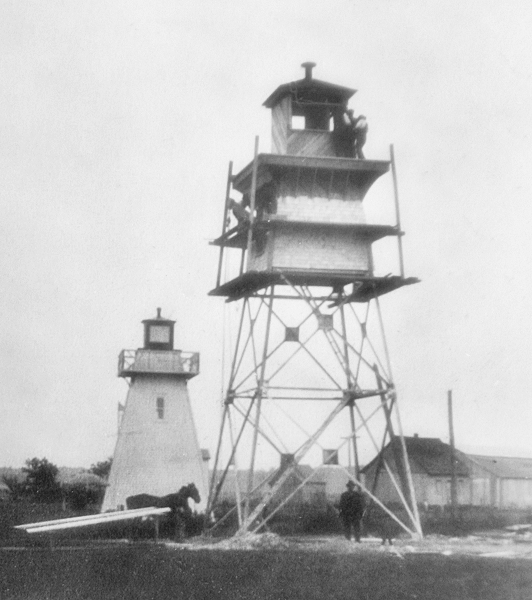
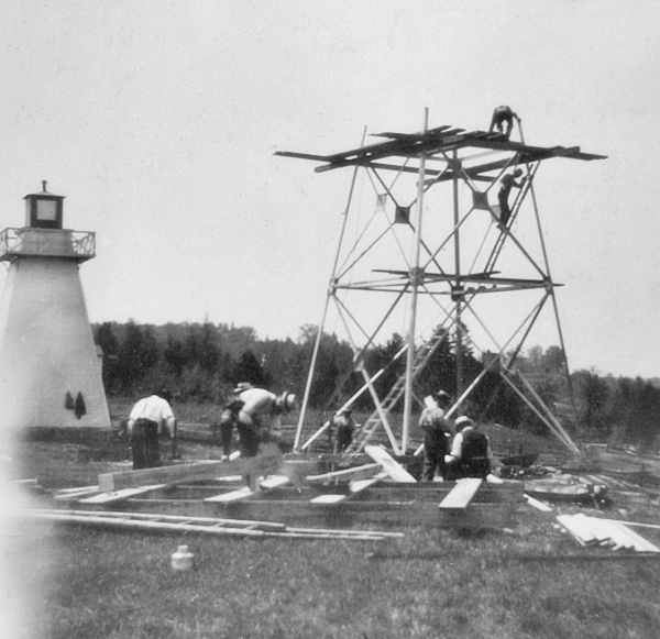
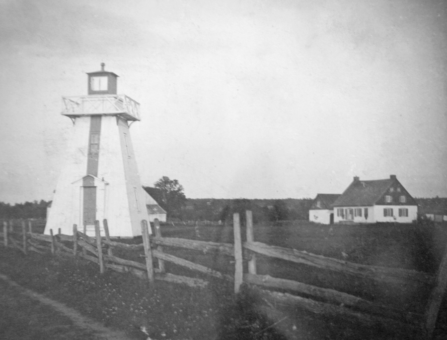
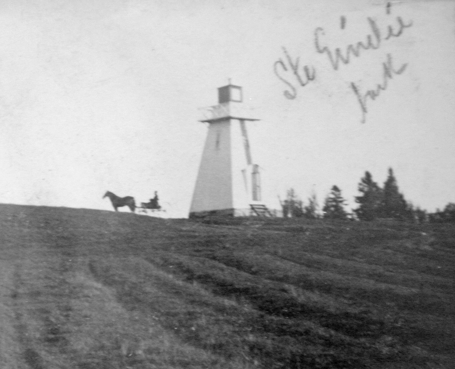
Photo Gallery
Photo Gallery
|
Ste. Emmélie Range Lights were built to replace those at Cap Charles but they were not initially activated as the Montreal Harbour Commissioners had not completed dredging the new deep water Cap à la Roche Channel the new range was intended to mark. After it was found that heavy-draft vessels did not pass through this part of the new Cap à la Roche Channel at night, the decision was made to not activate the range but to have them just serve as day beacons.
The range lights were finally activated on October 26, 1898 to help keep the Montreal and Quebec passenger steamers clear of the buoys while fighting the channels swift current. The following description of the range was given at that time:
The front range building stands on the south side of the highway running along the top of the cliff on the south shore of the River St. Lawrence, and is situated about midway between the mouth of Grande Rivière du Chêne and the mouth of Petite Rivière du Chêne. At the site, the river bank rises steeply to a height of about 80 feet, and the top of the bank is clear, level, cultivated land.The tower is a square wooden building, with sloping sides, surmounted by a square galvanized lantern, and is 30 feet in height from its base to the ventilator on the lantern. It is painted white, with a red stripe down the middle of the west side, facing the channel. The light is a fixed white light, elevated 114 feet above high watermark, and should be visible 16 miles from all points of approach by water. The illuminating apparatus is catoptric.
The back range light tower is similar to the front building, and stands on a gentle rise backed by woods, 3,420 feet S. 70° 30 E. from the front tower. The light is a fixed white catoptric light, elevated 131 feet above high water mark, and should be visible 16 miles in and over a small arc on each side of the line of range.
The two lights in one lead midway between the red and black buoys, from the curve at Cap Charles to the curve at Cap à la Roche. The channel marked by this range is 300 feet wide, with a least depth of 27 ½ feet at mean low water.
|
Urgent repairs to the towers foundations were carried out in 1900 by a mason sent from Quebec, and in 1901, the light exhibited from the back tower was altered so that it could be seen from all points of approach in the channel rather than only along the line of the range. This change in the light was made for the convenience of coasting steamers calling at Ste. Emelie wharf, in the mouth of Great Chêne river.
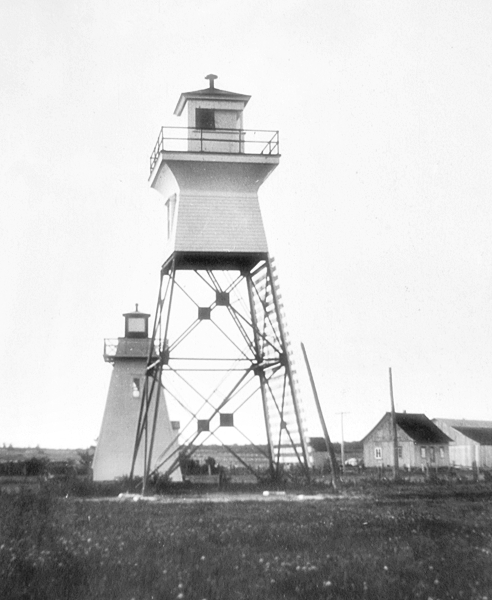
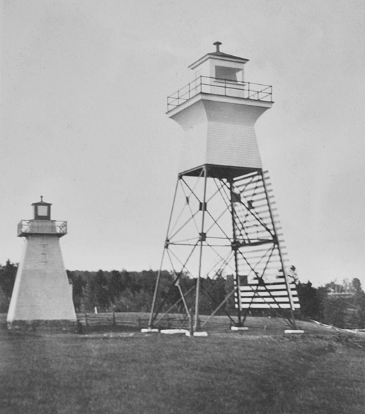
In 1915, new steel, skeletal towers surmounted by an enclosed watchroom and lantern room replaced the original wooden towers (front and rear) at Ste. Emmélie Range. This work was carried out under the direction of A. Martin at a cost of $2,517.59. Each of these two new towers stood forty-seven feet tall, and the side of the towers facing the range line was covered with slats that were painted white with a black vertical stripe. The front light was exhibited at a height of 128 feet above the river, and the rear light, located 1,220 yards from the front light, at a height of 183 feet.
In 1983, the front range light was moved away from the edge of the cliff, and in 2002, a simple square, skeletal tower replaced the square, pyramidal, skeletal tower with an enclosed top that had housed the front range light. By 2008, a square skeletal tower had also taken the place of the square, pyramidal, skeletal tower with an enclosed top that had housed the rear range light. The range is now listed by the Canadian Coast Guard as Leclercville (St. Emmélie) range.
Keepers:
References