Little Burin Island, NF 

Select a photograph to view a photo gallery

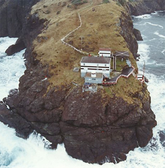
Photo Gallery
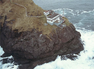

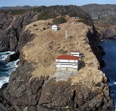
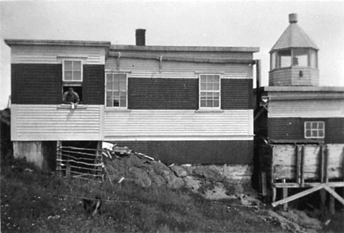
Photo Gallery
Photo Gallery
According to legend, Burin Inlet received its name when a French sailor standing on the deck of his ship holding a burin, French for chisel, was struck by how closely the shape of the inlet resembled his burin.
|
The first known English settlement in the inlet occurred in 1718, when Christopher Spurrier of Poole, England established a shipbuilding company at Ship Cove. By 1813, the population of Burin stood at 1,092.
In 1912, a fog alarm was established on the eastern side of Little Burin Island to mark the entrance to the inlet. The signal was housed in a wooden, flat-roofed building that stood adjacent to a keepers dwelling. Both of these structures were painted in black and white horizontal bands.
The diaphone fog alarm, operated by air compressed by an oil engine, was sounded during thick or foggy weather, giving one four-second blast in every eighty-eight seconds.
A wooden, octagonal lantern, painted white, was mounted atop the engine house in 1915 to beam forth a fixed white light at a focal plane of 27.5 metres (90 feet).
On November 18, 1929, an earthquake occurred off the southern coast of Newfoundland, sending a fifteen-metre-high tidal wave into Burin Inlet. Nine lives were lost, and numerous homes, barns, wharves, and boats were destroyed. The tidal wave also caused significant damage to the fishing grounds, which did not fully recover for over a decade.
In the 1950s the facilities on Little Burin Island were replaced by a new double dwelling and a fog alarm building. Commercial power reached the station in 1970, and two years later, the keepers and their families, who had been living on the island for months at a time, were replaced with a four-person rotational crew.
During severe storms, the turbulent waters of Placentia Bay would sometimes reach the fog alarm building that was positioned at the very edge of the cliff. After years of abuse, the fog alarm building topped by a lantern room was replaced with a concrete structure attached to the foundation of the keepers dwelling.
The station was destaffed in 2003, and the vacant keepers dwelling slowly deteriorated until the Department of Fisheries and Oceans had it and a generating shed torn down in 2014. The dwelling was built using hazardous materials, such as lead paint and asbestos, which had to be disposed of properly. It was a walk back in time for the demolition crew as a 2003 calendar still hung from a wall and kitchen table and chair looked as though the occupants had just stepped out.
Navigation aids, consisting of a solar-powered light and an automatic fog signal remain on the island.
Keepers: W. Inkpen (1912 - ), George Brown (at least 1938), Harvey Inkpen (1960s).
References
