Miminegash Range Rear, PE 
Select a photograph to view a photo gallery
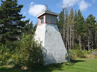
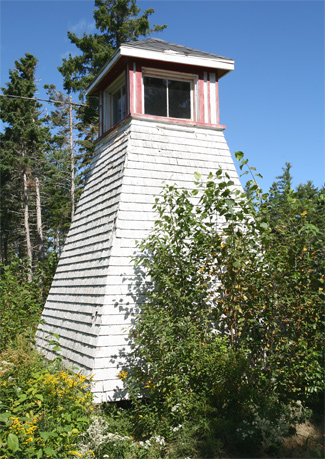

Photo Gallery


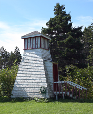


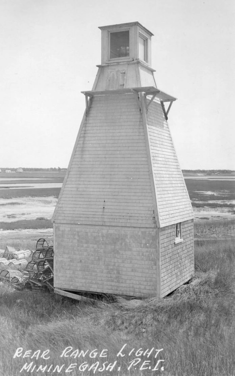
Photo Gallery
Photo Gallery
|
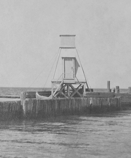
The Miminegash Range Lights were upgraded in 1900 as described by the following entry extracted from the Annual Report of the Department of Marine and Fisheries.
The range lights heretofore shown from lanterns on masts, to indicate the entrance to Miminegash, in the Gulf of St. Lawrence, have been improved by substituting lights shown from inclosed towers for the exposed lanterns, and by changing the positions of the lightbuildings. The front light is now shown from a square wooden tower, with sloping sides, surmounted by a square wooden lantern, the whole painted white, standing on the outer end of the south breakwater at the entrance to the pond. The building is 17 feet high from the pier to the ventilator on the lantern.The light is a fixed catoptric light elevated 17 feet above high water mark. The light shows red over an arc of 135° between the bearings of N. E. round through E. to S., covering Miminegash reef, and white from S. to S. 41° W., over an arc of 41°, which includes the line of range.
The back light is a fixed white catoptric light, elevated 28 feet above high water mark, visible over a small arc on each side of the line of range. It is shown from a square wooden tower with sloping sides, surmounted by a square wooden lantern, the whole painted white. The building is 27 feet high, from its base to the ventilator on the lantern, and stands on a cribwork block on the beach of the pond, 720 feet S. 11° W. from the front tower.
The lights in one, lead to the entrance to the pond between the breakwaters, clear of all outlying dangers. The towers were built last winter by days labour, under the supervision of Mr. Milton Walsh, and cost $254.30.
Two years later, the arc of visibility of the lights was changed as described in the Annual Report for that year.
The red sector shown from the front range lighthouse on the outer end of the south breakwater now shows over an arc of 78 ½° between the bearings of N. 79° E. and S. 22 ½° E. Between the southern edge of this sector and the land to the southwestward of the lighthouse no light shows. The white sector now shows between the bearings of S. 22 ½° E. round through south to S. 41° W. over an arc of 63 ½°, which includes the line of range.The illuminating apparatus consists of a compressed glass lens reinforced by silvered reflectors. The illuminated sector of the back lights has been increased so that it now shows from N. 79° E. round through east and south to about S. 41° W., or until cut off by the high land to the northeastward of the lighthouse. This change was made to enable small vessels to find the entrance from the southward to anchorage behind Miminegash reef.
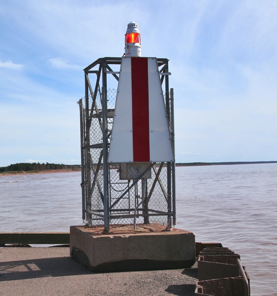
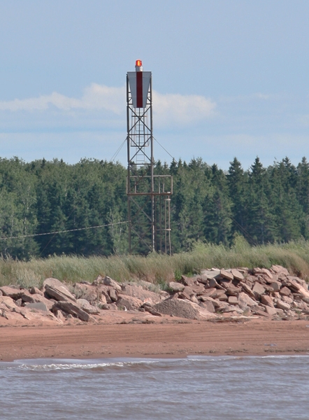
Today, a pair of skeletal towers, (front, back), serves to mark the entrance to Miminegash Pond. The old, wooden Miminegash Rear Range Lighthouse has been relocated across the northwest tip of Prince Edward Island to the grounds of a private cottage near Kildare.
Keepers:
References
