Big Tignish, PE 
Select a photograph to view a photo gallery

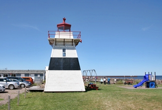
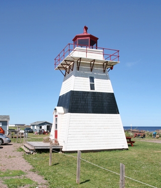
Photo Gallery
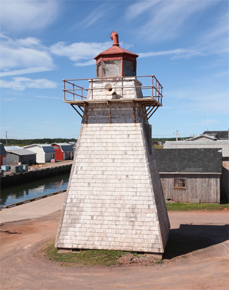


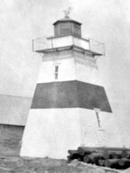

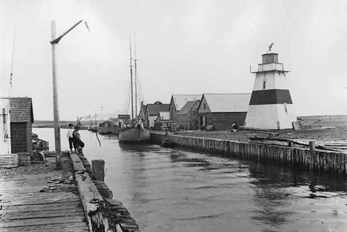
Photo Gallery
Photo Gallery
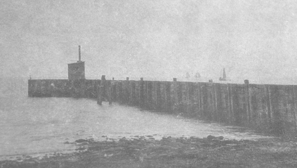
In 1877, two fixed beacons hoisted atop masts were established to guide vessels into the harbour. The front light was placed at the outer end of the breakwater and the back light stood about 320 metres (350 years) shoreward from the front light. The lights were erected by Theodore Bernard at a cost of $130, and Isidore Chasson was appointed the first keeper of the lights at an annual salary of $100. The lights were called a great boon to the fishermen of that place, but after just a year of operation, the beacons were destroyed by a gale on October 29, 1879.
|
The gallery surrounding the lantern room is mounted on iron brackets, which is not uncommon. The shingled lighthouse has no attached dwellings and only minor changes have been made to the tower over the many years it was in operation. Originally, it had one broad black band around the middle, but this was later painted over.
On September 15, 1883, a second light was established atop a pole at the outer end of the north pier to mark the location of the pierhead and, when aligned with the inner light, to guide vessels between the breakwaters. The light was fixed red, exhibited from a height of 4.3 metres (14 feet), and was located at a distance of 189 metres (620 feet) from the main light.
In 1888, a new mast and shed had to be erected to replace the former front light that was carried away by a gale the previous fall. In 1895, Captain J. Gallant replaced the rotten wooden foundation under the main tower with a stone foundation at a cost of $125.
Big Tignish Lighthouse was operated by oil until the tower was electrified in 1962. At this point, Alphonse Gaude, the last keeper who as being paid an annual salary of $590, was replaced by John Pitre, a caretaker who earned just $100. The tower continued to serve as a rear range light until 1989, when it was converted to a coastal light. The light was decommissioned in 1997, and in 2008 the tower was relocated from the harbour entrance to Fishermans Haven Park at nearby Tignish Shore.
Keepers: Isidore Chasson (1877 - 1881), Isidore Gaudet (1881 - 1894), J.S Richard (1894 1895), Fidele J. Gaudet (1895 1897), Agate Gaudet (1897 1912), D. Handrahan (1912 ), Jerome J. Perry (1923 1956), Alphonse Gaudet (1956 1962).
References

