William E. Dever Crib, IL 
Select a photograph to view a photo gallery
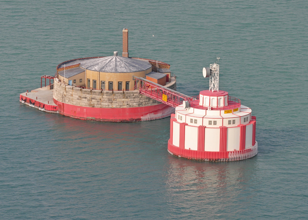
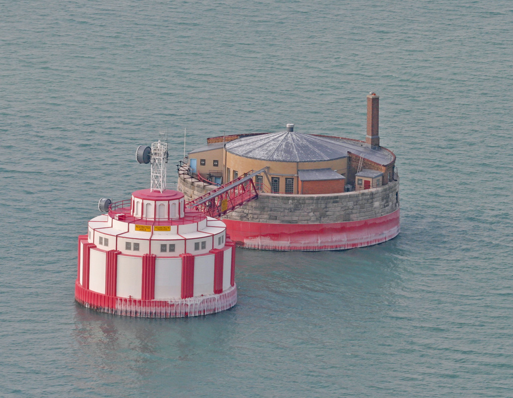
Photo Gallery
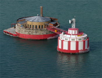
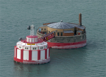

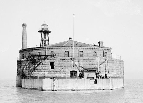

Photo Gallery
Photo Gallery
|
By 1860, the citys population had burgeoned to over 100,000, and the Chicago River had become a veritable cesspool as raw sewage and waste from the numerous slaughter houses and other industries flowed freely into it. With a significant number of its citizens dying from cholera and typhoid fever, the city hired Ellis Chesbrough in 1861 to serve as the Chief Engineer of the newly formed Board of Sewage Commissioners and tasked him with improving the citys water supply and sanitary systems.
Chesbroughs plan called for the excavation of a supply tunnel to connect a pumping station situated five miles inland to an intake crib located two miles out in Lake Michigan, well beyond the increasingly polluted shoreline. Dull & Gowan of Harrisburg, Pennsylvania signed a contract for the massive project on October 28, 1863, and work got underway the following May.
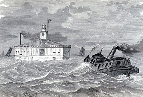
A wooden, double-walled crib, pentagonal in shape and with a height of forty feet, was built on shore and then towed into the lake by steam tugs and sunk in position by filling its hollow walls with stone. A cast-iron caisson was lowered inside the intake crib, appropriately named Two Mile Crib, and then driven into the lake floor. After the water was evacuated from the caisson, workers entered and excavated a vertical shaft to the prescribed depth before tunneling horizontally to meet the passageway being extended from shore.
|
The tunnel was completed on November 30, 1866, and the water system commenced operation the following year. Although the City of Chicago was responsible for maintaining the light and fog bell on the crib, these navigational aids did appear on the Lighthouse Services official List of Lights. In 1877, the Lighthouse Board noted that a proper light should be placed upon the crib at the outer end of the tunnel of the Chicago water-works, to replace the present inefficient one, not under the control of the Light-house Establishment. Four years later, the Board noted that they had reached an agreement with the City of Chicago to furnish the crib with a third-order lens, lamps, &c, and set them in working order when the city builds the tower and lantern.
As the population of Chicago continued to grow, additional cribs were built offshore. In 1898, the existing eight water intake cribs were capable of supplying the city with nearly a billion gallons of water each day. The cribs that exist today are Four Mile Crib (1891), 68th Street Crib (1892), Carter H. Harrison (1900), Edward F. Dunne Crib (1909), Wilson Avenue Crib (1918), and William E. Dever Crib (1935). The final crew of keepers was withdrawn from duty in 1990.
To thwart terrorist activity, security systems were installed on all the intake cribs in 2002. These systems include motion detectors, video cameras, and door sensors, and are linked to the Chicago Police through a microwave link. Vessels are prohibited from entering a buoyed zone around each crib.
|
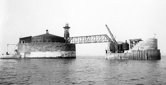
The Carter H. Harrison Crib was completed in 1900 and named in honor of Carter Henry Harrison, who served as Mayor of Chicago from 1879 to 1887. He was re-elected to a fifth term in 1893 but was assassinated later that year. The crib was built of stone, with the outer walls of the dwelling and well chamber faced with hydraulic pressed brick. A red skeletal tower topped with a gray lantern room formerly stood atop the crib and exhibited a single red flash every three seconds. In 1932, the Commissioner of Lighthouses noted that a submarine cable had been run between Chicago Harbor Lighthouse and the Carter H. Harrison Crib, and that the tower and structure at Carter-Harrison Crib were modified to accommodate machinery and apparatus, and air whistle, electrically driven air compressor, and 36-inch revolving airways beacon were installed.
William E. Dever Crib
The William E. Dever Crib, named after William Emmett Dever who served as Mayor of Chicago from 1923 to 1927, was constructed adjacent to the Carter H. Harrison Crib and then placed in operation in 1935. Upon completion of the Dever Crib, the navigational light was transferred from the Harrison Crib, to the apex of the taller Dever Crib. The thirty-five-year-old Harrison Crib was deactivated when the Dever Crib was fully operational, but when the citys water requirements continued to grow, the Harrison Crib was reactivated. The tunnel system connected to the aging Harrison Crib collapsed in 1998, and the crib was removed from service.
References