Pass a l'Outre, LA 
Select a photograph to view a photo gallery
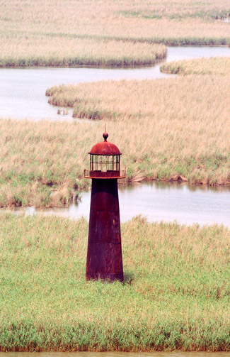
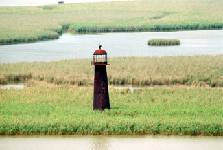

Photo Gallery


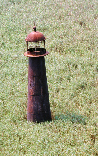

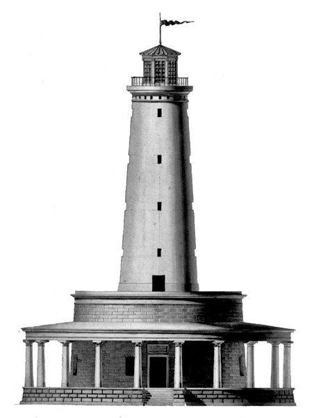
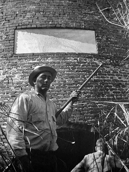

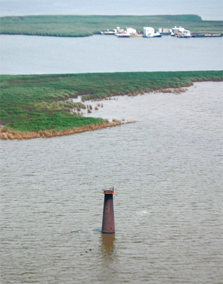


Photo Gallery
Photo Gallery
|
Following the Louisiana Purchase in 1803, the United States government allocated funds for the construction of a substantial lighthouse on Franks Island, located at the entrance to Northeast Pass, a branch off Pass a lOutre. Initially, while the new lighthouse was being constructed, a temporary beacon was established nearby atop an existing tower. Then in 1821, the lightship Aurora Borealis, the gulfs first, served offshore near Franks Island until the lighthouse was completed.
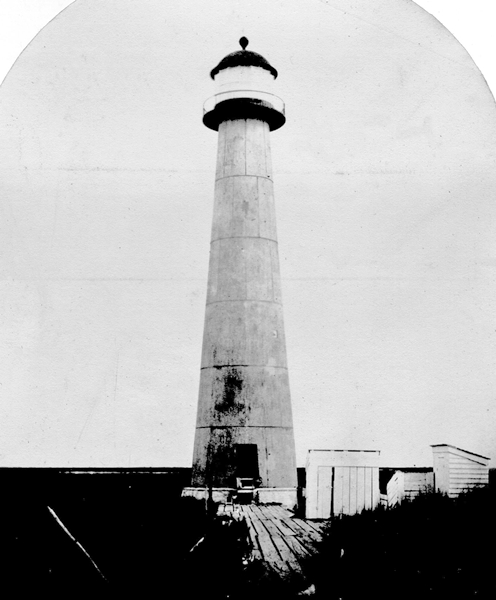
Benjamin H. Latrobe, architect of the United States Capitol, drew up the plans for the lighthouse on Franks Island. His design called for a magnificent structure consisting of a conical brick tower surrounded at its base by a circular dwelling, which was in turn encircled by an overhang supported by stone columns. The detailed plan for the tower was a bit grandiose for the mosquito-infested swampland, and no bidder could be found to assume the contract. Construction was further delayed by the War of 1812.
In 1816, Henry Latrobe simplified his fathers design, but still no contractor could be secured, even for the tempting sum of $55,000. In desperation, the Treasury Departments Commissioner of Revenue persuaded his friend Winslow Lewis to accept the job. Lewis already supplied the reflector and lamp system used in American lighthouses, but this was his first foray into lighthouse construction. He would eventually become Americas most prolific lighthouse builder, with more than eighty lighthouses to his credit.
Lewis was cautious and demanding in accepting the contract. His minimum fee was $79,000, and he insisted on having an inspector on site to verify his strict adherence to the proposed design. Lewis believed this safety measure would exonerate him in case the project failed.
|
Storms, tides, and the current of the mighty river are constantly transforming the marshy land of the Birdfoot Delta. Over time, Franks Island gradually disappeared and Lewis abandoned tower settled some twenty feet into the mud. Remarkably, the tower remained erect for years, until in 2002 the towers foundation was undermined, and it toppled into the murky water.
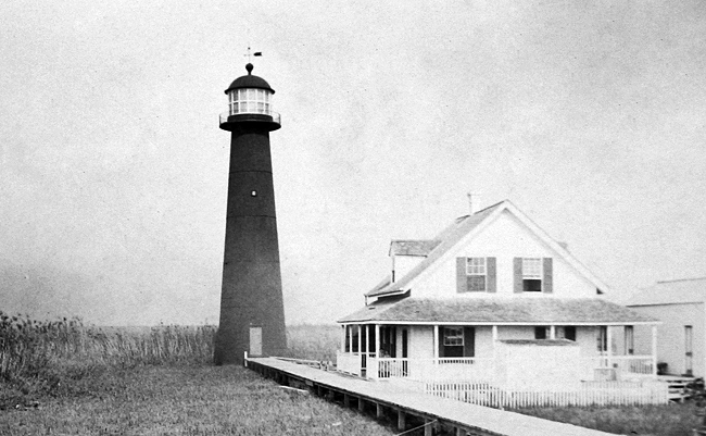
As Northeast Pass, serviced by Franks Island Lighthouse, started to shoal in, Pass a lOutre to the north deepened, providing better access to the river for large vessels. A tall iron tower in use at Head of Passes farther upstream was considered unnecessary, so rather than build a new lighthouse at Pass a lOutre, the iron tower was dismantled and relocated. Congress appropriated $6,000 on March 3, 1853 for moving the tower to Pass a lOutre and building a small beacon at Head of Passes. A new dwelling was constructed for the keeper at Pass a lOutre, and the light atop the relocated tower was lit for the first time in December 1855. John Lory, the last keeper of Franks Island Lighthouse, was the first keeper at Pass a lOutre. The third-order lens installed atop the relocated iron tower produced a fixed white light varied every minute-and-a-half by a bright flash at a focal plane of seventy-seven feet.
The lighthouse was put out of commission during the Civil War, when in June 1861 Conference forces removed the lamps from the station and destroyed the 120 gallons of oil on hand. Union forces later took down the Fresnel lens, and Confederate soldiers burned the keepers dwelling on January 1, 1862. The light was returned to service on April 20, 1863, after a new keepers dwelling was built and the iron tower had received a new brick liner and a thick coat of coal tar for rust prevention.
By 1868, the keepers dwelling, which rested on nine brick piers, had settled three feet into the soft ground. Around the same time, the tower also started to sink. The floor of the lighthouse was originally eight feet above the ground, but by 1876, water from high tides was flooding the tower floor. To provide continued access to the tower, the floor was raised five feet and a three-foot-square section of the tower above the doorway was cut out to create a new entrance.
|
A powerful hurricane struck the station on September 28, 1917, blowing away the tool house and inflicting heavy damage to the dwelling, walks, and wharf. Assistant Keeper Steven Coludrovich was in charge of the station in the absence of the head keeper and was commended by the Secretary of Commerce for performing his duties under hazardous and unusual conditions. The dwelling was subsequently raised and placed on concrete piers, and another new door was cut in the tower.
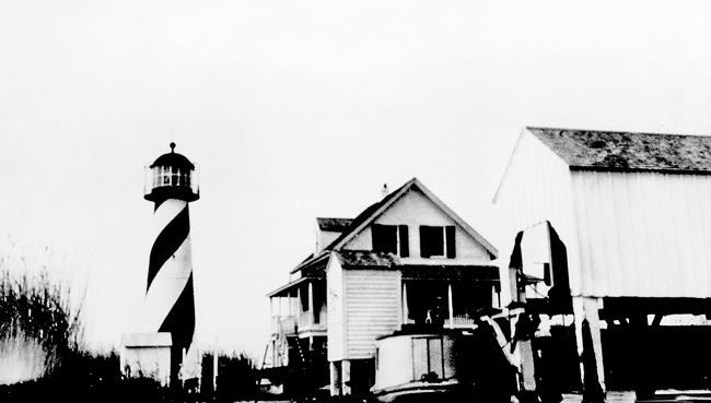
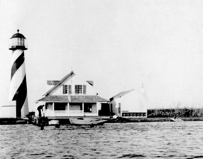
Mud lumps started to form in Pass a lOutre around the end of the nineteenth century, reducing the depth of the channel to just seven feet. Large vessels were then forced to access the river via an alternative pass. In 1919, the tower was given a spiral black and white daymark, similar to the candy cane striping at Cape Hatteras, North Carolina and St. Augustine, Florida.
Keeper John McNamara retired from Pass a lOutre on April 26, 1926, his seventieth birthday. McNamara served as a fireman and deckhand on vessels in the eighth lighthouse district from 1876 to 1893 and again from 1896 to 1910, and then served as a lighthouse keeper from 1911 to 1926, making a total of forty-six years of service.
Pass a lOutre Lighthouse was decommissioned on January 11, 1930, when the crew of the tender Magnolia removed the towers Fresnel lens. Head Keeper Frank Coludrovich and his assistant, Norvell A. Jackson, were initially offered transfers to other stations. These offers were later withdrawn after an investigation found that the keepers had failed to report a suspicious vessel believed to be engaged in rum running.
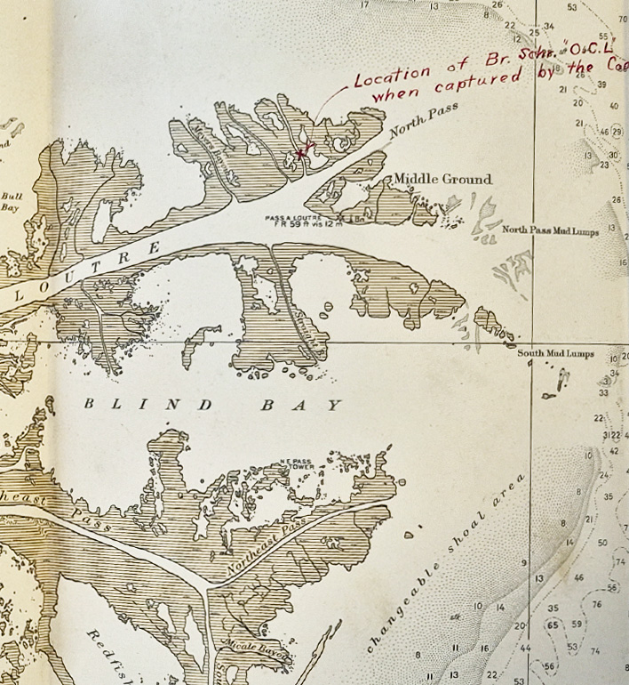
The incident occurred on November 1, 1929, during the Prohibition era. A picket boat from the Biloxi Coast Guard base seized the British schooner O.C.L., which was suspected of having recently unloaded a cargo of liquor. Coast Guard personnel had stopped at Pass a lOutre Lighthouse the previous day, October 31, and climbed the tower to use binoculars to observe the schooner. The vessels mast was visible from the lighthouse dwelling, and the schooner had reportedly been anchored nearby for several days. Despite this, both keepers stated that they had not noticed the vessel.
After reviewing the circumstances, the district superintendent concluded that the keepers had been negligent in their duties. In a letter to Coludrovich, he wrote that the keepers must have been blind not to have seen the schooner in the bayou one mile away, or not to have seen her the moment she entered Pass a lOutre. The investigation also noted that a known rumrunner, Fred Jeanfreauwho was related by marriage to Coludrovichhad been operating in the area at the time, further raising suspicions. This map shows where the schooner was anchored in relation to the lighthouse.
Although no liquor was found aboard when the schooner was seized, immigration authorities ordered the deportation of her captain, Robert Powery. After the lighthouse was decommissioned, the Coast Guard continued to use the abandoned structure as a lookout post for spotting rumrunners until the end of Prohibition in 1933.
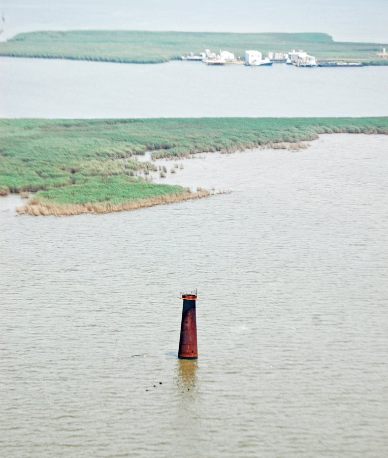
The towers spiral bands had started to fade by the 1950s, and by the end of the century, the tower was covered by rust and graffiti. No outbuildings remain at the station. With less than half of its original height showing above ground, the metal tower continues to be ever so slowly swallowed up by the marshlands of the Birdfoot Delta. Around 2007, the lantern room, loosened by Hurricane Katrina, fell off the tower. It seems that it will be only a matter of time before Pass a lOutre Lighthouse, true to its name, passes beyond.
Keepers:
References