Boon Island, ME 


Select a photograph to view a photo gallery
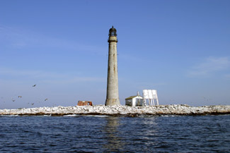


Photo Gallery

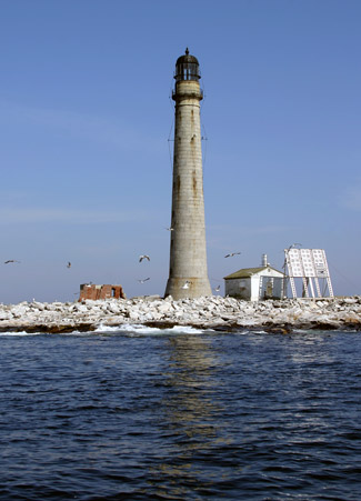
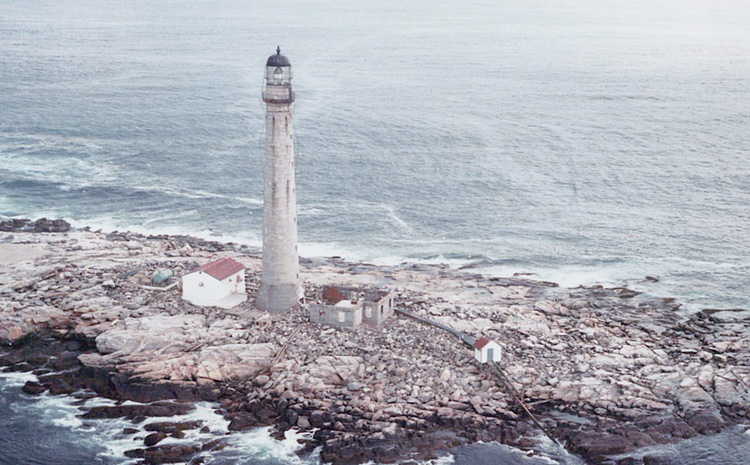


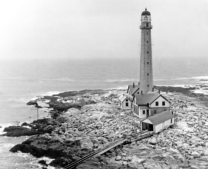
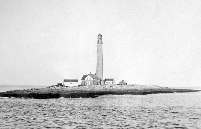

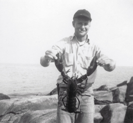
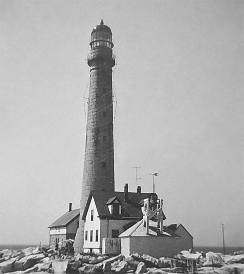


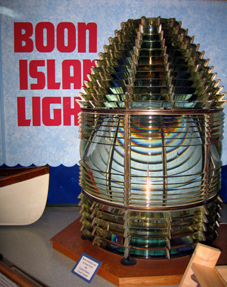
Photo Gallery
Photo Gallery
|
Following two shipwrecks in 1810, a twenty-five-foot tall tower topped by an octagonal lantern was constructed at a cost of $2,377 along with a stone keepers house for $150. While the island itself is barren, it has a lush history best told in the words and deeds of its keepers and their families.
At first, Boon Island was barely able to attract and retain a keeper. The first man offered the position refused. The second, David Oliver, accepted, but left without notice to work aboard a ship after the government refused his salary request. I have made a calculation and find that what would make me comfortable, Oliver wrote, would amount to nearly five hundred dollars [per year]also the wages of a Man and Boy would be thirty dollars a month. Therefore on these considerations I feel myself inadequate to the task, unless government will supply me with some of the above stated articles.
In March 1812, Thomas Hanna, grandfather of Marcus Hanna who would receive notoriety as keeper at Cape Elizabeth, agreed to man the light for $300 per year, plus a $100 advance for provisions. Hanna soon realized the sum was insufficient and requested $450 annually. After a year on the island, Keeper Hanna wrote the following threat: unless the Government provides for me and my family as agreed, I shall on the first day of April leave this place. Hannas request was forwarded to Secretary of Treasury Albert Gallatin with the following notation, it has been difficult to get anyone who would consent to accept the appointment as keeper for the compensation allowed. All the fresh water, wood and necessaries for a family must be carried on to the Island. Gallatin answered with a $100 salary increase. Three years later, Hanna left and was replaced by Eliphalet Grover. Hanna later returned to the service as keeper at Franklin Island.
In 1816, keepers salaries varied from $150 per year at Plymouth Lighthouse to a well-deserved high at Boon Island of $400. By 1818, an increase in salary prompted unscrupulous competition for the job at Boon Island. On November 11, 1818, Keeper Grover sent a letter to Collector Dearborn that included the following: I have just been informed that I am dead, but I am yet alive and hope to live to see those people brought to justice for making the report; one of the three is the man that has sent you his recommendation.
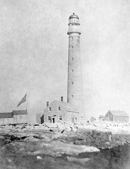
A new, forty-nine-foot-tall granite tower with an octagonal wrought-iron lantern was built by Colonel Seward Merrill for $3,406.65 in 1831. Although Merrill said he took pains with the mortar and later wrote, I did my utmost to have it done well, an 1843 report said it was laid up in bad lime mortar, the tower was leaky, and the walls inside were covered with ice in winter and green mould in summer. After the twelve lamps, set in fourteen-inch reflectors, went into service in the new tower, the old one was taken down to a height of twelve feet and used as a wood shed.
Grover was still keeper in 1837, earning $600 per year, and his letter-writing enemies continued their assault, branding him a profane man, uncivil to those who visit the island and alleging that he lived in great intimacy with his wifes sister (while apparently estranged from his ailing wife). Grover was cleared in court, but the accusations, and other difficulties, would continue.
On January 26, 1839, the Grovers were forced to retreat to the Light House as a place of safety as the sea broke into the porch, unhung the doors and forced the door of the dwelling house and entered the lower rooms, causing considerable damage. The Grovers had faced a similar situation on October 31, 1829 as recorded in the keepers logbook. At 9 PM all my family was forst to go to the Lighthouse and Stay until 5 next morning. At our return to the house found all our water gone and all my turnips and cabage washt away and my walls all Down. I have been hear 13 years and 4 months 28 days and never see such a time before. The sea washd the small rocks from under the Lighthouse and Dwelling house; the island was all under water for 4 hours.
On May 10, 1839, the complaints about Keeper Grover must have finally hit their mark, as the keeper wrote in his log: Turnd of[f] of Boon Island after Serving as Lighthouse Keeper 22 years and 10 months and 20 Day Without Cause.
|
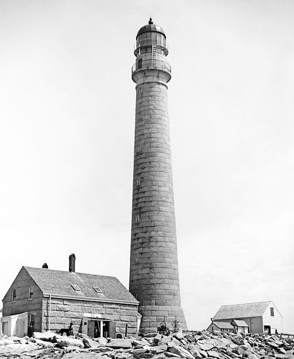
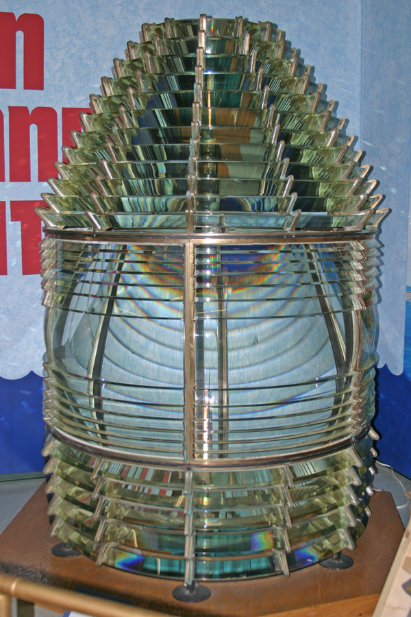
At 133-feet-tall, the new Boon Island Lighthouse, built of granite quarried in Biddeford and lined with brick, was and is the tallest in New England. The towers powerful second-order Fresnel lens, produced in France by Sautter et Compagnie, went into service on January 1, 1855. 175 steps were required to climb the tower, a task the keepers had to perform several times each night to trim and fill the lamps, often toting heavy containers of lamp oil. To ease the burden, two assistant keepers, the stations first, were assigned to Boon Island in 1855.
William C. Williams signed on as second assistant on August 5, 1885, earning $450 annually. He was promoted to first assistant with a $20 increase in salary in 1886, and received another $10 in 1888, before being promoted that year to head keeper at $760 per annum. That would be his last raise, even though he stayed on for twenty-three more years. From 1897 to 1905, his son, Charles S. Williams was first assistant, following his promotion from second assistant.
Although William C. Williams remained at Boon Island longer than any other keeper, his mind was not immune from the effects of the storms that often raked the island:
There were days when I first went on station that I could not get away from the idea that I was locked up in a cell . When rough weather came we didnt know as it would make much difference as to whether we went into the tower or not When the terrible seas would make up and a storm was in the offing, I was always thinking over just what I would do in order to save my life should the whole station be swept away .I believe it is these things which gradually wear on the mind and finally upset the brain.
The 1888 Annual Report of the Lighthouse Board described the structures at the station. The lighthouse was twenty-five feet in diameter at its base, twelve feet in diameter at the top, and 118 feet high to the base of its lantern. The tower itself and its fourteen windows, which were sealed shut, were leaky. The interior was damp. The stone dwelling designed for two keepers is occupied by three, two of whom have families. It is old and its interior is in bad condition, needing thorough renovation. The island is a bare rock; communication with the coast is infrequent in winter, and the keepers have had to store their vegetables and provisions in the halls adjoining their bed-rooms. The same report also noted that the vibration of the slender tower had been checked by installing six iron ties with struts that were attached to the top of the lantern and anchored to the masonry 40 feet below the watch-room deck.
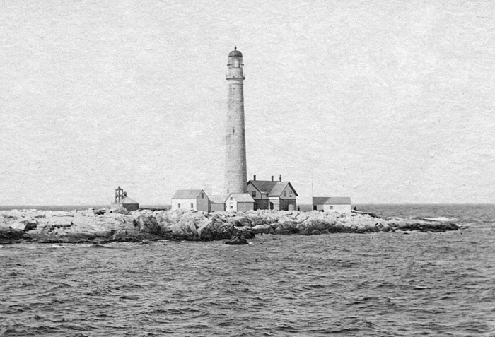
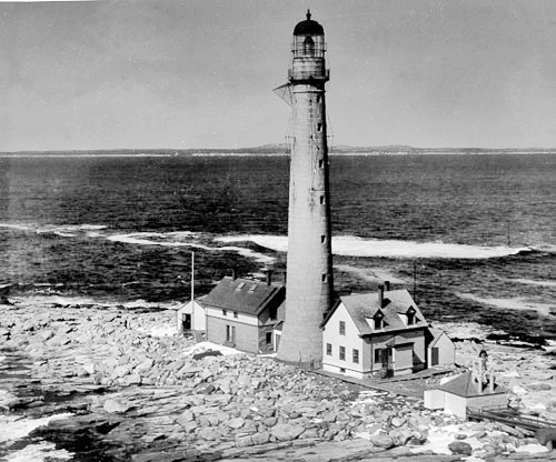
To improve the conditions described in 1888, the exterior of the stone dwelling was torn out and rearranged, and a frame upper story was added to the dwelling. In addition, a supply shed, measuring twelve by twenty feet, and a brick oil house were erected on the island.
On the evening before Thanksgiving Day 1890, few provisions remained at the station. Keeper Williams was inside the tower worrying about what he and his boys could enjoy the next day, when suddenly there was a crash on the parapet deck. He found eight dead black ducks that had smashed into the tower, and four more on the rocks below. The next day, the family gave thanks to the Creator for remembering them. Salted cod, sea fowl, and lobsters ranked high in the keepers diets, though lobster was far from being a delicacy. In those days, some workers even signed contracts to prevent lobster from being fed to them too frequently.
In 1890, the stations cracked 1,200-pound bell was recast and placed atop a newly completed stone and brick oil house that measured sixteen by fourteen feet. A bell-buoy was placed on Boon Island Ledge, about three miles east of Boon Island, starting in 1858 to mark this navigational hazard. In 1901, the Lighthouse Board requested $10,000 for a powerful fog signal to replace the bell used on Boon Island. Although this request was repeated for over a decade, a fog horn did not replace the bell until around 1960.
|
Until construction of the new dwelling was completed in 1905, animosity festered, as was noted in a letter by First Assistant Charles W. Torry, charging the Keeper of that station with neglect of duty, in not properly keeping an account of oil expended at the station, and a waste of the Government property in throwing surplus oil away in order to make his account of expenditures tally. Apparently, no disciplinary action was taken against Keeper Williams; but Torry soon found himself unemployed.
The worst storm that struck the island during Keeper Williams lengthy tenure began on January 31, 1898 and was described by Williams in a letter to The Portsmouth Herald. The wind reached nearly 100 miles per hour and stirred up waves that dashed against the dwelling and tower, coating them in thick layers of ice. Two water tanks, weighing about four tons each, were lifted off their granite foundations and carried a distance of seventy-five feet to the northeast end of the island and totally wrecked. Rocks weighing fifteen tons or more were moved twenty feet, and two outbuildings were swept away. The fires inside the dwelling went out after the chimneys became capped with ice.
Charles Williams, who served as first assistant to his father, had recently married and was celebrating his honeymoon on the island with his new bride. The other occupants of the island at the time were Head Keeper Williams and his wife, and S. H. Sawyer, who was filling in for Assistant Keeper Seaward, who was ashore taking care of his wife.
Keeper Williams account of the storm included the following:
It was a dangerous piece of work, and the chimneys were cleared only after a hard struggle. But it was a case of clear out the flues or starve, for the whole house was an iceberg and as for that matter the whole island was the same.It was the hardest night we ever passed, and no one slept on the island during the entire night. The island in the morning was one of the grandest sights I ever witnessed.
When John Morris was in charge of Boon Island Lighthouse in December 1945, a similar storm struck the island. The storm washed huge rocks up on the island, demolishing the keepers house and a couple of small outbuildings. Morris, his wife, their two-year-old son, and two coastguardsmen sought refuge in a small, sturdy structure, and a helicopter was dispatched to drop food to them after the waves subsided.
Keepers at Boon Island occasionally assisted mariners who found themselves in dire circumstances near the station. In December 1892, the British Schooner Gold Hunter wrecked on Boon Island with the temperature at four degrees below zero. Keeper Williams and his assistants saved the six crewmembers, though afterward, the keepers and the crew were almost equally incapacitated by exposure. In 1919, Keeper Harry Smith and his two assistants rescued seven men aboard the schooner Hazel E. Ritcey, after it struck a rock and sank near the island.
During the early 1930s, Fred Batty was an assistant keeper at Boon Island. His wife Florence recalled that in lieu of indoor toilets, each of the three families would cut off the tops of five-gallon tins of kerosene oil and place them in an outhouse. Once during a storm, Florence heard her daughters shrieks. The tin, above which she was perched, had been two-thirds full and when the sea come, it struck the back of the toilet and it knocked the windows out of the back of the toilet and all that stuff come right out of the square can right onto Arothusa! Right in her hair .So after that, she started using the chamber pots. Florence related a similar experience had by Keeper Harold Hutchins. A little while after that same storm, Hutch put the teapot on the stove to get the tea hot, and he got up to go to the bathroom and the sea took bathroom and all and took it all out back on the high rocks I was glad to get off that place. I was scared out in that place...It was an awful life.
On August 20, 1932, a newspaper printed a letter about the life of a keeper at Boon Island. One has to have a varied knowledge of things to be a lightkeeper. As one keeper here recently said, I thought all one had to know how to do out here was to clean, paint, and polish brass, but I have found out that one has to be doctor, painter, steeplejack, glazier, boatman, gasoline engineer, electrician, stonecutter and even a cook when the women folks leave us in the fall.
|
Miriam (Dolby) Hammel, wife of a coastguardsman stationed on the island during World War II to watch for German U-boats, had fonder memories of Boon Island. I look back at the months that we spent on Boon Island as a marvelous part of my life. But her description of the water system would disgust most people. The rain would be allowed to wash off the roof where all the seagulls sat every daythen at the foot of the downdrains from thereof, a cup would be turned up to catch the water that came down the drainpipes. From there it would run into a cistern in the cellar. We boiled every bit of what we drank or bathed with. Yuck! That cistern had green scum an inch thick on top of it.
Despite the storms and hardships, several children and grandchildren loved their time on Boon Island. Mary Luther spent summers there with her grandfather, William C. Williams. She did chores, roller skated on the islands boardwalk, searched tide-pools, worshipped with the family every evening, and picnicked on Sundays. Eva Philbricks father was an assistant keeper on Boon Island from 1913 to 1917. Eva recalls, Sometimes I played alone on the rocks, and when there were a lot of seals, Id make believe that was my army. When a whale went by, spouting, Id make believe that was my submarine. And Harold Hutchins daughter Shirley Kelley said: As a kid, it was my idea of Paradise! There was always something to do on the island. We made kites and flew them anytime, as there was always a breeze coming off the ocean.
Ruth Abbott Carley, who met Gordon B. Kenny at the USO on Boston Common and was dating the coastguardsman while he was stationed at Boon Island Lighthouse in 1951 to 1952, kindly provided the images embedded in this paragraph. Ruth doesnt recall many stories from Gordons service on the island, but she does remember that the difficulty in accessing the island with the stations boat delayed his coming to visit her in Boston on more than one occasion!
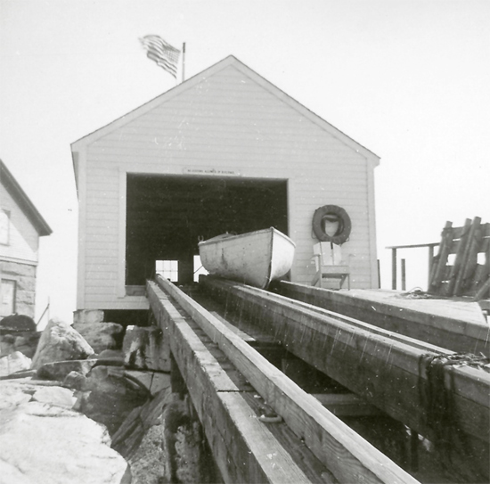
The Blizzard of 1978 helped write the last chapter in Boon Islands history as a manned light. There were two Coast Guard keepers on the island when the storm hit, tossing boulders across the island. The men sought refuge in the tower as the angry seas damaged the fuel tanks, helicopter pad and generator building, and destroyed the boathouse and boat launch. Not long afterward, the station was automated, and the damaged dwelling was burned in 1981.
Following some competition, Boon Islands original second-order Fresnel lens, which had been removed from the tower in 1993, was given to the Kittery Historical and Naval Museum in Kittery, Maine where it may be viewed by the public. The museum has the following table of lens sizes posted.
In 2013, the Kittery Historical and Naval Museum announced it was having difficulty paying the premium on the $800,000 insurance policy for the Boon Island lens. Not wanting to see the lens returned to the Coast Guard, the Greater York Region Chamber of Commerce held a raffle that generated $2,000, enough to pay the premium for two years.
In May 2000, Boon Island Lighthouse, from which a flashing white light, visible for nineteen nautical miles, is emitted every five seconds, was leased to the American Lighthouse Foundation. On May 16, 2012, Boon Island Lighthouse was made available under the National Historic Lighthouse Preservation Act of 2000 to eligible federal, state, and local agencies, non-profit corporations, educational agencies, and community development organizations to be used for educational, recreational, cultural, or historic preservation purposes. Interested entities were given two months to submit a letter of interest expressing their desire to submit an application for ownership. When no qualified custodian was found, an online auction for the lighthouse was opened on May 14, 2014. Thirteen bidders participated in the auction, which closed on August 17 with a high bid of $78,000. Though the government has the right to reject all bids if it believes a fair market price has not been achieved, the $78,000 bid was approved a few weeks after the auction closed, and the lighthouse was awarded to Arthur Girard a real estate developer from Portland, Maine. Girard was one of two bidders seriously pursuing Ram Island Ledge Lighthouse in 2010, but he dropped out of that auction after losing a coin toss to the eventual winner.
In December 2014, just months after acquiring the lighthouse, Girard sold the property to Boon Island LLC for $119,673. The new owner is Bobby Sager, a lighthouse enthusiast and philanthropist with enough assets to fund a thorough restoration of the tower. Sager acquired Minots Ledge Lighthouse at auction later in 2014 and then Michigans Grays Reef Lighthouse in 2016.
Keepers:
References

