Au Sable Point, MI 


Select a photograph to view a photo gallery
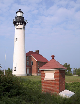


Photo Gallery

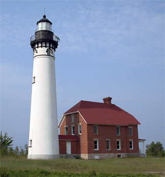
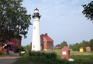

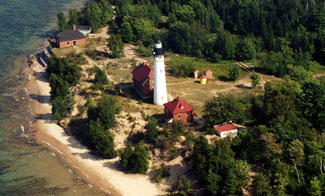
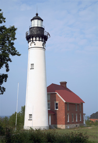
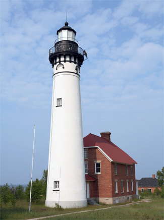

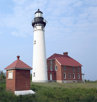
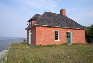

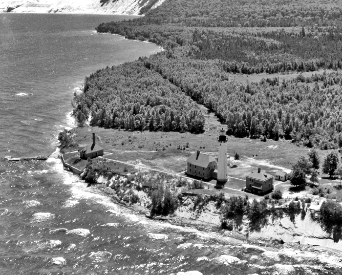


Photo Gallery
Photo Gallery
|
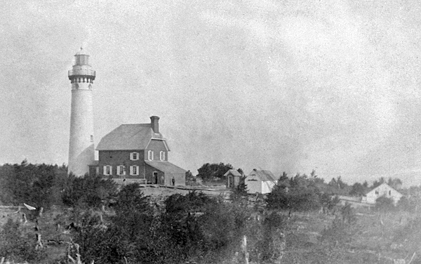
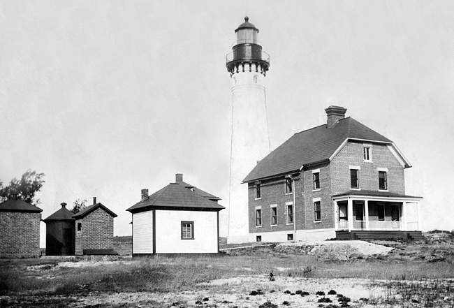
For the convenience of the keepers, a twelve-and-a-half-foot-long passage was built to link the base of the tower to the two-story dwelling. While the tower was whitewashed, the redbrick dwelling was left unpainted.
By the end of June 1874, work at the station was finished except for plastering, outside whitewashing, and installing the Fresnel lens. After this work was finished, Keeper Casper Kuhn displayed the light for the first time on the night of August 19, 1874.
Gus Gigandet arrived at Big Sable on May 21, 1884 to take charge of the station and noted in the stations logbook that he was Contented and Satisfied whit the Station. On July 24, 1893, Keeper Gigandet recorded that during a thunderstorm that day, lighting struck the tower at 9 p.m., boring two holes in the bottom of the tower right at the foot of the Stairs, burning and damaging the paint in several places about the floor.
On July 17, 1891, the passenger steamer Empire State ran aground on a reef near the station in a thick fog. The twenty-four passengers and forty crewmembers all came ashore at the lighthouse, where they were accommodated until the passengers were placed aboard the India the following day, and the crewmembers left on the 20th. After being ill two weeks, Keeper Gigandet died at the station on October 29, 1896.
While the light was appreciated by mariners, it wasnt much assistance in thick weather. In 1892, the Lighthouse Board made the following plea for a fog signal at Big Sable:
This important light-station is on the southern shore of Lake Superior, about halfway between Marquette and White Fish Point. The entire traffic of Marquette, which, it was stated, was some 1,772,400 tons in 1890, passes close to this station, and in time of southerly gales the whole commerce of Lake Superior hugs the south shore. A steam fog signal is required to complete the satisfactory equipment of the station. It is estimated that it can be established at a cost not exceeding $5,500, and it is recommended that an appropriation of this amount be made therefor.
|
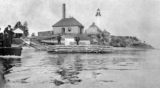
A brick oil house was built at the station in 1895, and a wood shed was added in 1904. Also in 1904, the iron smokestacks atop the fog signal building were replaced by a forty-foot-tall brick chimney, and a brick cistern was built for the fog signal water supply. A roadway from the station to the public highway was cut through the surrounding woods in 1905. In 1906, a sixty-eight-foot-long seawall was built of rubblestone laid in cement mortar to protect the stations boat landing and water supply crib.
In 1909, the original dwelling was remodeled to create two separate apartments for the assistant keepers, and a new two-story dwelling was built west of the tower for the head keeper. The station was attended by two keepers, a head keeper and an assistant, until a second assistant was added in 1904.
On August 29, 1913, the intensity of the light was increased from 1,200 to 28,000 candlepower by changing the illuminant from oil to incandescent oil vapor. The fog signal was converted on October 15, 1928 to an air diaphone that sounded two one-and-a-half-second blasts every thirty seconds.
Lighthouses keepers often went to the assistance of mariners, and a fine example of this is the following account by Keeper Klaas Hamringa:
On November 30, 1929, steamer Kiowa drifted 6 miles west of the light station, with a northwest gale. The crew launched a lifeboat, Saturday, which capsized, drowning five of the men. Everything on board the Kiowa was coated with ice, making it impossible to launch the boats. The steamer was on the side, stern down, with a 45 degree list. Mr. Chilson and two others were coming from a hunting trip west of the light station at 2 p.m. Sunday in a small gas boat, with rowboat in tow. Seeing the steamer, they picked off three men, and made for the lighthouse, as the wind began to pick up from the northeast. The men were almost frozen.We immediately sounded the whistle at 2 p.m. and gave danger signals for an hour or so. We could not see help coming, so we launched our gas boat. We started about dusk and it was dark when we arrived at the steamer Kiowa. Six men were accommodated in the gas boat 5 in the rowboat, and 5 in Chilsons boat. When we had the crew all off and were about a mile from the boat, following the shore line, making for a hunting camp about 4 miles from the station we saw the light of the Coast Guard boat coming. Flashing them signals, we ran alongside and put 16 of the crew on the Coast Guard boat, which took them to Grand Marais.
Keeper Hamringa, and his two assistants, John Hamann and William Campbell, were commended for the assistance they gave the crew of the Kiowa.
|
The characteristic of the light was changed from fixed white to a group of two white flashes every fifteen seconds in 1944. Au Sable Lighthouse was automated in 1958, and its keepers withdrawn.
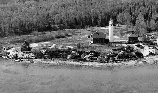
In 1968, Au Sable Light Station became part of the surrounding Pictured Rocks National Lakeshore, which had been created in 1966. When the stations third-order lens was removed from the tower sometime after 1972, it was placed on display at the old Grand Marais Lifeboat Station, which doubled as a maritime museum and the lakeshores ranger station. After the lantern room was restored, the lens was returned to its rightful home atop Au Sable Lighthouse in 1996.
In 2010, the Park Service celebrated a nearly thirty-year-long effort to rehabilitate the structures and landscaping at Au Sable to return the station to is 1909 appearance. Some of the final projects included whitewashing the tower, replacing pressed metal roofs, and restoring auxiliary structures. Volunteer light keepers now live in the upper floor of the head keepers dwelling and provide tours to visitors during the summer months.
Keepers:
References
