Point Au Roche, NY 
Select a photograph to view a photo gallery


Photo Gallery


Photo Gallery
Photo Gallery
|
Vessels traveling near the northern end of Lake Champlain must veer to the east at La Roche Reef, just south of Isle La Motte, to avoid shoals, and on August 31, 1852, Congress appropriated $5,000 for a lighthouse to mark the navigational hazard. The federal government purchased 10.4 acres on the New York shore near La Roche from Nathan Perry for $440 to serve as the site for Point au Roche Lighthouse, but the lighthouse was not activated until the opening of navigation in 1859, the same year as its two sister lights at Windmill Point and Crown Point. A temporary beacon light was exhibited from Point au Roche from 1856 until the lighthouse commenced operation.
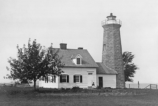
Point au Roche Lighthouse consisted of an octagonal blue limestone tower connected to a wooden cottage, and like its sister lights, had trapezoidal panes in its lantern room. A sixth-order Fresnel lens was used to produce a fixed white light that from its focal plane of fifty-four feet above the surface of the lake could be seen for thirteen miles.
A barn and stable were erected for the keeper in 1868, and in 1879 a cistern was built in the dwellings cellar.
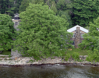
In the interest of efficiency and economy, the Lighthouse Service requested funds in 1919 to discontinue all oil lights on Lake Champlain, except at stations with a fog bell, and replace them with acetylene lights, but this conversion process didnt start until the early 1930s. At all other Lake Champlain lighthouses, an automated beacon was placed on a skeletal tower near the now-inactive lighthouse, but at Point au Roche, an electric light was installed atop the limestone tower in 1933. All the lighthouse property at the point, save a fifty-foot-square lot surrounding the tower, was then sold for $2,100 in 1934 to Grover C. Oliver, a former keeper, who moved the keepers cottage just north of the tower and used it as a private residence. Grover C. Oliver served as first assistant keeper at Eatons Neck on Long Island Sound for several years before being placed in charge of Point au Roche Lighthouse in 1919.
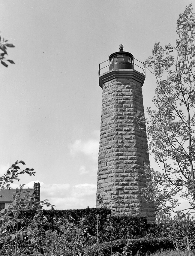
Over time, the shoreline in front of the tower eroded away, and the masonry of the tower deteriorated. In fact, a large section of the cornice just beneath the lantern room has fallen from the tower. In 1989, the Coast Guard determined the tower was unsafe and replaced Point au Roche Lighthouse with a buoy on La Roche Reef.
Head Keepers: Warren Clark (1856 1859), Allen Ormes (1859 1861), E.F. Chamberlin (1861 1865), Ambrose Gillette (1865 1866), William A. Nicholls (1866 1886), Amos Walker (1886 1892), Frank E. Diamond (1892 1901), Peter Savage (1901 1919), Grover C. Oliver (1919 at least 1921), William H. Bailey (at least 1925 at least 1930).
References