Borden Flats, MA 


Select a photograph to view a photo gallery
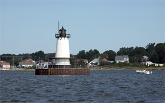


Photo Gallery

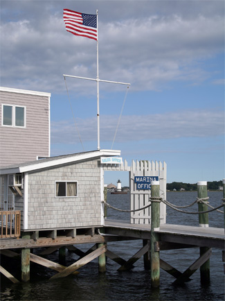
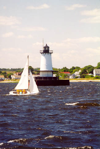

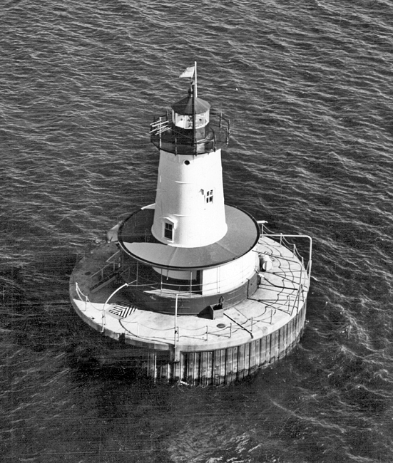
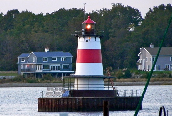
Photo Gallery
Photo Gallery
|
To warn ships away from shoals and underwater rocks at Fall River, $25,000 was appropriated for a lighthouse at Borden Flats on June 16, 1880, following a recommendation by district officers of the Lighthouse Board. Prior to the lighthouse, an unlighted day beacon had marked the danger since at least 1868.
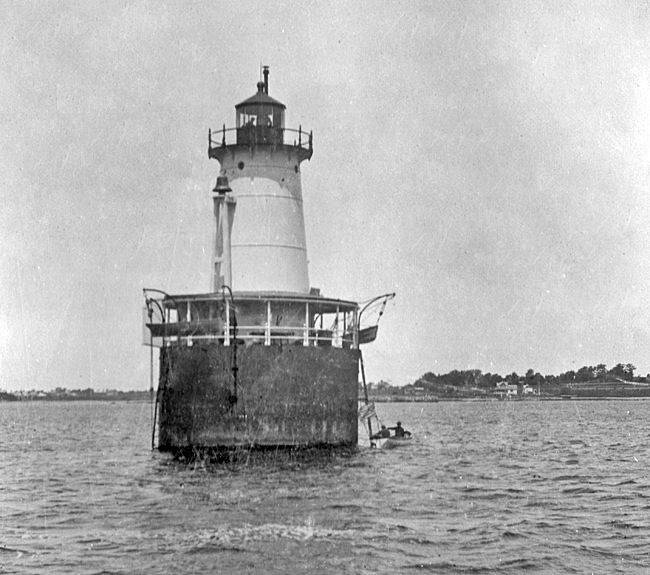
Work on the lighthouse began in 1881 when three sections of an iron pier were sunk in place, leveled, and filled with cement. The cylindrical iron tower and lantern were cast elsewhere and shipped to Fall River in July of that year. The station, which also included a fog bell operated by machinery, was lighted for the first time on October 1, 1881. The following item announced the establishment of the light and fog bell:
Notice is hereby given that on and after Oct. 1, 1881, a fixed red light of the fifth order will be exhibited from the light-house recently constructed at Bordens Flats, Mount Hope Bay, Mass. The apparatus lights 270° of the horizon, and the focal plane is 50 feet above mean low water. The light should be seen in clear weather, from the deck of a vessel 15 feet above the sea, 12 ½ nautical miles.The structure is an iron tower, standing on an iron pier filled with concrete. The pier and tower are red, the lantern black.
A fog-bell, struck by machinery, will be sounded during thick and foggy weather.
The circular rooms in the tower are twelve feet across with ceilings a little over seven feet tall and provide about 1,000 square feet of internal space. The windows are cased in iron, and a staircase circles the interior walls of the towers five floors. A basement cistern captures rainwater that falls on the lighthouse.
Although the light is not far from the mainland, its remoteness almost led to the death of Keeper Herman Georgy. In September 1897, Georgie was struck by an acute case of appendicitis. His alarmed wife rang the fog bell and waved her arms to flag down passing boats for some time before it was realized that she was not merely in a friendly mood. For two days, he suffered intense agony, wrote the Boston Globe, attended only by his wife.
|
Keeper Joseph Meyers account of life at the light has been preserved in the stations log, which is now housed in the National Archives. One entry described the storm of October 8, 1907: Violent SW gale. Occasional heavy squalls. 11 a.m.A barge of about 800 tons of coal sank in the harbortwo men drowned, and a sloop of 10 tons was wrecked on the beach.
According to Meyer, winter often found the light surrounded by the frozen sea or chunks of ice. On February 15, 1908, he wrote: Started fog bell at 6:30 a.m. Bell broke 11 a.m.struck by hand until 1 p.m. In 1912, the Boston Globe noted that Meyer was iced in and stranded at the light from January 4 to February 1. Once he finally made it to the mainland, his return was difficult. The tug which brought him ashore was obliged to leave the harbor before he was ready to return, and the keeper set out at midnight for the lighthouse, but got caught in the drift ice and was more than two hours getting back to shore, reported the Globe. In consequence of his absence the beacon failed to shine for the first time in seven years.
Keeper John H. Paul (1912 1927) filled many log pages with tales of the perpetual scraping and painting of the light. But on August 3, 1912, he had a far more eventful day. Paul witnessed a rowboat overturn as two local men aboard changed places. Keeper Paul rushed to his boat and was able to rescue one man, but the other, who was unable to swim, drowned. Paul received a bronze Carnegie lifesaving medal for his heroism that day.
While for Keeper Paul it was the endless cycle of painting that vexed him, for Elaine, daughter of Keeper Joseph Covo (1927 1943), it was the brass. Everything was brass, Elaine said. You polished brass from morning to night with government polish.
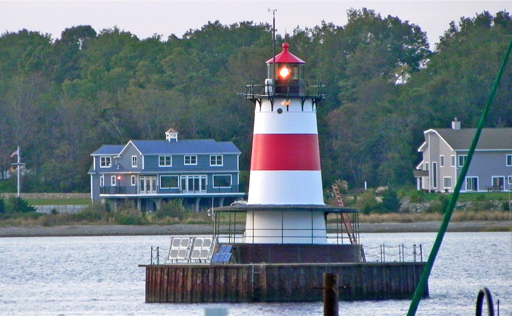
During the Great New England Hurricane of 1938, wind-driven seas hit Borden Flats Lighthouse with such force that the tower tipped a bit to the north. The lighthouse retains the slight lean to this day, but a larger caisson was subsequently built around the tower to provide added stability.
Truman Sawyer viewed his time at Borden Flats from November 1955 to December 1956 as punishment. Although the light, refrigerator, and stove were powered by kerosene, the fog-bell still had to be wound by hand. When the light was finally electrified in 1957, the kerosene lamp was retained for backup.
A modern optic, flashing white every two-and-a-half seconds, replaced the Fresnel lens in 1977, and an automatic horn took the place of the fog bell in 1983. In 1989, the light was converted to solar power. Inside Borden Flats Lighthouse, a row of batteries, the size of a car engine, power its automated light. The towers biggest room is the covered porch (roughly six feet wide) that wraps around the lighthouse about ten feet above the water.
|
Gabriel, who had planned to convert the lighthouse into a microbrewery capable of producing enough beer to pay for its upkeep, defaulted on closing. Despite Gabriels legal wrangling to prevent it, the lighthouse was put back up for sale by the federal General Services Administration on June 30, 2010.
With the backing of his parents Craig and Cindy, Nick Korstad became the new owner of Borden Flats Lighthouse on August 31, 2010 with a bid of $56,569. Korstad bid on the lighthouse, with its cracked concrete, bushels of weeds tumbling out of roof gutters, rusted railings, and gutted interior, sight unseen. This isnt the first lighthouse Korstad has owned, as he won a similar auction for Virginias Wolf Trap Lighthouse in 2006, but after being unable to obtain a loan for the property, he had to sell that lighthouse to another individual.
The terms of sale for Borden Flats Lighthouse require Korstad to preserve the structure, to allow the light and fog horn to continue operation, and to grant the Coast Guard access for maintenance and repairs. Thats fine with Korstad, who said, It is a lighthouse. Thats what I want it to be.
Initially, Korstad didnt have exact plans for the structure, but stated, I want to restore it back to what it was originally, and I want to make it accessible to the public. In 2011, Korstad altered the lighthouses daymark by painting a red band around the middle of the tower. The Coast Guard was fine with the change, as mariners rely mostly on the lights signature. Korstad started offering public tours of his lighthouse in June 2013, and shortly thereafter also opened it up for overnight stays. While the light remains active, visitors dont have to worry about the fog signal, as it was deactivated in May 2013.
In 2017, Korstad placed the lighthouse on the market for $389,900, and it sold the following year. Nick has definitely not lost his enthusiasm for lighthouses as he used the proceeds from the sale of Borden Flats Lighthouse to help purchase Michigans Big Bay Lighthouse. Korstad relocated to Michigan in 2018 to become innkeeper at his new lighthouse. Kevin and Carole Ferias, who purchased Borden Flats Lighthouse from Korstad, kept the overnight lightkeeper program going that was started by Korstad but also planned to add events like wine tastings and weddings. Some of the people interested in purchasing the lighthouse wanted to make it private. Kevin and Carole Ferias spent a night in the lighthouse to celebrate their twenty-fifth anniversary and want others to have the chance to enjoy the lighthouse.
In 2023, Kevin Ferias placed Borden Flats Lighthouse on the market with an asking price of $1.25 million.
Borden Flats Lighthouse might one day lure more visitors to Fall Rivers than Lizzie Borden, but with the publics undying fascination with the murders, that isnt likely to happen too soon.
Keepers:
References