Newburyport Harbor Range Rear, MA 


Select a photograph to view a photo gallery
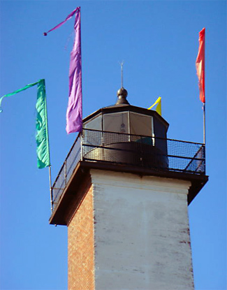
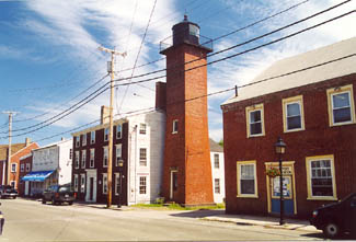

Photo Gallery


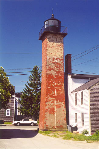
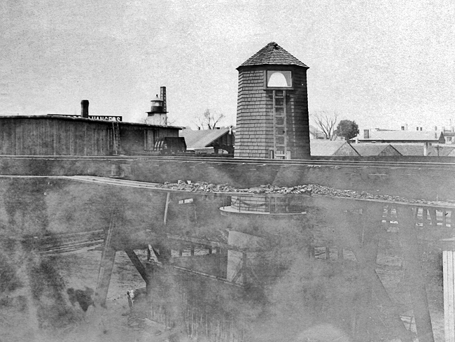

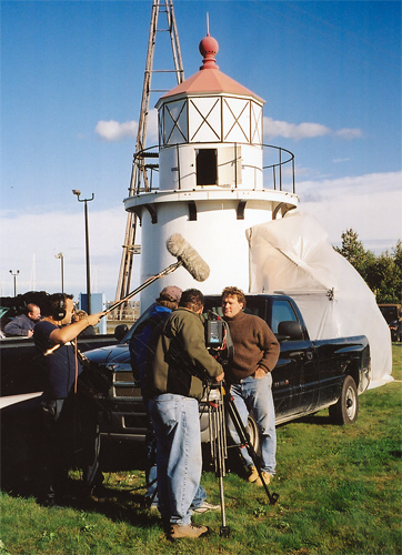
Photo Gallery
Photo Gallery
|
Fires were routinely set on the beach at Plum Island to guide mariners to the mouth of the Merrimack River until the Marine Society of Newburyport erected two day beacons in 1783 and employed men to hoist lanterns atop them at night. The construction of two formal lighthouses on the island in 1788 proved even more beneficial for mariners wishing to enter the Merrimack River, but it was obvious that another set of range lights was needed to help mariners navigate roughly two miles up the river to reach the town.
Range lights, also known as leading lights, are typically a pair of lights displayed at different heights and located far enough apart to enable mariners to line one above the other to indicate the center of a channel. Normally, the front light is shorter than the back or rear light.
For several years, a pair of range lights in Newburyport Harbor was maintained by private subscriptions. In 1871, the citizens of Newburyport petitioned the Government to take charge of these lights. The Lighthouse Board estimated that it would cost $10,000 for two new structures to serve the range and also recommended that $6,000 be provided for a day beacon on Black Rock, as further aid to mariners entering this difficult harbor. Negotiations to obtain titles to the range light sites so that new towers could be erected were underway in 1872, and on June 10 of that year, Congress appropriated $10,000 for re-establishing and setting up two small beacon lights in harbor of Newburyport, the site of one of which has been washed away by a storm.
The construction of the present Newburyport Harbor Range Lights is detailed in Lighthouse Board records:
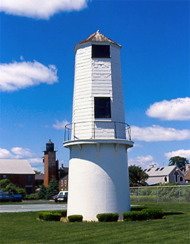
Two range lights to guide up the river Merrimack to the city of Newburyport have been established in the same position as the private lights before maintained by subscription, and were lighted June 1, 1873. The front light is on an iron tower, conical in form, 14 feet 6 inches high, located on Bayleys new wharf, and the focal plane is 25 feet above the sea. The rear light is about 350 feet W. ½ S. from the front light, on a brick tower, pyramidal in form, 32 feet high, and the focal plane is 47 feet above the sea.
Local caretakers were initially responsible for the lights. The first keeper of Newburyport Harbor Range Lights was George Stickney, who started at an annual salary of $250 and served until 1886. He was followed by Matthew F. Barrett, who served from 1886 to 1889 and then again from 1893 to 1908, when he died of carcinoma of arm.
|
The front light has always displayed a fixed red light, while the rear light was fixed green up until March 15, 1907, after which date it was fixed red.
Bernard W. Barrett replaced his father as keeper of the range lights in 1908. He initialy was paid an annualr salary of $365, but his pay was reduced in 1910 based on the following judgement by Insepctor Wilson W. Buchanan: Newburyport Upper Harbor are two range lights burning gas from the city supply. These lights are in the town, and there is little work attached to them, simply lighting a gas jet. This station has a Keeper, Bernard W. Barrett, paid at the rate of $31 per month, and in addition receives 30 cents per day ration money. I recommend that the position of Keeper be abolished, and in place a Laborer in Charge, at the rate of $20 per month, be appointed. Laborers in Charge receive no rations. This position does not interfere with any ordinary occupation that the man might have. I am told that the present keeper is a bank clerk.
Bernard Barretts tenure at the range lights was discontinued on April 15, 1933, after the range lights had been electrified.
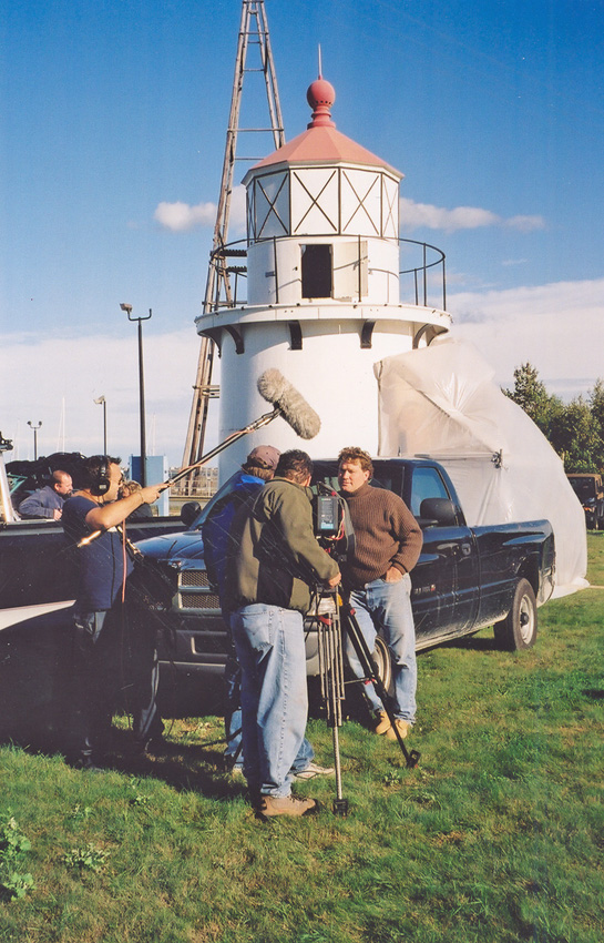
In 1961, both range lights were decommissioned. Not long after, the rear range light was sold to a private party. The front range light has been incorporated into the Merrimack River Coast Guard Station. The front range light suffered severe fire damage in the 1990s and has subsequently been restored to its original form with a replica lantern room placed on top of its iron base.
Newburyport is called the Birthplace of the U.S. Coast Guard by some, as the U.S. Revenue Cutter Massachusetts, the first cutter commissioned by the Federal Government, was built in Newburyport in 1791. The Revenue Cutter Service was merged with the Lifesaving Service in 1915 to form the U.S. Coast Guard, and the Lighthouse Service was brought under control of the Coast Guard in 1939.
The Lighthouse Preservation Society is raising money to create a national memorial to commemorate Newburyports connection with the U.S. Coast Guard. The memorial will include a museum in Newburyport Harbor Front Range Light along with a monument entitled First Guardians, that will feature a uniformed representative of the Revenue Cutter Service, the Lifesaving Service, and the Lighthouse Service.
Diners who enjoy a meal atop Newburyport Harbor Rear Range Lighthouse help support the efforts of The Lighthouse Preservation Society to maintain the Newburyport Range Lights and create the memorial. The elevated dining room is reportedly quite popular and has raised over $100,000 for the society.
In 2009, the rear range tower received a new exterior paint job and a complete interior makeover of the lantern room under the direction of local interior decorator and textile designer, Bridgette Newfell. In addition, a powerful new heat pump was installed, which will allow the dining opportunity to be offered year-round.
Head Keepers: George W. Stickney (1873 1886), Matthew F. Barrett (1886 1889), Edwin F. Hunt (1889 1893), Matthew F. Barrett (1893 1908), Bernard W. Barrett (1908 1933).
References

