Cape San Blas, FL 


Select a photograph to view a photo gallery
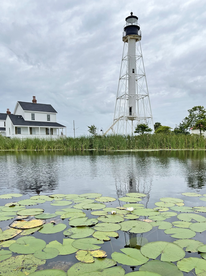


Photo Gallery


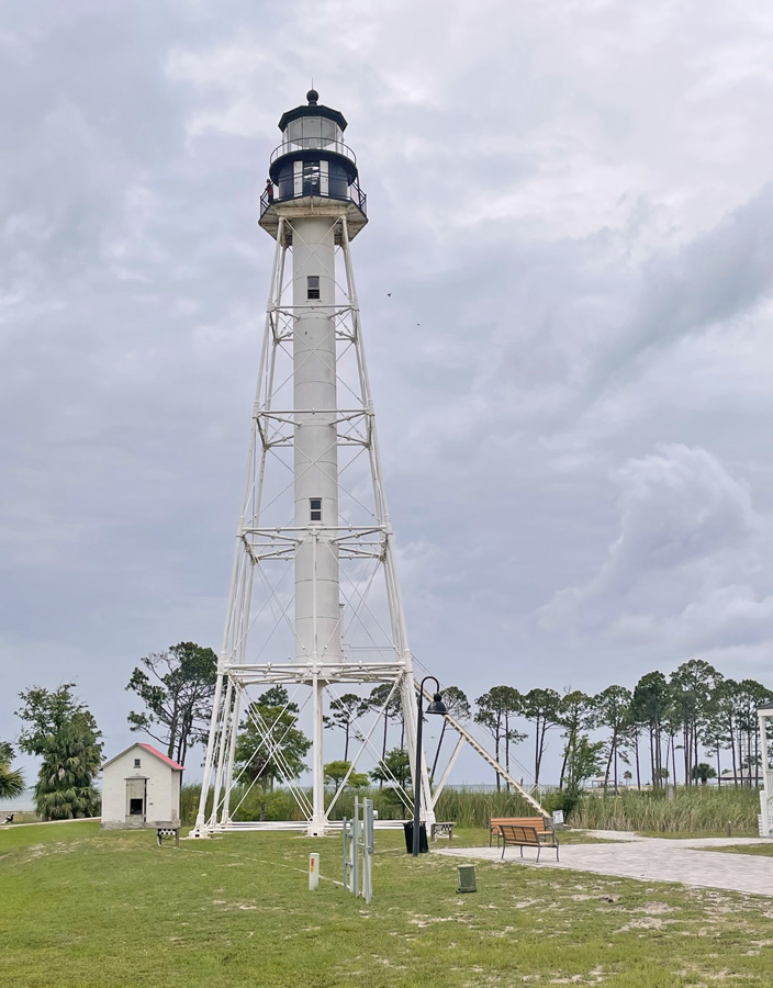
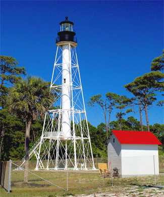
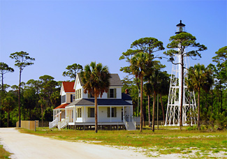
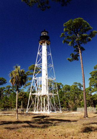
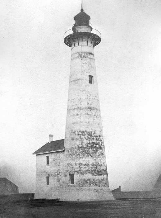
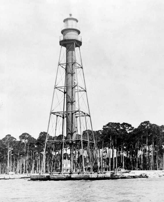
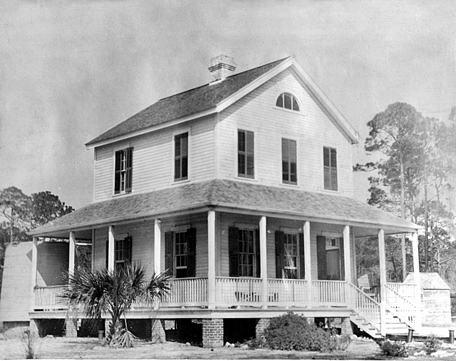
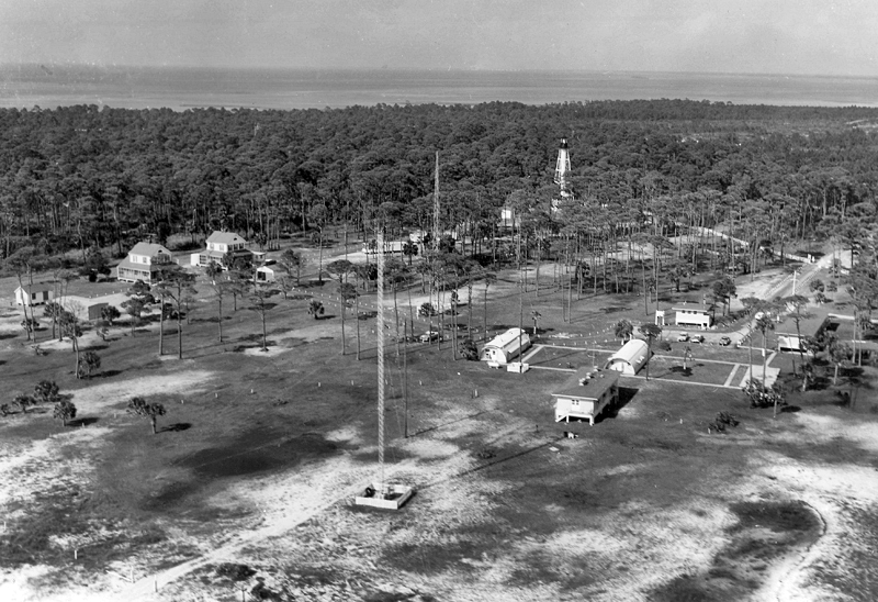
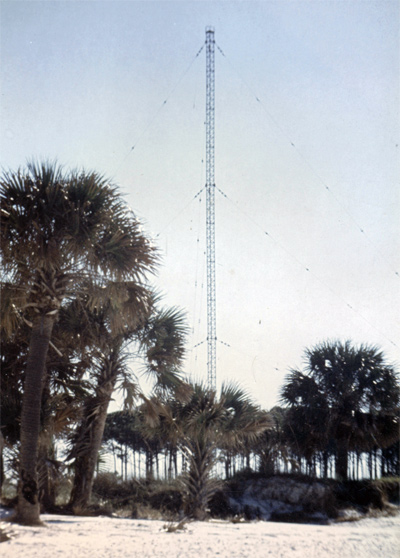

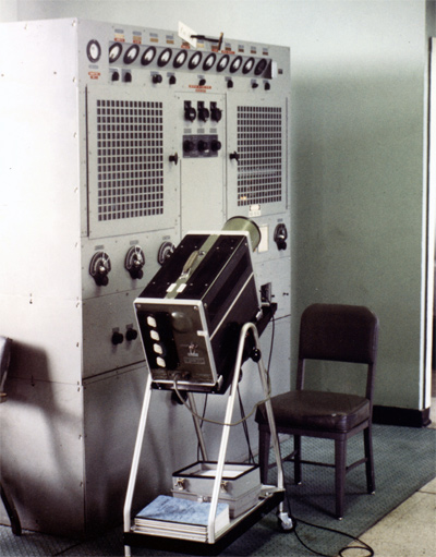

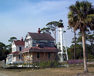

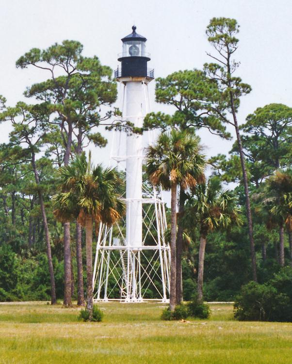
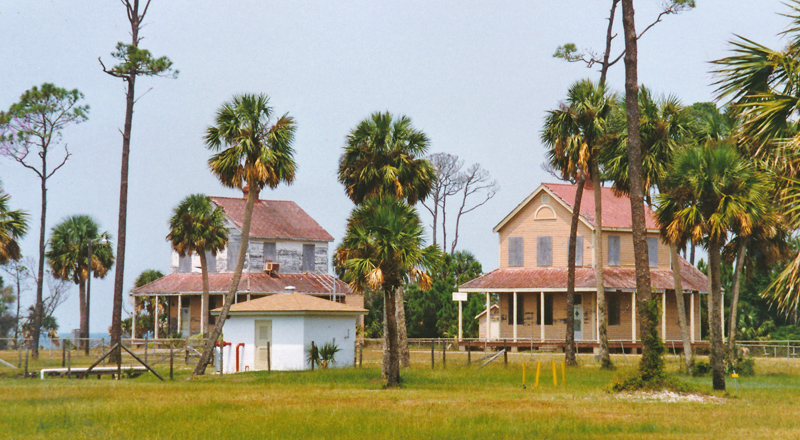
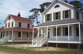

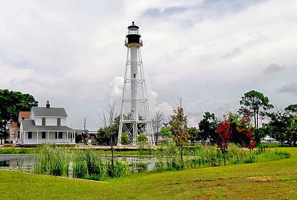
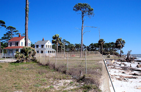

Photo Gallery
Photo Gallery
|
A year after the loss of the first lighthouse, Congress appropriated $12,000 for a second brick tower and a keepers dwelling for the cape. Due to an outbreak of yellow fever and delays in obtaining the lantern and Fresnel lens, the tower was not lit until November 1855, when Keeper Joseph Ridler was transferred from Dog Island. Ten months later, on August 30, 1856, another hurricane struck Cape San Blas. A Lighthouse Board report described the destruction inflicted on the station: The sea rose so high at that place that the waves struck the floor of the keepers dwelling, elevated eight feet above the ground, and about fourteen feet above the ordinary tides. A lagoon now occupies the site of that lighthouse."
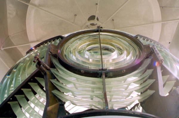
On March 3, 1857, Congress allocated $20,000 for a third brick tower, which was equipped with a third-order Fresnel lens and first lit on May 1, 1859. A two-story dwelling was attached to the east side of the lighthouse, and the light, which flashed every ninety seconds, was displayed at a focal plane of ninety-six feet. Following the outbreak of the Civil War, the Confederate lighthouse superintendent had the lens removed from Cape San Blas Lighthouse before Union forces could claim it. During the war, the keepers dwelling and the wooden portions of the tower were burned. The lighthouse returned to operation on July 23, 1866, after repairs had been made and a new lens was supplied. Congress didnt provide funds for a new dwelling until July 15, 1870, when $10,000 was appropriated, so in the interim, the keeper was forced to live in the towers cramped watchroom.
By 1869, the beach in front of the lighthouse had mostly disappeared, and the gulf was starting to threaten the tower. The Lighthouse Board requested $5,000 in 1875 to build a jetty to stabilize the beach, but a sum of only $2,000 was granted. That amount was deemed insufficient for any kind of protective measure, and no action was taken, even though the sea was washing the base of the tower during high tides. The report of the Lighthouse Board in 1881 details the dire condition of the tower: The sea has been encroaching on this tower until its base is in the water. Brush mattresses were made, pinned down to the sand with small iron screw piles, covered with sand and occasionally blocks of concrete, to further check such encroachment, but the almost constant surf, beating against the mattresses, tore them into pieces. An appropriation for a new tower, further inland is much needed. It is recommended that a skeleton iron tower be erected; then if the sea again encroaches, it could be taken down and reerected."
|
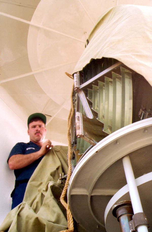
In 1883, $35,000 was granted to build an iron skeleton tower as requested by the Lighthouse Board. The tower was fabricated in the North, and then loaded on a ship for its journey to the cape. En route, the ship went down along Floridas west coast, but fortunately the wreck was in shallow water, and most of the material was salvageable. Work on the two keepers dwellings and the lighthouse began in September 1884 and was completed the following February, except for the installation of the lens and illuminating apparatus. The towers third-and-a-half-order Fresnel lens was first lit on June 30, 1885, showing alternate red and white flashes spaced by thirty seconds.
The new skeleton lighthouse had four iron legs that ran the length of the tower and were tied together with a network of braces. The central column, which housed the spiral staircase, was different from most used at other lighthouses as it did not extend all the way from the lantern room to the ground. Instead, it stopped twenty feet from the ground, and an external metal stairway was used to access the door to the tower. This arrangement would hopefully keep the entrance to the tower above any waters that might encroach on the station. The bottom portion of the tower was also supported by four additional legs that extended midway up the tower.
The ninety-eight-foot tower was originally placed 1,500 feet from the shoreline, but 300 feet of this buffer was lost by 1887, and by 1890 only 144 feet of sand separated the tower from the breaking waves. The tower obviously had to be moved or it too would be lost. Congress provided $20,000 for the task. Originally, the new site was going to be a point on the inside of the cape, about one-and-a-half miles from where the tower stood. However, obtaining title to the property proved difficult, and on October 8-9 of 1894, a powerful gale destroyed the keepers dwellings, damaged the iron tower, and left it standing in water. Keeper William Quinn lost all of the property he had at the station during the storm and provided the Lighthouse Board with an itemized account amounting to $124.75. Assistant Keeper George L. Long likewise submitted $75 in losses, but incomprehensibly, the Board was still requesting reimbursements for the keepers a decade later.
After the 1894 gale, the decision was reached to move the tower to Blacks Island, located a few miles north of the cape in St. Joseph Bay. Work on preparing the island and dismantling the lighthouse started in early 1896, but after a couple of months of work, funds ran out. Before work recommenced, the Lighthouse Board again changed its mind and decided the lighthouse should just be moved farther north on the cape. While the Board was busy changing its mind, the beach started to build up around the iron tower, and it was decided to leave the light where it was. In 1904, the Lighthouse Board was granted permission to use $7,000 of the $20,000 appropriation for relocating the station to construct two new two-story keepers dwellings.
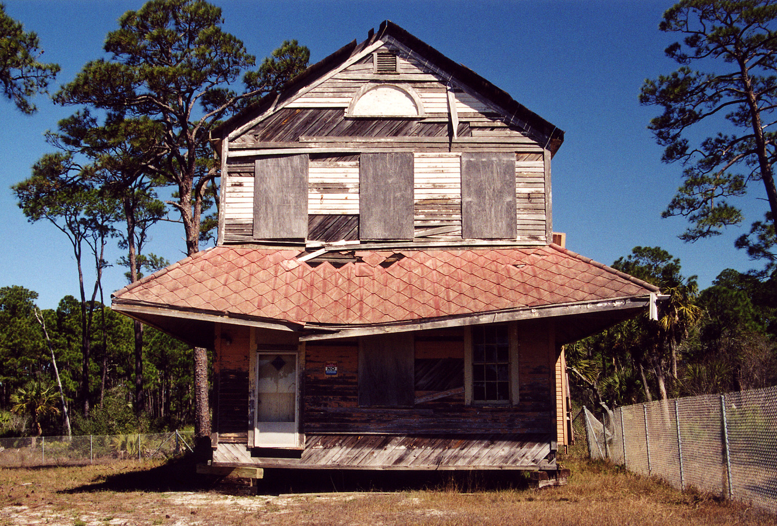
On May 14, 1908, a fire destroyed the dwelling occupied by Assistant Keeper David D. Silva. Keeper Silva was earning an annual salary of $440 at the time, and his list of items lost in the fire totaled $743.62. The Lighthouse Board would not assume responsibility for the loss of personal property, saying that keepers should take the same means to insure themselves as would citizens in other occupations. Keeper Silva appealed to Congress for remuneration, claiming that no company would insure his household goods at a station where there was no fire protection and noting that he had lost his lifetime earnings in the fire. It appears Keeper Silva was never compensated, as he was still asking for reimbursement four years after the fire. The dwelling of Head Keeper Walter A. Roberts was also lost in the fire, and he too filed an affidavit for reimbursement. The fire started in a defective flue in the kitchen of Keeper Silvas dwelling. New dwellings were soon built to replace those lost in the fire.
The tower was safe until a hurricane in 1916 stripped away the beach protecting the lighthouse, and another one the following year left the tower standing 120 feet offshore. Plans were again made to relocate the tower farther inland, and in 1918 the tower was moved 1,857 northward. The light was temporarily discontinued on April 30, 1918 and then shown from its new location atop nine reinforced concrete blocks for the first time on January 22, 1919.Life on the cape was obviously difficult for a lighthouse, and it wasnt much easier for the keepers and their families. The station was quite isolated, with a trip to the nearest settlement requiring a one-way trek of twenty-three miles. Keeper Ray Linton found the lonely vigil and wide expanse of the Gulf too great a burden, and in 1933, he took his own life with a gun. Just two years earlier, Keeper Linton had rescued two men and a girl who got into trouble off the cape. Keeper Linton provided the following account of the incident:
On March 15th, which was Sunday, a party of six people from Apalachicola came down to the beach here by the lighthouse. Three of the girls and one of the boys went in bathing out on the extreme end of the point. Two of the girls swam out in deep water where the tide caught them and was drifting them away from the beach. This other girl and boy went to get them, and the girl gave out and the boy brought her back to the beach. By this time, he was tired. Then he took a tire off his car and got the inner tube and went after the girls. Before he got to them one of them went down, and by this time other people had gathered there.Two men swam out to the girl but didn't have any means of a life preserver, and were swimming against the tide. During this time, a lady came to the station end told me of this. I at once got a long lime and a gourd which was all the means of a float that I could think of and get quick. I took this line out as far as I could go without swimming. One man held the end of the line and I got the line out to the two men and the drowning girl with the gourd as a float and a man to pull the line. We got these three people to the beach, with the girl in an unconscious condition and the men completely exhausted. By quick work we got a long fishing seine and made a drag and got the drowned girl on the first haul, though she had been in the water about two hours and a half. All efforts failed to revive her as she had been in the water too long.
The first girl that was rescued and one of the men were brought to the station where we built a good fire and soon got them warm, while the second girl was taken to Apalachicola. If I could have known of the accident ten minutes sooner, I think that we could have saved the girl from drowning. The water was so, cold that when I got ashore I couldn't stand up. As soon as I got warm, I was all right.
Five years later, another keeper lost his life prematurely at the station. Assistant Keeper Ernest W. Marler, a thirty-eight-year-old father of four children, was attacked and stabbed in a workshop at the station. His six-year-old daughter discovered her fathers body when she went to call him for the noon meal. The identity of the perpetrator was never discovered. Some claimed he was murdered by moonshiners, while others believed the keeper was killed for testifying against thieves a few days earlier. According to the stations logbook, Keeper Marler committed suicide, and his body was found at an old house on the reservation at 2:30pm. At 9pm that evening, his body left for Destin for burial.
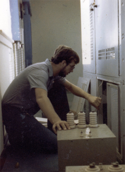
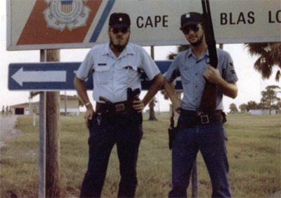
In 1952, a LORAN radio station was installed near Cape San Blas Lighthouse. Later that decade, the Air Force established Test Site D-3 on the majority of the rest of the cape to provide radar tracking capabilities for over-water test and training missions. Steve Barnold spent a year at Cape San Blas as an ET2 (Electronics Technician Second Class) starting in October 1977. Barnold was responsible for maintaining and repairing the LORAN transmitter and protecting the station from pesky civilians. In 1981, after the LORAN station was deactivated and the lighthouse was automated by the Coast Guard, the Air Force received a five-year permit to use and maintain the lighthouse property. When the permit expired, negotiations were entered into for an extended twenty-five-year agreement. Apparently there was some question over who would care for the keepers dwellings, and they were excluded from the agreement.
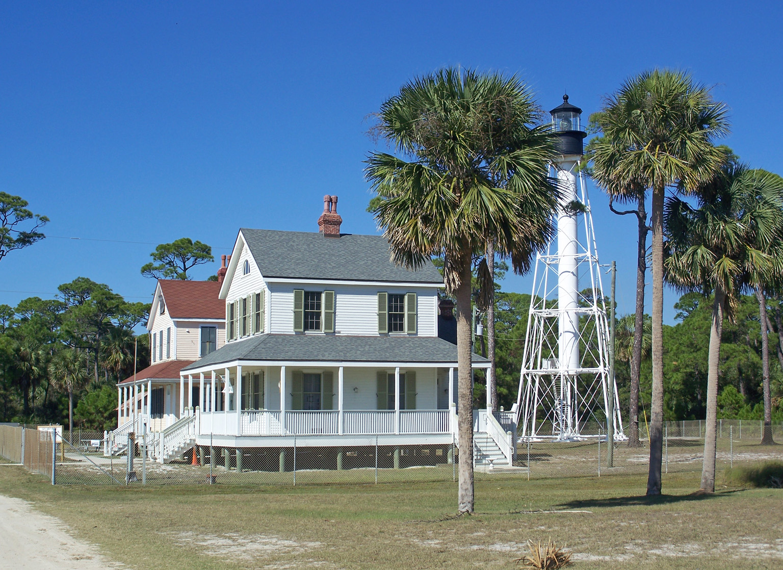
The dwellings were left unattended for several years, and they began to deteriorate. In 1996, the lighthouse was deactivated, and two years later, the dwelling that was closest to the shore received considerable damage from Hurricane Earl. In 1999, after the Air Force finally assumed responsibility for the keepers dwellings, the two structures were moved from their position on the shore to a site next to the tower. The dwelling that was in the best condition was restored at that time, while the second dwelling had to wait until 2005 for its turn.
|
Hurricane Isaac, which struck the Gulf Coast in August 2012, caused significant erosion at Cape San Blas, leaving just a fifty-foot buffer between the dwellings and the gulf. Operations at the lighthouse were shut down on October 14, 2012, so preparations for moving the tower and two dwellings by the Air Force, which still owned the property, could begin. In early December, Stones House Movers relocated the two keepers dwellings and the oil house 100 feet inland, as a temporary measure.
The City of Port St. Joe and the Gulf County Board of County Commissioners both applied for the stations buildings, which the Air Force was anxious to offload, and the National Park Service awarded the structures to the city in December 2012. The announcement allowed Port St. Joe to start raising funds for relocating the buildings to a public park and recreation area located along the shore of St. Joseph Bay in Port St. Joe.
In January 2014, the lens was removed from Cape San Blas Lighthouse in preparation for the relocation of the tower, and three months later, Port St. Joe Commissioners selected GAC Contracting to relocate the lighthouse and keepers dwellings at a cost of $510,450, the lowest bid received for the project. This amount did not include an estimated expense of $170,000 needed to lower and raise power lines during the move.
After the tower had been placed on its side and the two dwellings jacked up, the three structures and an oil house were moved roughly twelve miles from Cape San Blas to Port St. Joe on July 15, 2014. People lined the street to witness the parade of historic structures, and crews worked quickly ahead of and behind the slow-moving convoy to take down and then raise power lines along the route.
With the help of three cranes, the lighthouse was lifted up and placed atop its new foundation on July 24, and on September 12, 2014, the first climbers were allowed to experience the breathtaking view of St. Joseph Bay from the top of the relocated tower.
Keepers:
References


