Munising Range, MI 
Select a photograph to view a photo gallery

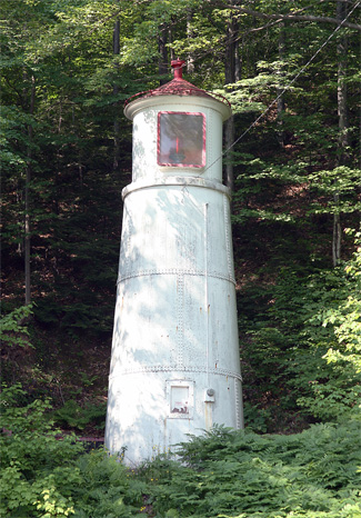
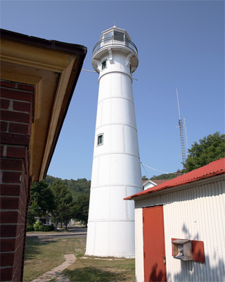
Photo Gallery
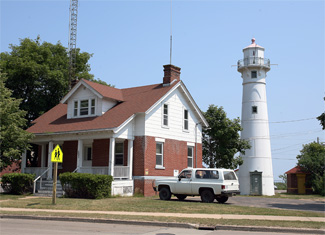


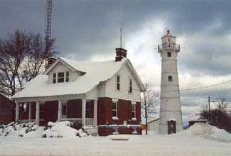
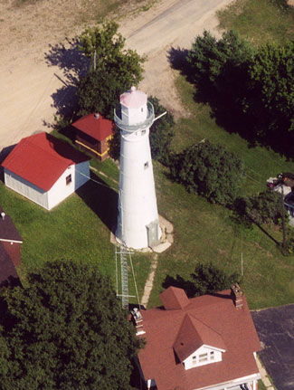
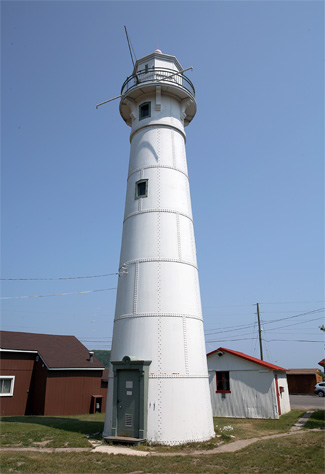
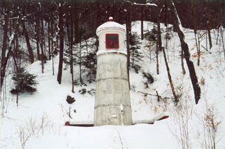
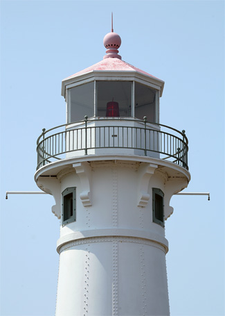
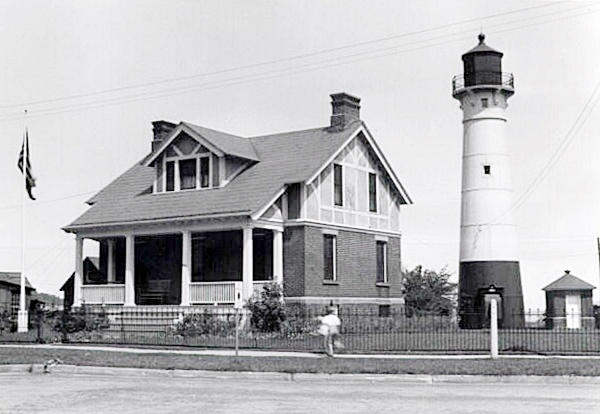

Photo Gallery
Photo Gallery
|
A contract to provide two metal towers for the range was awarded to Champion Iron Company of Kenton, Ohio. Lots 16 and 17 were purchased for the front range tower and keepers dwelling, and work on the dwelling began in the latter part of May 1908, with a target completion date of August 3. On June 30, the close of the fiscal year for the Lighthouse Service, the excavation for the dwelling was complete, the foundation walls had been carried up to the grade line and plastered, and the main floor joists were framed. When completed, the redbrick dwelling had a steam radiator in each of its seven rooms for heat and was identical to the keepers dwellings at Grand Marias and Pointe aux Barques that were also built in 1908.
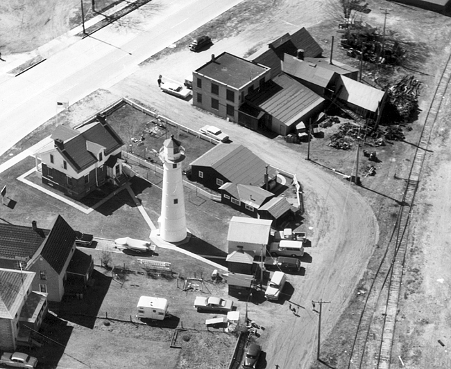
The front tower, located fifty feet east of the dwellings rear door, was built of 5/16 steel plates, and tapers from a diameter of twelve feet at its base to a diameter of eight feet at the lantern room. The fifty-five-foot-tall tower rests on a five-foot-deep concrete foundation, and a spiral staircase leads to its octagonal lantern room, which is encircled by a gallery.
The companion rear tower, located 1,150 feet southwest of the front tower, is just thirty-one feet tall, but thanks to the hillside on which it stands, it has a focal plane of over 100 feet. Both towers originally displayed fixed red lights produced by Adams & Westlake reflector-style lanterns. A brick oil house, capable of holding fifty five-gallon oil cans, was built twenty-five feet east of the front tower.
Keeper George Prior exhibited the light at Grand Island Harbor Lighthouse for the final time on the night of October 29, 1908, and then sailed over to Munising the next day to make the inaugural lighting of the new Munising Range Lights.
|
On October 30th, a range of fixed red lights was established at Munising, Grand Island harbor, as a guide for the channel on the east side of Grand Island. These lights are exhibited from conical steel towers, the front light being 77 feet above the lake level and the rear light 104 feet.The range leads in clear of the Manhattan wreck, which is marked by [a] gas buoy, through the narrows between Grand Island harbor light and the shoals northwest of Sand Point, a red spar buoy marking the outer edge of the shoal extending eastward from the harbor light.
With the establishment of the new range the deep area lying south of Grand Island becomes available during northerly storms as a refuge for the largest class of vessels plying on the Great Lakes. With the installation of this range there will exist serviceable ranges both to the east and to the west of Grand Island. The anchorage is to the south of Grand Island and the holding ground is good. Upon the establishment of this range, the Grand Island Harbor light station was discontinued in compliance with an act of Congress.
On April 1, 1940, Keeper Alf Evensen retired after thirty-eight years of service on Lake Superior. Keeper Evensen started his career in 1902 as second assistant at Whitefish Point Lighthouse. After one season there, he was promoted to first assistant at Marquette Lighthouse, where he served until being promoted to keeper and placed in charge of Grand Island North Lighthouse in 1908. Keeper Evensen spent the last fifteen years of his career at Munising Range Lights, and at the time of his retirement, his son Harold was carrying on the familys connection with the Lighthouse Service, working as the second mate aboard the lighthouse tender Amaranth. The range lights were electrified in 1941, greatly reducing the work associated with minding them.
Fred W. Hawkins, also a veteran of the Lighthouse Service, was transferred from nearby Au Sable Point Lighthouse to replace Evensen and served from 1940 to 1947 as keeper of the range lights. Floyd W. Miller retired from serving as the light attendant for Munising Range, as well as Grand Island Harbor Range and Grand Island Light, in 1961. Before being transferred to Munising, Floyd Miller had served at Lansing Shoal Lighthouse, Split Rock Lighthouse, and Poverty Island Lighthouse. With the retirement of Miller, Munising Range Lights became the responisbility of a Coast Guard team at Munising that was responsible for not only aids to navigation but rescues as well.
Munising Range Lights were transferred to Pictured Rocks National Lakeshore in July 2002 under the National Historic Lighthouse Preservation Act. During the winter of 2008 2009, the metal range towers were sandblasted, then sealed with an undercoat and painted. The sandblasting was performed by St. Germain Sandblasting of Negaunee, and workers afterward welded together areas of the tower where oxidation had eaten through the metal shell. The keepers dwelling now serves as offices for three permanent and several seasonal employees of the lakeshores Science and Natural Resources Division.
Keepers: George Prior (1908 1912), Thomas Hendrickson (1912 at least 1924), Alf Evensen (1925 1940), Fred W. Hawkins (1940 1947), Floyd W. Miller (at least 1960 1961).
References


