Goat Island, ME 

Select a photograph to view a photo gallery
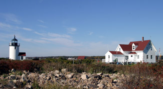
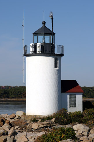
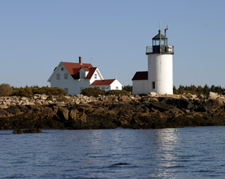
Photo Gallery


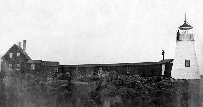

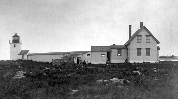

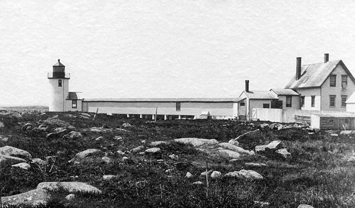

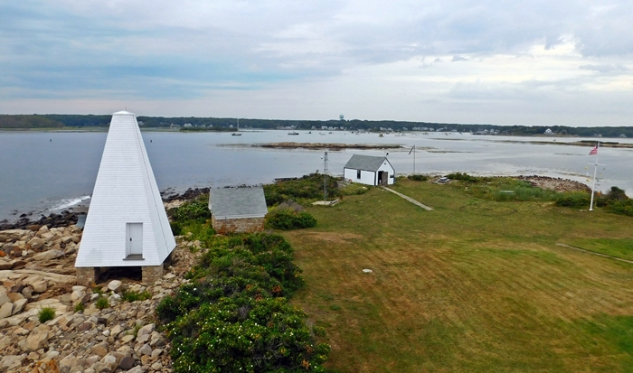
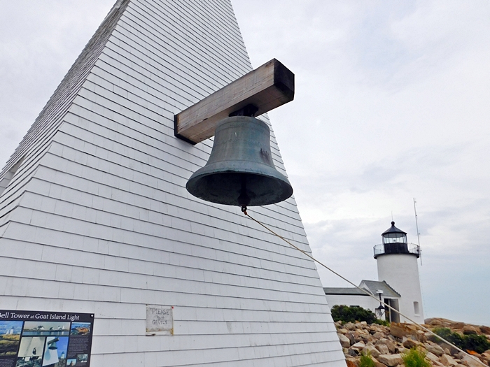
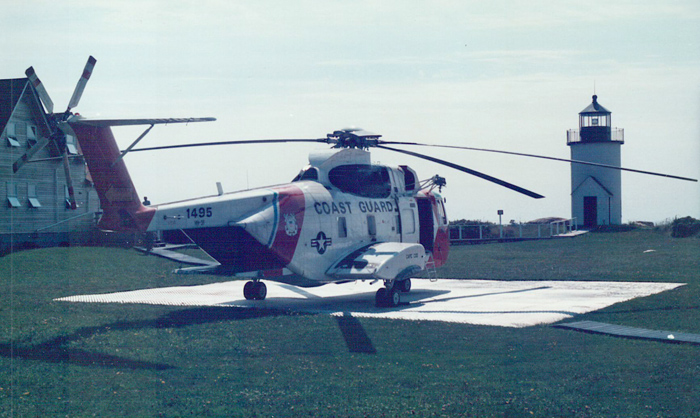
Photo Gallery
Photo Gallery
|
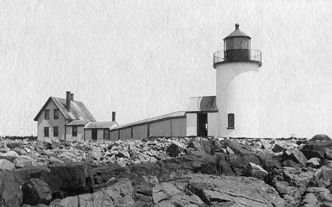
Congress appropriated $6,000 on March 3, 1831 for a lighthouse at or near Cape Porpoise, and later that year John Chandler, local customs collector, called for proposals to construct a tower and dwelling on Goat Island. The resulting conical rubblestone tower, topped by an octagonal wrought-iron lantern, was first lit in August 1833. The lighthouse stood twenty feet tall and had a focal plane of thirty-eight feet above mean high water. The original keepers dwelling was a stone house with three rooms on its first floor and another three rooms in its smaller upper story. Adam McCulloch was finally paid $300 for the title to Goat Island in 1846.
John Lord, the lights first keeper, came from an upstanding local family and earned $350 per annum. Thatcher Hutchins succeeded Lord as keeper in 1841.
Only $2,711.80 of the original allotment was spent in building the structures on Goat Island, and it seems the government got what it paid for. Inspector I.W.P. Lewis wrote about the stations poor condition in his 1842 report, noting that the tower was laid up in lime mortar of bad quality, with a loose and leaky roof and decaying woodwork. The keepers house was in similar condition, plus it had rotten cisterns. The eastern portion of the dwelling lacked a proper foundation, and its cracked walls rendered it uninhabitable during the winter.
Keeper Hutchins added that leaks and condensation in the lantern required him to wipe the lantern glass three times per night. The station also lacked outbuildings. Although Hutchins was provided a boat, there was no place to store it, and to house his animals, he had to pay six dollars each year to rent a barn the previous keeper had built on the island.
While George Fletcher was keeper at Goat Island, an August 1850 inspection report noted that the tower and lantern were in good order, and concluded, The keeper is a good one. Not all keepers at Goat Island rose to this high standard. A July 6, 1887 inspection found deplorable conditions, with the dwelling being dirty from top to bottom. The keeper was warned, but a return inspection noted the whole station was found in a dirty condition, with the lens and lantern covered with dust and fly specks, and the dwelling filthy and offensive to sight and smell. Keeper John Emerson was summarily dismissed.
|
After Emersons dismissal in 1887, the light was cared for by Leander White for a year and then George Wakefield, who moonlighted as a harbor pilot and fisherman. After he died on the island in 1921, Wakefield was remembered for his unusual care and watchfulness which saved lives because he was able to act quickly to bring rescue to sinking vessels.
The numerous reefs and islets at its entrance made entering the harbor at Cape Porpoise a dangerous undertaking. In addition to recording their work in the stations logbook, some keepers also kept a log of nearby shipwrecks. Between 1865 and 1920, forty-six vessels were wrecked nearby, and twenty-eight of these were total losses. Not a single person of the 229 individuals aboard those vessels perished, thanks, in part, to the vigilance of the keepers on Goat Island.
Coastguardsman Joseph Bakken and his family were on Goat Island during a 1947 gale that sent waves crashing across the island, damaging the walkway and boat slip, and sweeping away a fence. During the turmoil, the family forgot about their dog and her newborn puppies. The mother and her litter were later found safe and sound in a box, floating in several feet of water that had flooded the basement.
The stations fog bell was replaced in 1959 by a horn that sounded every twenty seconds. In 1976, locals petitioned the Coast Guard to delay their plans to automate the station. Youre damn right we fought for the light, a local fisherman explained. That lighthouse just isnt something for the tourists to gawk at. Theres a man up there and we know he watches out for us. A machine cant do that.
The Coast Guard listened, and Goat Island remained staffed until the fall of 1990, making it the last station in Maine and one of the last in the entire United States to have a keeper. A modern 300-millimeter optic replaced the historic Fresnel lens upon automation.
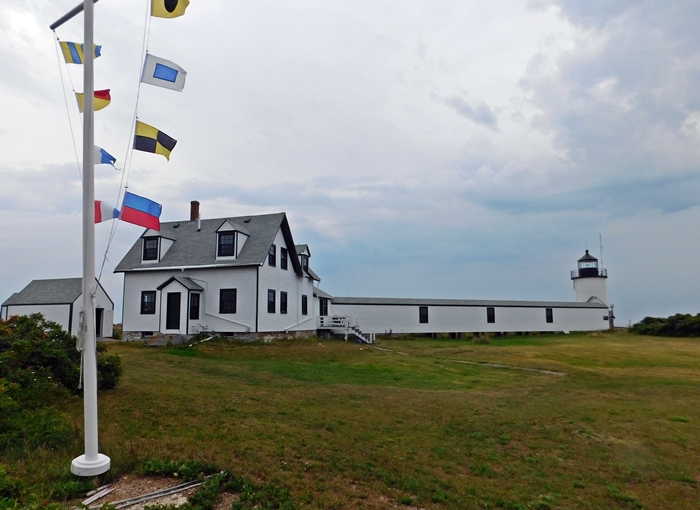
In 1992, the station was leased to Kennebunkport Conservation Trust, and in 1998, title to the station was turned over to the trust under the Maine Lights Program. The trust has been actively restoring the station to its 1950s appearance.
Richard Dick Curtis started serving as caretaker on Goat Island in 1994 and was well-known for his jokes, smiles, and laughter. In 2002, Curtis apparently fell overboard and drowned while on a boat ride with his dog and three other dogs he was caring for. Two of the four dogs swam to shore, but the other two were never seen again. Scott Dombrowski, who replaced Curtis as caretaker, shares the belief with many locals that Curtis ghost remains on the island.
|
Items gone missing on the island would eventually turn up, always on the kitchen table. And then one day, Dombrowski remembers, it was cold and I was exhausted, so I sat in Dicks easy chair and said, Dickie, give me some heat. There was an old electric heater that hadnt worked for years and much to Dombrowskis astonishment it turned on.
Problems with the foghorn began in 2007, the year Dombrowski hung American and Russian flags at the lighthouse to honor a visit to the nearby Bush estate called Walkers Point by President George W. Bush and Russian President Vladimir Putin. (Goat Island has a good view of the Bush estate, and secret servicemen were often stationed there during the presidency of George H. W. Bush.) Bush senior came on his boat and took pictures, Dombrowski recalls. Then he brought his son and President Putin and said, See, our people want us to work together. Wanting to know what his invisible friend thought of that, Dombrowski queried, Hey, Dick, what do you think of that?, and the foghorn, which had been quiet, suddenly sounded.
After that, the foghorn began to go off more frequently, even when it was clear. In response to complaints from locals, the Coast Guard tried new sensors and even disconnected the power, but it still sounded. Only after the Coast Guard replaced the entire unit, did Dick stop giving his friendly signals. Dombrowski missed the contact from beyond. It was just a very calming, wonderful presence. I wish hed still show himself.
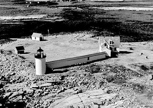
Keeper Martin Cain had just exited the stations covered walkway in 1978 when the wind-whipped ocean picked it up, folded it like an accordion, and carried it away. On October 12, 2011, Martin and his wife Kathy, who had not been back to the island in thirty-three years, participated in the dedication ceremony that marked the end of a $1 million renovation project. During work that started the previous spring, Kennebunkport Conservation Trust rebuilt the covered walkway destroyed during the Blizzard of 1978 and a bell tower that had been absent since 1962. The original bell, which had been on display at the Kennebunkport Historical Society, was mounted on the new bell tower and rung by all of the roughly forty people ferried to the island for the celebration. Goat Island now looks much like it did during the 1950s.
In November 2022, the submarine power cable to the island failed, forcing the Trust to consider whether to install a solar-powered system for the entire island. The light used for navigation was already solar powered. Generators were used to supply some power to the island until solar panels were finally installed on the covered walkway in June 2024. You can follow the happenings at Goat Island Lightstation on this Facebook page.
Head Keepers: John Lord (1833 1839), Tobias Lord (1839 1841), Thatcher Hutchins (1841 1845), Oliver Freeman (1845 1849), George Fletcher (1849 1853), Samuel Grant (1853 1857), George W. Averill (1857 1861), Joseph Huff (1861 1868), Stephen Ilsley (1868 1873), Bradbury Emerson (1873 1878), John Emerson (1878 1887), Leander White (1887 1888), George W. Wakefield (1888 1921), Leo Allen (1921 1926), James M. Anderson (1926 1939), Justin A. Foss (1939 1942), Melcher F. Beale (1943 ), Joseph Bakken (1945 1950), Robert McWilliams (1950 1953), Bruce Jordan (1953 ), Lavaughn Bryant (at least 1958 1962), Clifton W. Cousins (1962 1964), Edward A. Warren (1964 1965), Wallace R. Potwin (1965 1967), David M. Sweet (1967), Dennis V. Wilson (1967 1969), Robert L. Haley (1969 1970), Charles H. Worrell (1970 1973), Richard Heon (1973), Mark Brooke (1973 1975), Martin Cain (1976 1978), Mark Estey (1978 1980), Larry L. Toler (1981 1983), Bradley Culp (1985 1990).
References

