Browns Head, ME 

Select a photograph to view a photo gallery

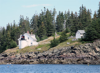
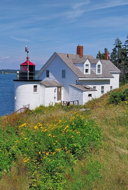
Photo Gallery
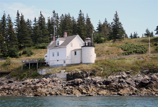


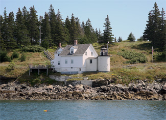
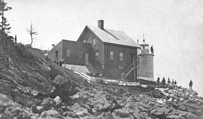
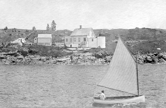
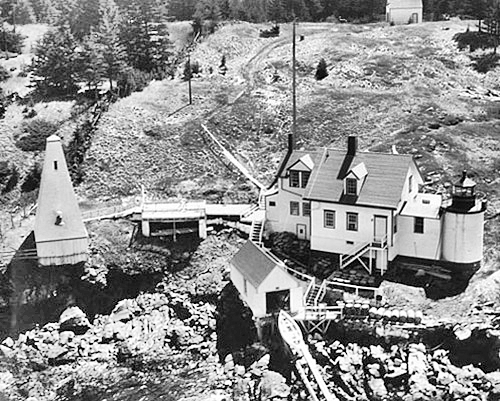

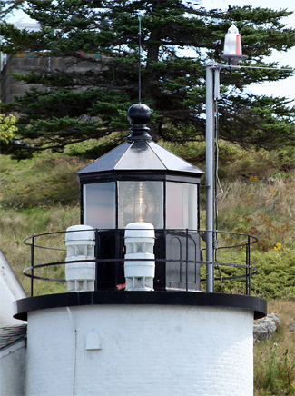
Photo Gallery
Photo Gallery
|
John Baxter (keeper in the 1970s) and his wife Gail had their fourth child, Stephen, at Browns Head Lighthouse in 1973. Stephen was the first baby born in a lighthouse under Coast Guard control and is likely the last baby born at any light under the Coast Guard. Gail vividly remembered one storm in particular. Once we had a storm and I watched lightning hit the rocks and it scared me to death. I was cooking one night and lightning came in and went right around the burner. And lightning hit the telephone pole at the top of the hill and split it in two.
Before Browns Head Lighthouse was automated in 1987, one of the last keepers was Charles Lawson, who was joined by his wife Valerie and their two sons. I thought I would hate the loneliness and the confinement, Valerie said. But I grew to love the lighthouse, partially because Chuck was home all the time after all those years when he was away so much. It was the first time we would have had to raise the children together .We are going to miss all that.
One of the earlier keepers, Benjamin Eldridge Burgess, who started in 1867, married his second wife at the light and reared seven children there. They even took in three grandchildren following their mothers death. Tragically, three of Burgess daughters died within four years of each other. He was praised for the exquisite neatness and order of the station and described as a good man, a good servant of Uncle Sam, and a saver of countless lives. After nearly forty years at Browns Head, Burgess retired in 1905 at the age of eighty-one. For the last few years of his career, Keeper Burgess had been the oldest keeper in the lighthouse service.
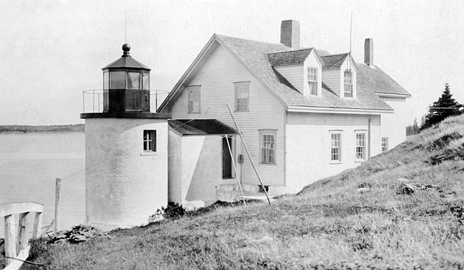
Historically, the Fox Islands were home to the Red Paint People, who arrived 3,800 to 5,000 years ago, followed later by the Abenaki and other Native Americans. European explorers sailed by in the 1500s, followed in 1603 by English Captain Martin Pring, who dubbed them the Fox Islands for the abundant gray foxes found there. English settlements did not begin in the area in earnest until after the French and Indian Wars in 1763 and then increased quickly after the Revolutionary War. In the Fox Islands, the island and town of Vinalhaven were named for John Vinal, Esquire, who defended islanders in a 1785 court case. The other major island in the Fox Islands became known as North Haven. Browns Head Lighthouse was set on the northwestern corner of Vinalhaven Island to guide trade ships navigating Fox Islands Thoroughfare, the mile-wide strait the runs between the two islands.
Vinalhaven residents have always relied on the sea for a living. From the 1800s to the mid-1900s, local fishing fleets regularly brought in catches of 10,000 pounds or more. Then in 1826, Vinalhavens reputation for its granite began to grow. For the next century, it was one of Maine largest quarrying centers. Local granite went into gun platforms at forts prior to the Civil War and was used in the Brooklyn Bridge, U.S. customs houses, post offices, federal office buildings, mansions, and more. The shift to structural steel and concrete as building materials forced the closure of the largest granite company in 1919, but the granite paving block industry operated on the island until the late 1930s.
|
Collector Chandler, the local lighthouse superintendent, noted on July 27, 1832 that the reflectors in the lantern room were in such bad condition that he assumed they had not been plated with the required six ounces of pure silver. However, he later wrote that the problem resulted from the workman leaving no vent hole, through mistake, and the Keeper being new did not perhaps know what the difficulty was, at first, although he will, I think, make a very good Keeper. The lack of proper ventilation resulted in excessive smoke and heat, but the problem was quickly fixed.
John Calderwood, from Vinalhaven, followed Wooster as keeper, earning $350 per year. When Engineer I.W.P. Lewis inspected Browns Head Lighthouse in 1842, he dismissed its importance, calling it merely a local beacon. Lewis standards were always high, and the stations location and construction did not measure up. He wrote that it was sited so low as to render no service in clearing the numerous ledges near it The tower was laid up in lime mortar of very bad quality. The mortar could easily be taken out by hand and stones could be lifted out of their beds in the wall. The towers stairway and woodwork had rotted, and the entire structure had shifted laterally from the frost. The dwelling was exceedingly rough and defective with cracked walls, a leaky roof, and falling plaster.
Keeper Calderwoods statement confirmed Lewis findings:
The house walls are cracked at all four corners, and settled away from the roof at the southeast end. The cellar is partially excavated only, leaving a sloping bank in one end thereof, which forms a drain for all the water that runs through the walls. The cause of the cracks in the walls owing to bad building, and the want of proper foundation on the downhill side; the frost has upheaved all the stone work. The floor beams of the house are round, just as they came from the woods, and were cut on the side of the house. Some of the studs have still the bark on.Keeper Calderwood had to travel twelve miles to Camden for supplies, and the station boat was worn out and there was no landing near the light. Not surprisingly, the Calderwood family left the next year, in 1843.The tower of the light-house is also badly built, and will certainly tumble down, if something is not soon done to save it. The walls are cracked in every direction, and the lantern shakes so in a gale of wind that the chimneys rattle like sleigh bells. The stairs and landing are rotten. Last winter the inside of the tower and staircase was covered with ice every time it rained and froze; afterwards we had to clear the staircase of ice with hot water. The door of the lantern faces the harbor, instead of being on the land side, and intercepts the light of two lamps. The site selected for this lighthouse was on the top of the bluff above the place where it now stands, so that vessels coming in from the southeast are unable to see the light, until they open it by the bluff, called Browns head. If the light had been placed where it should have been, on the top of the bluff, its usefulness to vessels found into Fox Island passage would have been much increased.
They were followed by Howland Dyer and his family, who would spend the next twenty-one years at the light, despite the dilapidated condition of the facilities that would not be remedied for fourteen more years. Dyer was complemented in the 1850 inspection report. The keeper is a first-rate one, and takes good care of the government property intrusted [sic] in his care.
|
On September 15, 1880, the light was changed from white to white and red, [with] the red cut or sector defining the west channel of entrance to Fox Island Thoroughfare, between Fiddlers Ledge and the Bay ledges. Perhaps this confused sea goers, as in 1889, the red sector was replaced by a white sector between two red ones, so that the white light indicated safety and the red light danger.
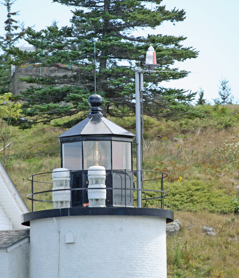
Other changes to the station came in 1891 in the form of a new fuel house and a 2,000-gallon brick cistern, along with a retaining wall in front of the dwelling. A boathouse and boat slip were added in 1895, and the intensity of the light was increased in late 1901 by replacing the fifth-order Fresnel lens with a fourth-order. A stone oil house was added in 1903 along with new cast-iron stairs that improved access to the lantern.
At a ceremony marking the automation of Browns Head Lighthouse in August 1987, Captain J.E. Williams, commander of the Coast Guard group in Southwest Harbor, remarked: Soon the manned lighthouse, like the dinosaur, will be a thing of the past. With each automation and unmanning, a little bit of our nautical history slips away. After Browns Head was automated, the only staffed lights in Maine were at West Quoddy, Fort Point, and Owls Head. Under the Main Lights Program, Browns Head Lighthouse was transferred to the Town of Vinalhaven in 1998. The towers Fresnel lens remains active and is serviced by the Coast Guard.
While the station grounds were open to the public, the house was closed and occupied by Vinalhavens town manager for many years. On October 23, 2015, Browns Head Lighthouse was transferred from the Town of Vinalhaven to the American Lighthouse Foundation. Plans call for overnight stays to be offered in the lighthouse. In 2019 the Foundation launched a campaign to raise $60,000 for restoration of the lighthouse, and in 2022, the Foundation transferred ownership to a new preservation group, the Friends of Browns Head Lighthouse, headed by Nick Korstad.
If you take the ferry to Vinalhaven from Rockland, it is best to bring your car to the island, as the lighthouse is several miles from the ferry landing. Maybe your own family will be brought together, as the keepers of old, by a visit to Browns Head Lighthouse.
Head Keepers: David Wooster (1832 1841), John Calderwood (1841 1843), Howland Dyer (1843 1864), William Thomas (1864 1865), Peleg Thomas (1865 1867), Benjamin E. Burgess (1867 1905), Charles T. Burgess (1905 1918), Alonzo Morong (1918 1929), Ernest V. Talbot (1929 1945), Merrill Poor (1945 1957), Roy V. Louder (1957 1961), Ernest G. DeRaps (1961 1962), Douglas R. Cameron (1962 1964), Stanley H. Doughty (1964 1970), David P. Speed (1970 ), John Baxter (1972 1976), Stanley Doughty, Millard Rackliffe (at least 1982 1983), Charles Lawson (1983 1984).
References


