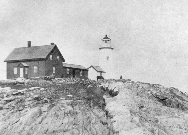
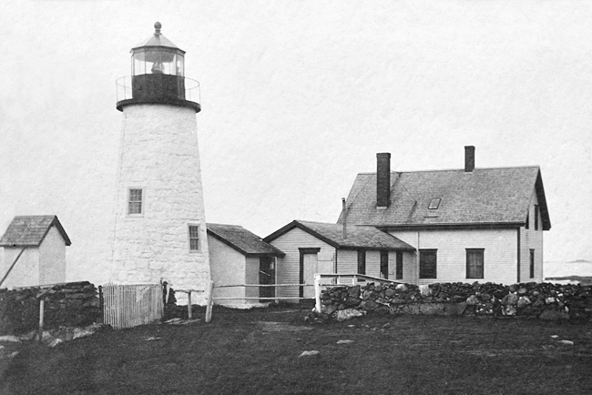
Pemaquid Point, ME 


Select a photograph to view a photo gallery


Photo Gallery
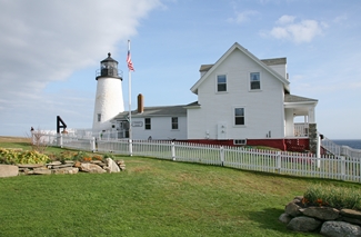
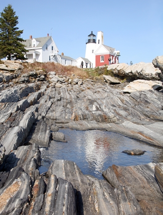
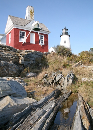
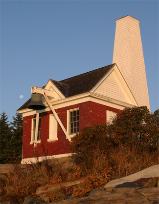
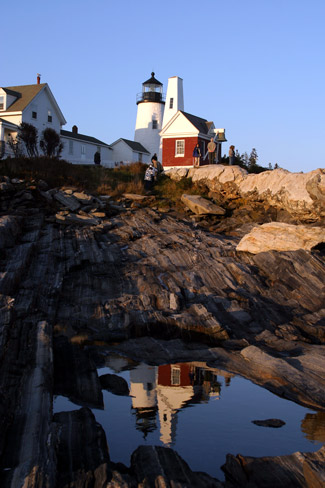
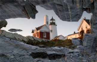
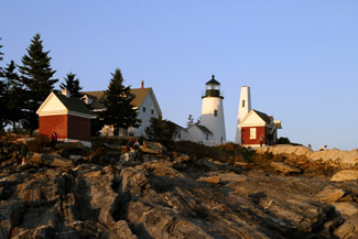
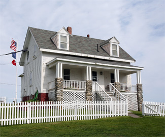
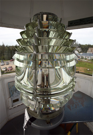


Photo Gallery
Photo Gallery
This picturesque lighthouse has attracted many, including Edward Hopper who captured its image in his 1929 watercolor, Pemaquid Light. Today, Pemaquid Point, with its colorful rocky shoreline, is one of New Englands most-visited and photographed lighthouses, drawing over 100,000 visitors annually.
|
The areas most famous shipwreck was the 240-ton Angel Gabriel, a British passenger galleon carrying about 100 English settlers and much needed provisions. The partially unloaded bark went down in an August 1635 hurricane taking four or five persons and all the passengers belongings.
After the region had been settled for over two centuries, an act dated May 18, 1826 finally provided $4,000 for the construction of a rubblestone lighthouse and a twenty by thirty-four-foot keepers house, with an attached ten by twelve-foot kitchen at Pemaquid Point. The light stations plot was purchased for ninety dollars from Samuel and Sarah Martin, descendants of survivors of the Angel Gabriel shipwreck. Jeremiah Berry of Thomaston built the structures, which ended up costing $3,503, and Pemaquids fixed white light went into service on November 29, 1827.
Although Stephen Pleasonton, the Treasury auditor in charge of lighthouses, recommended Esais Preble to be Pemaquid Points first keeper, the honor went to forty-year-old Isaac Dunham of Bath, Maine. Dunham had served as a privateer in the War of 1812, then moved to Maine and turned to farming before becoming a lighthouse keeper at $350 per year.
A scant eight years after Pemaquid Lighthouse was built, a replacement tower was required. To avoid past mistakes, the contract specified that the mortar was never to have been wet with salt water and that tower was to be built solid with Stone and Mortar, in a single wall and not to be done by building two walls and filling in. Joseph Berry of Georgetown, nephew of the original builder, received the contract for the conical granite tower. The need for the accompanying lighting apparatus was advertised in March 1835, and Winslow Lewis was awarded a contract to supply eight oil lamps and fourteen-inch reflectors.
This second tower, the one that survives today, measures thirty feet to the lantern deck, and is sixteen feet in diameter at the base and ten feet in diameter at the top. The original interior stairway was of good sound hard pine, and an octagonal, domed iron lantern capped the tower. Keeper Dunham oversaw the job and certified that a Better Tower and Lantern never was Built in this State. Also the Lamps reflectors and apparatus is according to Contract.
Keeper Isaac Dunham, his wife, and five children were joined in February 1831 by a baby boy, whom they named Benjamin Franklin Dunham. When Keeper Dunhams father, Captain Cornelius Dunham, passed away while at the station in July 1835, he was buried in a small cemetery near the lighthouse.
Keeper Dunham patented a system for keeping lamp oil from congealing in winter. Although Congress ordered the Treasury to adopt Dunhams invention in 1837, it is not known to what extent it was used.
|
The normally critical lighthouse inspector I.W.P. Lewis praised the tower at Pemaquid Point during his 1842 inspection, calling the general state of the tower good, even though it leaked during storms and had eleven broken panes of glass in its lantern. He did, however, have concerns regarding the necessity of the light: It is difficult to conceive for what particular purpose this light was originally placed here, and, from its contiguity to Franklin Island light, we are led to believe it has often been the cause of sad mistakes and disasters of a fatal character. There are both islands and dangerous ledges lying exterior to it, several miles, which have first to be clear before the light can be seen or, if seen, made any use of. Rather than abolish the light at Pemaquid, Lewis recommended that it be reduced from ten lamps and reflectors to a beacon light of just one lamp, suitably constructed.
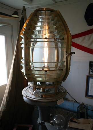
In 1857, a fourth-order Fresnel lens was installed at Pemaquid Point, and a new keepers dwelling was built.
The keeper after Jeremiah Mears was Joseph Lawler, whose wife, Sophronia, gave birth to a baby girl at the light in 1868. The next keeper was Marcus H. Hanna, son of James and Eliza Hanna who kept Franklin Island Lighthouse. After four years at Pemaquid Point, Hanna used his influence as a Republican and veteran of the Civil War to persuade President Grant to transfer him to Two Lights at Cape Elizabeth, Maine. His arrival was not well received by James Mariner, the keeper already in place there. On March 3, 1873, Mariner wrote in the stations logbook: Mr. Hanna from Pemaquid Light Station will take my place but not with my consent. I am no longer a Republican.
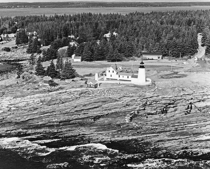
By the late 1800s, Pemaquid Point was a desirable location for families, as it was easily accessible by land and allowed a keeper to raise animals and crops. Pemaquid Point was not, however, easy to reach by water. Lighthouse tenders were forced to anchor offshore and lighter supplies to the station, making it an unpopular destination for the tender crews.
William L. Sartell was in charge of Pemaquid Point Lighthouse from 1873 to 1883, and he was followed by Charles A. Dolliver, who served from 1883 to 1899. After his stint at Cuckolds Fog Signal Station as assistant keeper, Clarence Marr transferred to Pemaquid Point Lighthouse as head keeper in 1899. When Keeper Marr retired in 1922, the Kennebec Journal wrote:
Captain Marr is one of the most widely-known lighthouse men on the Maine coast . As an expression of their feelings of appreciation toward Captain and Mrs. Marr for the many acts of kindness conferred and of regret at their retirement and departure, the summer visitors here have presented to the retiring keeper and his wife a purse of money and a souvenir book, bound in fine leather and containing an appropriate letter and the signatures of the donors.
|
After Marrs retirement, Herbert Robinson became keeper. In 1927, when Keeper Robinson was sixty-eight years old and ready to retire himself, he was commended for performing the following rescue:
On November an 18-year-old boy was washed off the rocks into a heavy sea near Pemaquid Light Station and was drowned. The keeper of the light station, Herbert Robinson, rescued the boys aunt and uncle, who were also washed off the rocks, this act requiring unusual heroism. It was impossible to rescue the boy, as he was not seen after the sea struck him.
The stations final keeper was Leroy S. Elwell, whom the Secretary of Commerce commended for the heroic rescue of three people from a capsized sailboat on August 6, 1930 under extremely hazardous conditions.
In 1934, Pemaquid Point Lighthouse was one of the first in Maine to convert to automatic acetylene gas operation. The Coast Guard removed the stations fog bell in 1937, but a smaller bell is now suspended from the seaward face of the bell house.
In March 1940, Bristol residents voted to purchase the lighthouse property, minus the tower, which was to remain with the Coast Guard. The town paid $1,639 to the government over a period of four years and renamed the site Bristols Lighthouse Park. The Pemaquid Group of Artists added an art gallery to the park in 1960, and the keepers house opened as The Fishermens Museum in 1972. In May 2000, the Coast Guard licensed the tower to the American Lighthouse Foundation, much to the chagrin of locals who didnt want outsiders running their lighthouse.
Pemaquid Point Lighthouse now gleams in the sun following extensive restoration, confirming Keeper Dunhams estimation that the tower was finely crafted. While restoring the exterior of the tower in 2007, masons discovered a forgotten, filled-in window on the east, ocean-facing side of the tower. The masons drew attention to the fact that the granite work closing the window was of poorer quality than the original structure and placed it as later work. Documents detailing exactly when and why the window was removed have yet to be found. Although the window was covered over again, its existence has been well documented in photographs. The towers interior brick veneer, which was added along with the cast-iron staircase during the mid-to-late nineteenth century, was restored in 2010. Restoration funds were donated by Lowes Companies, the National Trust for Historic Preservation, and private individuals through the efforts of the American Lighthouse Foundation.
Powerful storms in January 2024 heavily damaged the exposed bell house, knocking in its eastern, ocean-facing wall. Larry Luce Masonry of Union was hired to rebuild the bell house and managed to salvage about two-thirds of the needed bricks. This wasnt the first time the bell house has needed repairs. Hurricane Bob destroyed the bell house and associated white weight tower om 1991, and the structures were rebuilt the following year. Repairs to the bell house were completed during the summer of 2024.
Keepers:
References
