Fort Pickering (Winter Island), MA 
Select a photograph to view a photo gallery

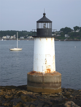
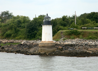
Photo Gallery
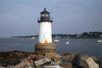


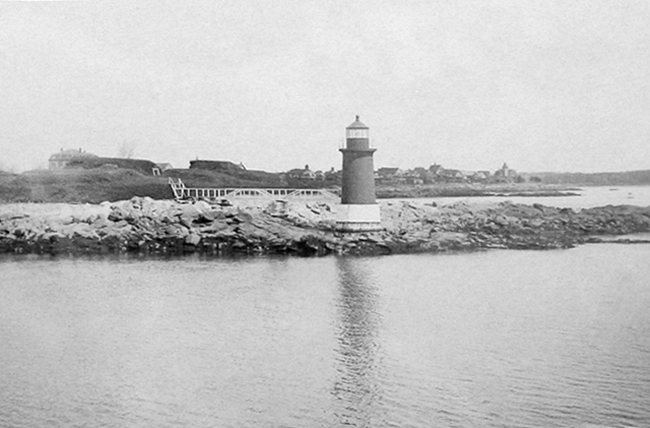
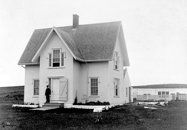


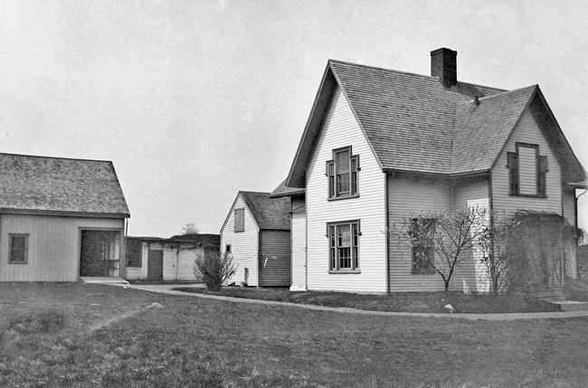


Photo Gallery
Photo Gallery
|
Keeper Harris had never ridden in a car, seen Salem after dark, nor watched a movie until after his retirement in 1919 at age seventy-five. It seems as though we have been out of the world for a long time, and it will take some time for us to learn how to act among people. He saw his first film on the night he left his post for good. Although he had seen a reenactment of the Battle of the Gettysburg years earlier, he said it couldnt beat the movies by a long shot.
After decades spent on secluded Winter Island, the Harrises moved to a busy Salem street corner in January 1919. I feel that I shall miss the quiet and freedom, Annie Harris mused. From the windows of our island home we had a wonderful view of both the inside and outside harbors and, with the broad expanse of ocean, it was an ideal spot for a home. The couple was absent from the island only seven months when Annie died, and John passed away the following April.
Not all keepers were as conscientious as John Harris. In a bid to generate additional income, another Fort Pickering keeper took a second job as superintendent at the nearby Plummer Home for Orphaned Boys. This move, however, backfired, as it was in violation of his lighthouse keeper contract and resulted in his termination.
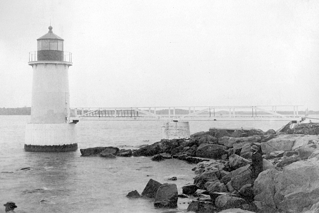
Winter Islands strategic position at the entrance to Salems inner harbor was underscored when fortifications were built there by 1643. The fort was originally named Fort William for King William of England, but the name was changed to Fort Anne after Queen Anne assumed the throne. In 1799, after America had gained its independence, the fort was named Fort Pickering after Colonel Timothy Pickering, a Salem native who served as Secretary of State under President Washington. Remnants of the fort, rebuilt in the Civil War era, still stand near the lighthouse.
|
In 1869, $30,000 was allocated for the construction of three small lighthouses (Fort Pickering, Hospital Point in Beverly, and Derby Wharf) to enable vessels to safely enter the harbor at all times.
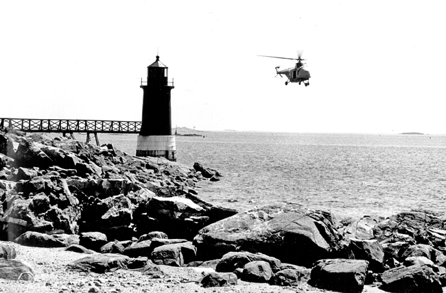
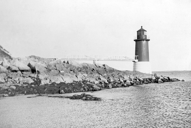
The cast-iron, brick-lined tower, which through much of its history was normally painted brown or red, was built just offshore and was attached to Winter Island by a wooden walkway, fifty-two-feet long, ten-feet wide, and seven-feet high. The light was moved from a temporary structure to this new tower where it first glowed through a fifth-order Fresnel lens on January 17, 1871. The flashing white light was situated a mere twenty-eight feet above sea level, making it one of the smallest of the conical cast-iron towers that would be popular from the 1870s into the early 1900s.
After passing Bakers Island, mariners would line up the lights at Fort Pickering and Derby Wharf to enter Salem Harbor.
The wooden walkway had to be rebuilt twice after being destroyed by ice in 1879 and 1904. The Harris family must have been pleased when in 1895 water pipes connected the keepers house with the Salem water system. By 1878, a sixth-order Fresnel lens was being used in the lantern room, and by 1920, an incandescent-oil-vapor light had been installed in the lantern room, but an oil lamp was kept on hand in case of a power outage.
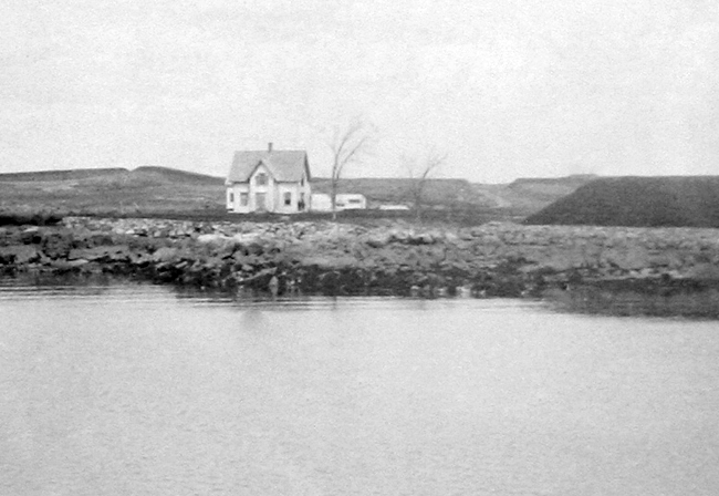
In the 1930s, a Coast Guard air station was built on Winter Island, and many of its personnel lived in the keepers dwelling until new quarters were completed. During a blizzard in 1934, thirty guardsmen were trapped in the dwelling. The temperature was well below zero, and they were getting low on fuel oil when a snowplow finally broke through to rescue them. The keepers dwelling was later converted to the Coast Guard Officers Club on Winter Island.
|
An offshore buoy replaced the lighthouse when the Coast Guard vacated the island in 1970, and the deserted tower soon began to deteriorate. The Blizzard of 1978 ripped the tower door from its hinges, causing it to fall into the harbor. In the early 1980s, the Fort Pickering Light Association was organized, and as part of their restoration efforts they fished the door from the harbor and replaced it on the tower. Following restoration, Fort Pickering Light was relit in 1983 as a private aid to navigation.
After the light was dark for a few months following the failure of its underwater power cable, the beacon was converted to solar power in April 1995. The light now flashes once every four seconds.
In 1999, the American Steeple Corporation of Salem, which had previously restored Bostons Old North Church and Quincys Church of Presidents, completed $13,800 worth of work on the lighthouse that included repairing iron work and painting the tower. After the light failed in July 2009, the Coast Guard installed a rebuilt solar-powered system in February 2010.
Although the keepers house, walkway, barn and other out-buildings no longer exist, frequent summer events, a campground, and a yearly blues festival draw many visitors to Winter Island and Fort Pickering Lighthouse.
Head Keepers: Charles A. Johnson (1871 1877), Abram F. Barenson (1877 1881), John Harris, Jr. (1881 1919), James Yates (1919).
References

