Cape Charles, VA 
Select a photograph to view a photo gallery


Photo Gallery
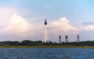
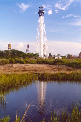
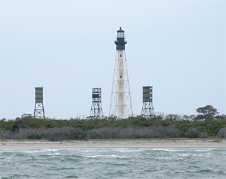
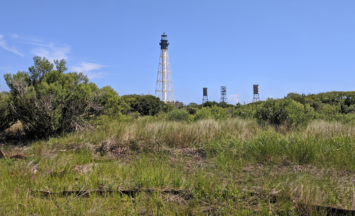
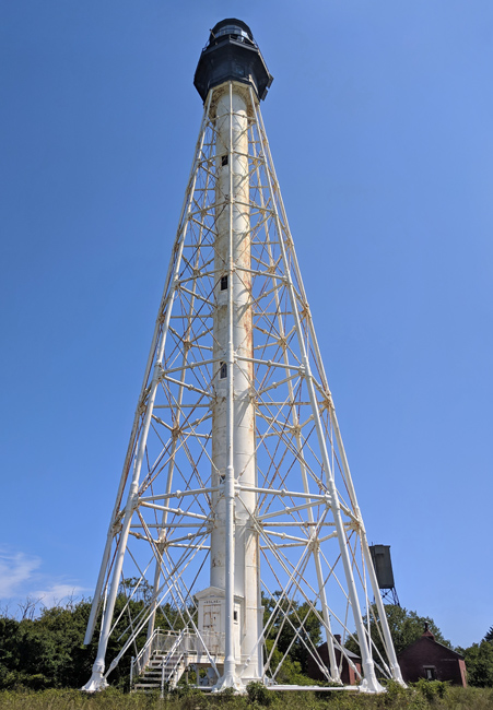
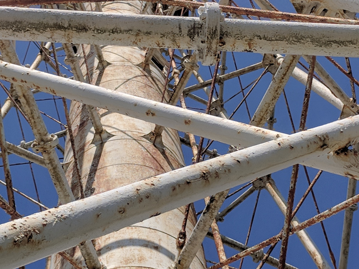
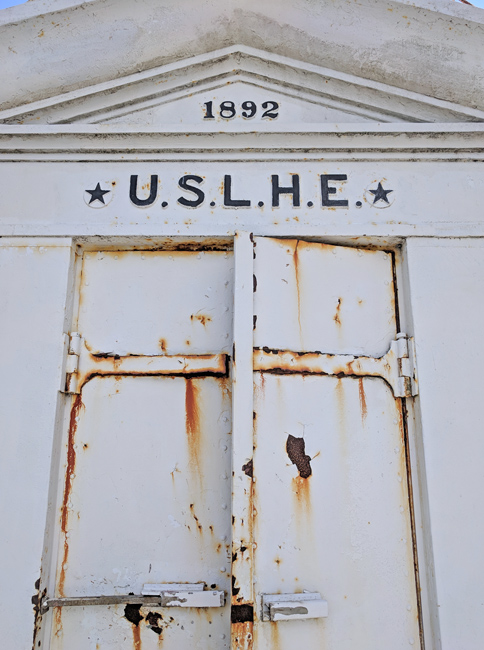
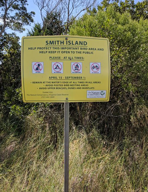

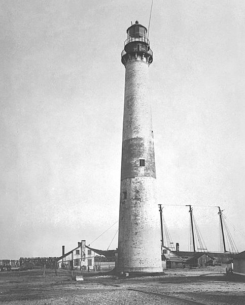
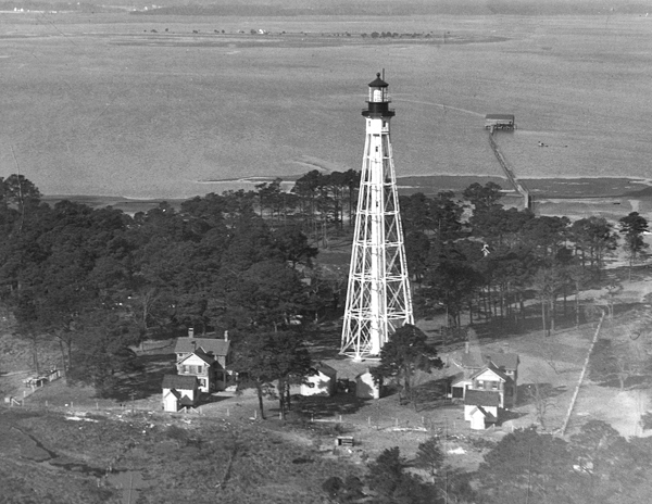

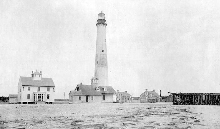

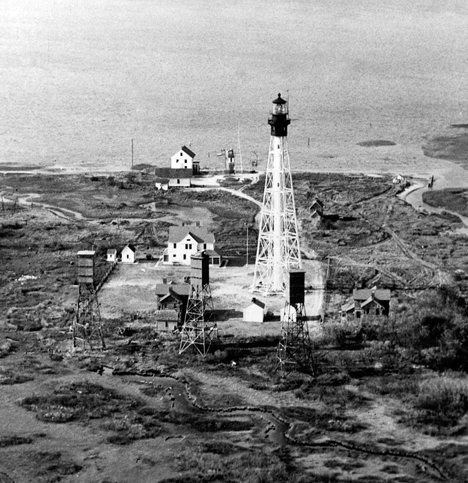
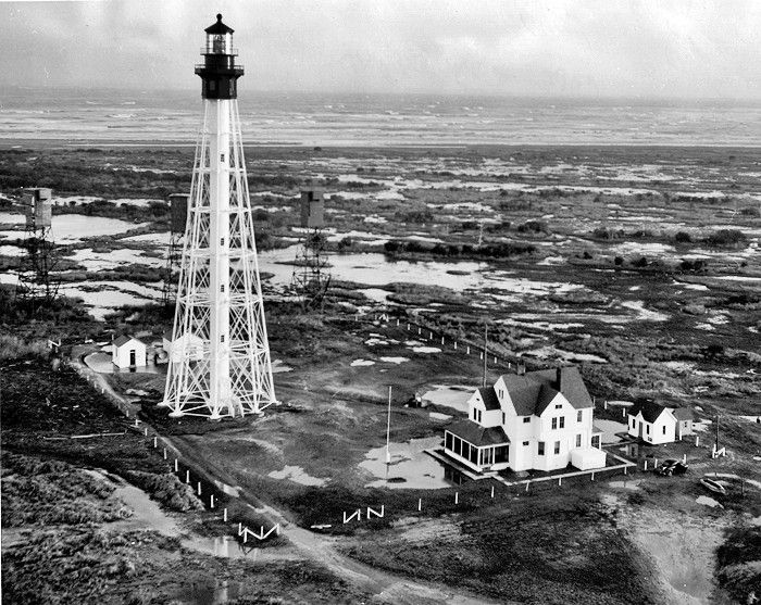
Photo Gallery
Photo Gallery
|
On August 18, 1856, Congress appropriated $35,000 for rebuilding the lighthouse upon a proper site, and fitting it with proper illuminating apparatus, but in order to better serve mariners while the new structure was being erected, a first-order Fresnel lens was installed in the old tower in 1858. In its report for 1857, the Lighthouse Board noted the rebuilding had commenced and its completion may be expected during the next year. This proved overly optimistic as the lighthouse had still not been completed at the outbreak of the Civil War in 1861, shortly after which Confederates removed the lens from the 1827 Cape Charles Lighthouse. A lightship was anchored offshore to mark the entrance to Chesapeake Bay until the Union captured Virginias eastern shore and re-established the light at Cape Charles on December 12, 1861. Keeper John S. Robins who has been represented as a consistent Union man throughout the rebellion, was again placed in charge [after] taking the oath of allegiance.
According to the Lighthouse Boards annual report, on August 3, 1863, Cape Charles was visited by a party of guerrillas, who completely destroyed the light; carrying away such portable articles as they deemed valuable. The new tower authorized for that station had, at the breaking out of the rebellion, progressed in construction to a height of 83 feet; the greater part of the materials to complete the tower to is proper height (150 feet) being on the ground, stored, ready for future use. During the rebel occupancy of this part of the peninsula the articles which had been thus stored were subjected to indiscriminate pilfering and spoliation, so that a new provision will have to be made.
Congress provided $20,000 on March 14, 1864 to complete the tower, and though the war was still raging, the lighthouse was finished and then placed in operation on September 7, 1864. To protect it from enemy attack, a competent military guard was requested for the lighthouse.
|
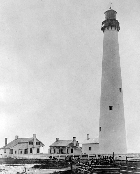
It is likely that this tall, banded lighthouse was more cherished than its predecessor, if one can read anything into the expensive and shortsighted attempts to save it from ruin. A six-hundred-foot buffer zone does sound like a significant distance, but one must keep in mind that the Chesapeake region suffers from extremities of weather and the shoreline erosion that accompanies them. The second Cape Charles tower was essentially doomed the moment its site was selected.
Mother Nature gobbled up the beachfront of Smith Island at a rate of about thirty feet a year, so that in 1883 the Lighthouse Board was forced to sound the alarm in its annual report. At that time, the towers distance from the shore had been cut in half, to three hundred feet, and the keepers house was closer still. Stakes spaced fifty-feet apart had been placed between the tower and shoreline so the rate of erosion could be accurately tracked.
In an attempt to save the lighthouse, the Board requested $15,000 for the construction of protective jetties. Congress granted $10,000 of this, and in 1885 the Board explained the only practicable method of making the protection is by means of piers or jetties of stone resting upon heavy timber mattresses to prevent too rapid sinking (of the stone) into the sand. The situation was further complicated as the lighthouse was surrounded by privately owned lands on Smith Island. The Board implored Congress to purchase some of the neighboring property so protective works could be built but warned that the funds already provided were entirely insufficient as the site was not readily accessible.
A contract for constructing a jetty and protection wall of brush and stone was awarded to the lowest bidder on April 19, 1886, and work got underway the following month. Due to difficulties in transporting stone to the site, the contractor needed a year to build a 200-foot-long protection wall along the beach and a 130-foot-long jetty perpendicular to this. In 1888, the Lighthouse Board noted that the outer thirty-five feet of the jetty had been washed away by high tides but judged the work sufficiently beneficial to justify extending the protection wall 500 feet north and 300 feet south. After a northeasterly gale washed away seventy-five feet of the jetty in April 1889 and entirely surrounded the station with water, the Board changed its minds and stated the most economical plan would be to build a new station at a cost of $150,000 rather than try to save the existing one.
The requested amount was provided on August 30, 1890, but erosion protection measures had to be built to preserve the old lighthouse until the new one could be activated. Work began on four jetties, each built of two closely driven rows of piles filled with stone, but mosquitoes were so numerous and troublesome as to practically cause a suspension of the effort. The jetties were finally completed in March 1891, and in July 1892, ten acres of land were obtained for the new tower through condemnation after one of its owners died and left a minor as one of his heirs.
|
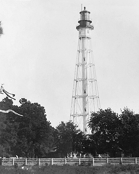
Because the new tower was to be situated in a low and inaccessible marshy region, three-quarters of a mile from its predecessor, a 1,345-foot- long wharf had to be built to reach water deep enough to permit boat access. A temporary tramway was also built from the pierhead to the lighthouse grounds to transport construction materials. The iron tower was manufactured at the foundry between June 1893 and June 1894, and during this time, workers on the island completed the nine foundation piers for the tower and a stable, and had roofed in the two assistant keepers dwellings and the oil house. The working party on the island was disbanded on June 30, 1894 as swarms of mosquitoes spawned in the swampy ground made it too irksome to continue.
Upon their return in November, the workers erected the tower and head keepers dwelling and then graded the grounds and filled in nearby marshes. Bermuda grass roots were planted to form an attractive lawn and hold the sand in place, and a modern telephone was installed. The Board noted that the scourge of the mosquitoes, sand flies, fleas, etc render existence almost unbearable for nearly half the year, and promised that every effort had been made in the design of the station to mitigate the undesirable conditions
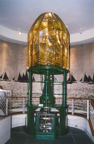
The stations lens was installed and tested in June 1895, however, its full-time service was delayed until mid-August so mariners could be properly informed of the stations new light characteristic. Lt. Frederick Mahan of the Lighthouse Board proposed that all U.S. lighthouses be given a numerical flash pattern. The first-order lens at Cape Charles made a complete revolution every thirty seconds, producing nine flashes: four quick flashes followed by a dark interval of three seconds, then five more flashes followed by sixteen seconds of darkness. Cape Charles would thus have a 4-5 pattern, and mariners could easily associate these numbers with Cape Charles. This numbering system was likened to a fire alarm bell stroking out the exact numerical identity of a beleaguered building. By this method, Mahan maintained, the light is identified absolutely Due to the high cost of these special lenses, only the 4-5 light at Cape Charles, and the 1-4-3 light at Minots Ledge were ever deployed.
|
The lens was removed from the second Cape Charles Lighthouse in October 1895, and on June 1, 1896, the speed of rotation of the lens in the new tower was cut in half as the flashes were being produced in such quick succession that they were indistinct when viewed from a distance. After having been used as an observation tower during World War I, the second Cape Charles Lighthouse finally toppled into the ocean on July 2, 1927. The lights at Cape Charles and Hog Island were electrified in 1933, completing the electrification of all coastal lights in the fifth lighthouse district.
In 1963, the Fresnel lens was removed and the light was automated through the installation of a DCB 2-24 aerobeacon. An Automated Monitoring Control System, installed at Cape Charles Lighthouse and Cape Henry Lighthouse, allowed the lights to be controlled remotely by a Coast Guard station in Portsmouth. This system, however, is no longer operative.
The Fresnel lens from Cape Charles Lighthouse was donated to the Mariners Museum in Newport News, where it revolves ceaselessly, emitting its distinctive 4-5 to the thrill of numerous visitors.
In July 2013, a fire broke out on Smith Island and burned down the head keepers dwelling, a wood privy, and a storage shed. The two assistant keepers dwellings were torn down around 1960, prior to automation of the lighthouse, but the head keepers house, along with an oil house and generator building, had been sold to a hunting club before being taken over by The Nature Conservancy in 1995. The Coast Guard abandoned this light after it failed in 2013, although it still continued to list the light until 2019.
Visiting Cape Charles Lighthouse today is an undertaking that only a truly adventurous and seafaring soul should attempt. One needs to be aware of the tides and familiar with the shifting sandbars. An old pair of shoes or hip waders is recommended while on the island, as one will likely encounter the same marshy conditions that plagued the keepers. This trip is perhaps best left for the Coast Guard, for even their landings on Smith Island are a trial-and-error mission.
Keepers:
References

