Craighill Channel Lower Rear, MD 
Select a photograph to view a photo gallery
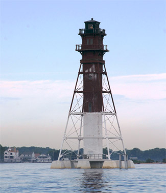

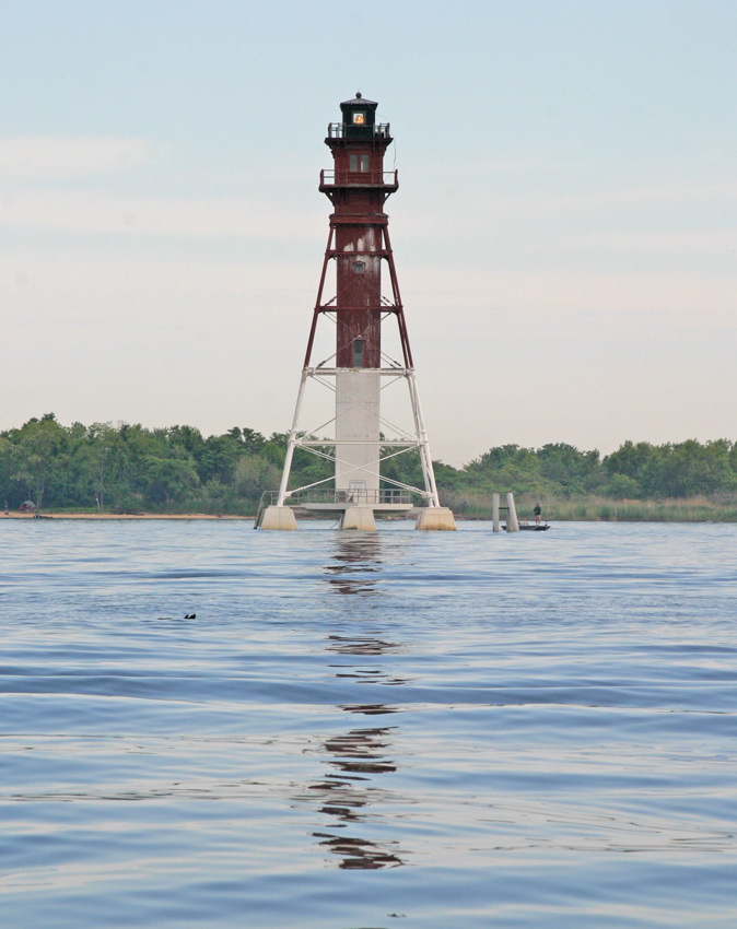
Photo Gallery

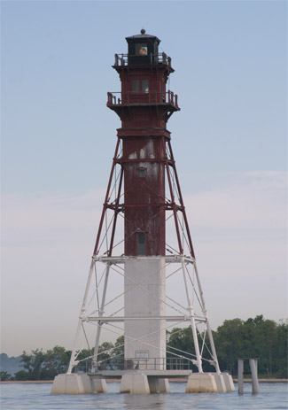
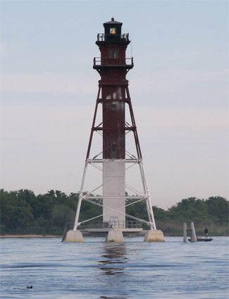
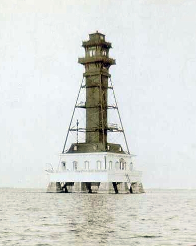
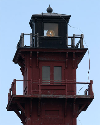
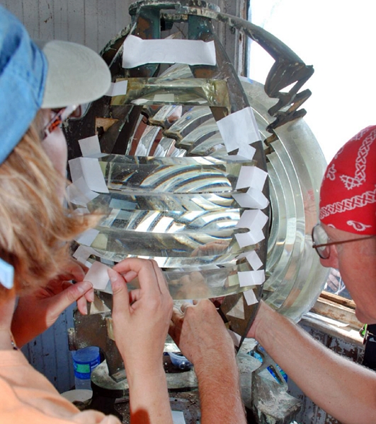
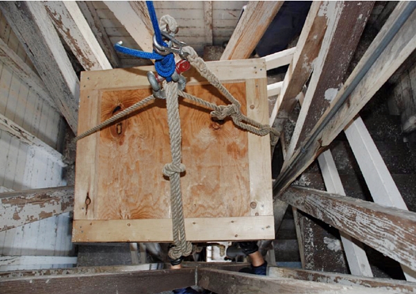


Photo Gallery
Photo Gallery
|
Due to the location of the Craighill Channel, it would have been problematic to construct range lights onshore and so the decision was made to build them on the bay. The original design called for standard screwpile foundations for both of the range lighthouses, however, before construction could begin, potentially dangerous ice conditions at the site of the front range were observed over the winter of 1872-73. This hazard prompted the Lighthouse to alter their plans and construct a small caisson structure for the front range and a granite pier foundation for the rear range using $45,000 that Congress had appropriated on June 10, 1872.
The precise location of the rear light took careful planning to ensure the necessary alignment with the front range light, which was positioned 2.4 miles to the south. Once the location was determined, a sampling of the substratum was taken as noted in the Annual Report of the Lighthouse Board. A careful examination showed that the soil was firm, hard sand, to a depth of two feet. Below this was a thick layer of sand and mud, mixed with stones, then soft mud to a depth of fifteen feet. Based on these findings, a pile and grillage foundation was designed to support the piers on which the dwelling and the columns of the frame-work tower would rest.
In April 1873, a sixty-foot-square cofferdam was built around the site in two feet of water, and the interior was then pumped dry. Foundation piles were driven into the muddy bottom, cut off evenly, and topped with a grillage of timbers. Atop this foundation, nine piers, arranged in three rows of three, were constructed of Port Deposit granite to support the lighthouse.
|
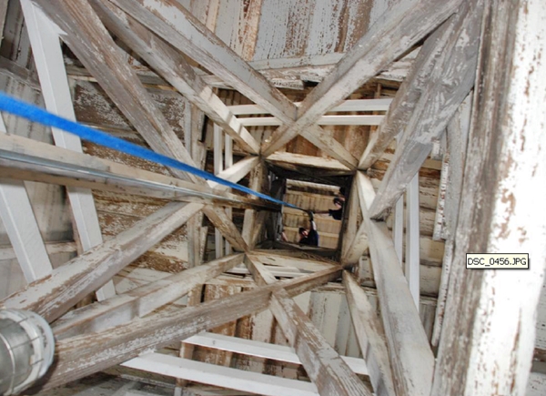
The lighthouse constructed atop the granite piers resembled a four-sided pyramid, with the residence located inside the base of the framework. The keepers house was a one-and-a-half-story, wooden structure built in a Victorian style with dormer windows. An enclosed square, wooden, stairway extended from the residence to the elevated service room, watchroom, and finally the lantern room. A cantilevered deck surrounded both the watchroom and lantern room, and a small heating stove was located in the watchroom. The towers exoskeleton was made of cast iron, while the interior portion was made of wood.
Craighill Channel Lower Rear Lighthouse measures 105 feet tall, making it the tallest light in Maryland and one of the tallest on Chesapeake Bay. A fourth-order Henry-Lepaute Fresnel range lens installed in the lantern room produced a fixed white light, and the lighthouse itself was described in 1884 as an open-frame pyramid of four sides with its lower portion straw-color, its upper part brown, and its lantern red.
According to historical records, extensive repairs, necessitated by the decay of nearly all of the towers wooden braces, were made to the structure in 1884. Metal beam braces replaced the wooden ones, and during this work, new boat davits were installed and the entire tower was painted. On August 21, 1888, a cyclone tore away the dwellings roof, its copper smokestack, and portions of the covering of the stairway shaft, but all of the damage was quickly repaired over the next two months.
In 1888, Nicholas S. Hill, an owner of land on Millers Island near the lighthouse, sued the federal government for unauthorized occupation of the lighthouse site, which the owner claimed under the laws of riparian rights. A district court ruled against the owner, stating that the government had the absolute right to erect and maintain a light-house wherever it was necessary, on any submerged land in navigable waters.
|
The rear light was electrified in April 1929, at which time a submarine cable was used to connect the tower to commercial electricity. A 94-watt railway headlight bulb was placed inside the fourth-order range lens, increasing the candlepower from 20,000 to 140,000, which was important as the rear tower is situated roughly ten miles from the entrance to Craighill Channel.
A Coast Guard engineering survey of the rear tower made on April 20, 1994 reported that the wooden portion of the tower will rapidly become a serious safety hazard to service personnel and recommend the Coast Guard shouldnt spend any more money trying to maintain it. Instead, the engineer advised that the wooden stairway should be demolished and replaced with a device to lower the light for required service. To date, the central column of the tower remains intact, and the tower has been determined eligible for the National Register of Historic Places, which may protect the tower from any alterations.
On August 11, 2010, Coast Guard personnel removed the historic Fresnel lens from the rear lighthouse, after stabilizing each of its prisms with archival tape. Portions of the lens annular rings are missing, and the original central bulls-eye has been replaced by a Pyrex version. Once the lens was removed from its pedestal, it was carried down a staircase to the service room, where it was packed in a crate before being lowered by rope down the towers central shaft. A sixteen-foot Coast Guard boat transported the lens to shore, and a government van carried the artifact to the Coast Guard Exhibit Center for storage.
Keepers:
References


