Sanibel Island, FL 
Select a photograph to view a photo gallery
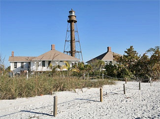

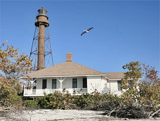
Photo Gallery

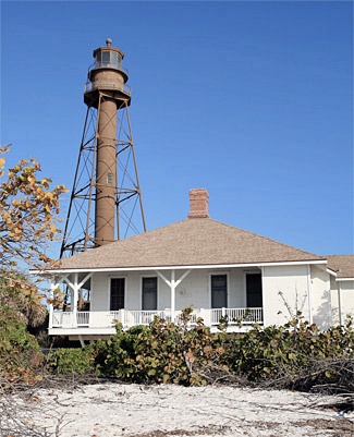

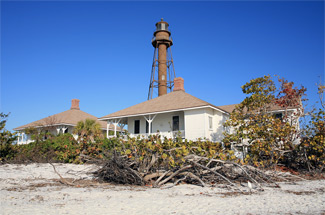
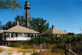
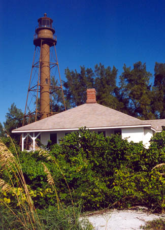
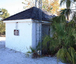
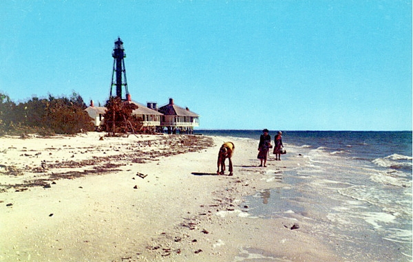
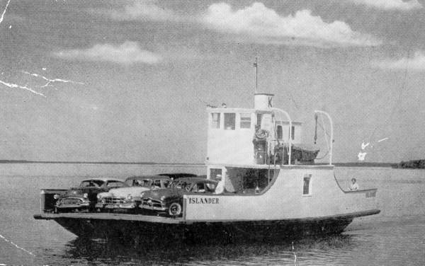


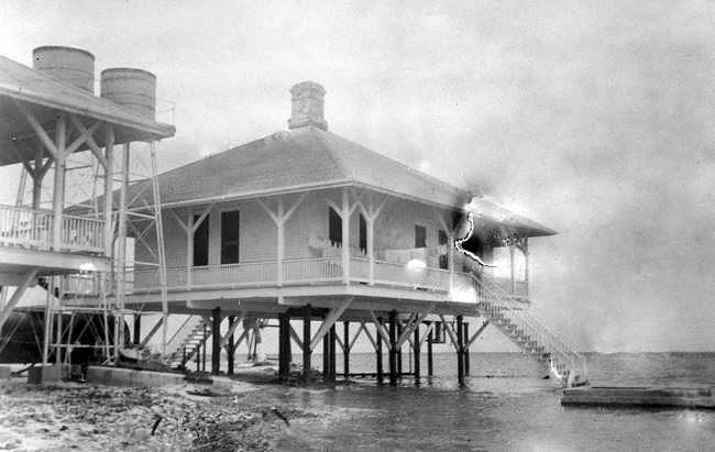

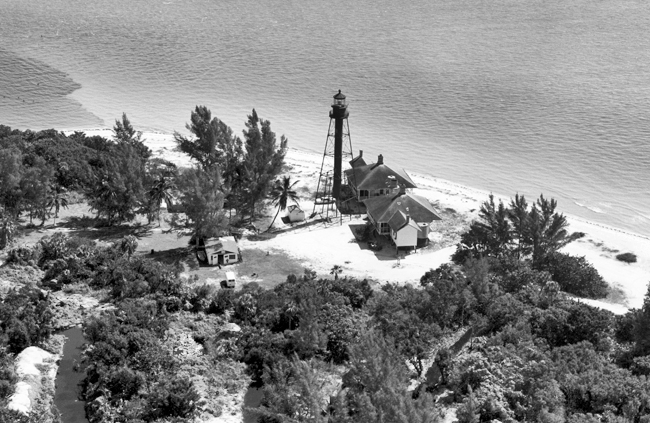

Photo Gallery
Photo Gallery
|
Punta Rassa, located on the mainland across San Carlos Bay from the eastern end of Sanibel Island, soon thereafter became a substantial port as cattle were driven to its docks from across Florida to be loaded onto vessels and transported to Cuba. In 1856, the Lighthouse Board recommended a beacon be established on Sanibel Island to light the port, but no action was taken. After the Civil War, another request for funding for the lighthouse was made in 1878, accompanied by the following justification:
A light on Sanabel [sic] Island would supply a want that has long been felt for a light-house between Key West and Egmont Key. The coastwise trade of Florida is considerable, and increasing. A great number of sailing-vessels, also six steamers, are now plying between Key West and ports on the west coast of Florida; and vessels bound across Florida Bay make their landfall at and take their departure from the southern point of Sanabel Island.Congress was slow in granting sufficient funds for the project, but all of the needed $50,000 was finally obtained in 1883.
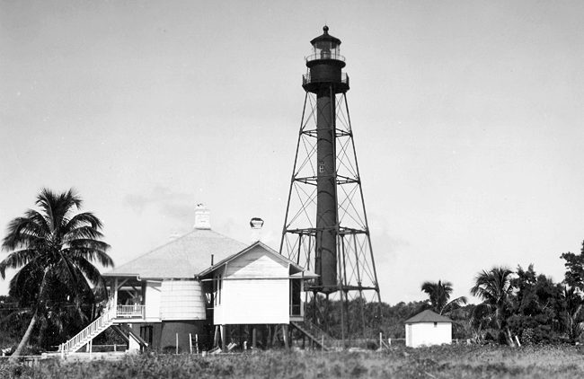
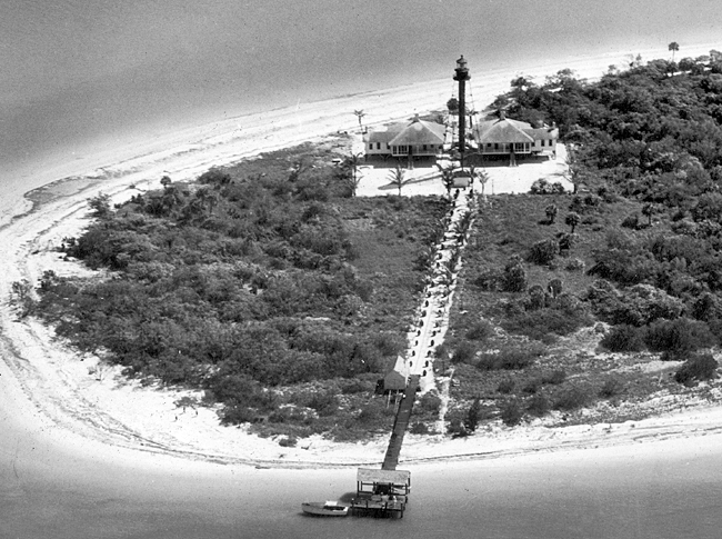
Work on the lighthouse began on the eastern tip of the island in February 1884, while the superstructure was fabricated in the north and shipped to the site. A 162-foot-long, T-head wharf was built on creosoted piles, allowing materials to be landed for the tower and for two square keepers dwellings, topped by hipped roofs and supported by iron pilings. Just two miles from Sanibel Island, the ship carrying the iron work from Jersey City for the towers at both Sanibel Island and Cape San Blas sank. Crews aboard the lighthouse tenders Arbutus and Mignonette, assisted by a diver, were able to fish up all of the pieces save two small gallery brackets, which were subsequently fabricated in New Orleans. Consisting of four iron legs arranged in a pyramidal fashion around a cylindrical central column topped by a lantern room, the lighthouse was ready to be lit by keeper Dudley Richardson on August 20, 1884. A third-order Fresnel lens graced the tower at a height of about ninety-eight feet and produced a fixed white light, punctuated every two minutes by a brilliant flash. Just like its twin at Cape San Blas, the central column of Sanibel Island Lighthouse stops about twenty feet from the ground and must be accessed by an external staircase.
|
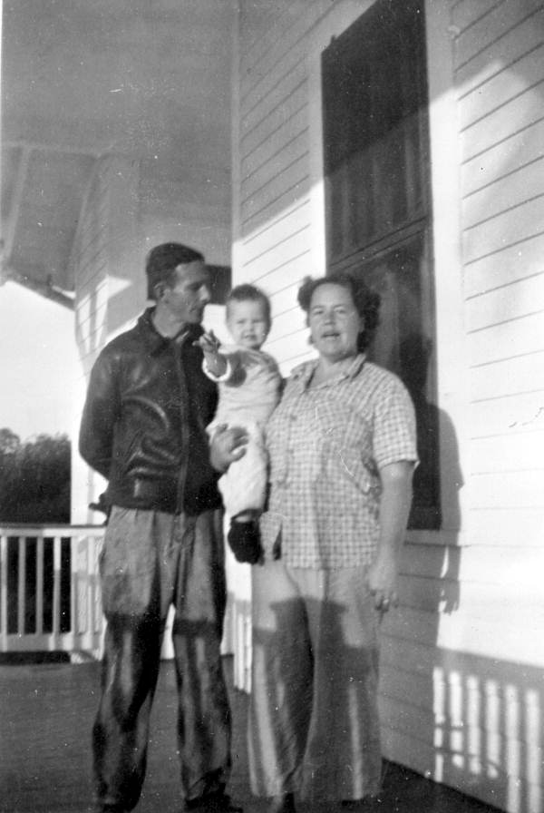
Needless to say, the family helped run the lighthouse. The Shanahans had a pet deer that would race up and down the beach along with a trained cat that would roll over like a dog. Henry passed away in 1913 after twenty-three years at the lighthouse, but his son Eugene, who had served as his fathers assistant for several years, would return in 1924 to carry on the familys connection to the lighthouse. Clarence Rutland, one of Henry Shanahans stepsons, served as an assistant keeper from a stint in the 1920s and again in the 1930s. Rutland left the following description of the daily routine at the lighthouse:
There were two men at the time. We changed watch each night at 12. It was an oil light then, and wed take a five-gallon can up full in the afternoon and pump the light and bring the can down empty in the morning.The light had clockworks with weights on it and you had to keep that flashing to the second. Somebody had to be with it almost every minute. During the day, we had curtains we hung around every one of those prisms.
The Fort Meyers Press of June 23, 1919 reported that Jesse W. Lee of Fort Myers had shot and killed Richard T. Barry, assistant keeper of Sanibel Island Lighthouse, the day before around noon after Barry had reportedly insulted Lees wife and refused to apologize. Five months later, a jury in Fort Myers acquitted Lee of murder. Lee admitted to killing the assistant keeper but claimed it was in self-defense. On the day of the killing, Keeper Charles Williams noted in the stations logbook that he had received word about 1:30pm that his assistant had been shot and killed. The lighthouse tendern Ivy arrived at the station the next day bringing Mrs. Barry and a new assistant keeper. Keeper Barry was forty-five years old and was taken to Key West for burial, where he had earlier served as an engineer.
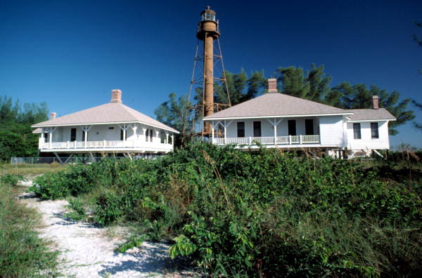
In 1923, the dwellings were modernized, receiving indoor plumbing and bathrooms, and enclosed porches. That same year, the light was converted from kerosene to acetylene gas. Roughly 670 acres were originally reserved for the lighthouse, but by 1923 the boundary of the station property only extended 1,000 feet west of the lighthouse.
|
The dwellings were not long empty, as they became home later in 1949 to employees of the J. N. Ding Darling National Wildlife Refuge. Charles LeBuff lived in the assistant keepers cottage for twenty-one years, starting in 1958.
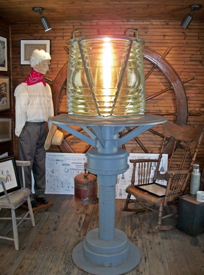
The Coast Guard electrified Sanibel Island Lighthouse in 1962 when the causeway was completed and electric conduit pipes were run along it for the island. In the process of electrifying the light, the Coast Guard removed the towers third-order Fresnel lens and installed a 300 millimeter drum lens that had been used on a lightship. A 190 millimeter beacon was placed in the lantern room in the 1980s, and the 300 millimeter lens was loaned to the Sanibel Historical Museum and Village, where it is currently on display.
In 1972, the Coast Guard proposed discontinuing the lighthouse, but feedback provided by local residents and mariners convinced them to keep it lit. The City of Sanibel assumed management of the lighthouse property, except the tower, in 1982, and city personnel were allowed to live in the dwellings rent-free in exchange for helping to maintain and supervise the grounds.
The property was transferred from the Coast Guard to the Bureau of Land Management (BLM) in 2000. The BLM accepted an application from the City of Sanibel for custody of the property in 2004, and after a lengthy delay, the lighthouse was officially transferred to the city during a ceremony held April 21, 2010. Using a $50,000 state historic preservation grant and money from its beach parking fund, Sanibel City Council awarded a $269,563 contract to Razorback LLC in May 2013 to restore the lighthouse. During the summer of 2013, the contractors replaced sections of deteriorated steel on the tower and then sanded and painted the exterior. The City of Sanibel has certainly shown it is committed to preserving the lighthouse property. In 2016, the lighthouse and dwellings were added to the City of Sanibels Register of Historic Sites and Structures.
In September 2022, Hurricane Ian, a category four storm, ravaged Sanibel Island and swept away the two keepers dwellings at Sanibel Island Lighthouse along with the oil house and a portion of one of the four main support legs for the tower. A section of the causeway connecting the island to the mainland collapsed during the storm, leaving the island cut off from immediate aid. The pieces of the support leg lost in the storm were later recovered. A structural engineer hired to assess the damaged structure found it to be structurally sound, though a ladder had to be used to reach the door to the towers staircase as the hurricane had washed away the foundation from which the access stairs ascend to the center column. The Florida Lighthouse Association provided $60,000 in emergency funds to help repair the damage Hurricane Ian caused at Sanibel Lighthouse as well as at Boca Grande Lighthouse and Gasparilla Island Lighthouse.
Five months to the day after Hurricane Ian nearly toppled Sanibel Island Lighthouse, a relighting ceremony was held at the base of the tower early on the morning of February 28. The reactivated lighthouse served as a literal beacon of hope as the island community continued its recovery.
On January 23, 2024, Sanibel Lighthouse received a new, permanent, metal leg in place of the wooden one that had been supporting the tower for over a year. Scaffolding was then placed around the lighthouse and that was in turn covered in a shroud so the tower could be sandblasted and painted. Repairs to the lighthouse, which cost over one million dollars, were completed in the summer of 2024. Insurance paid for roughly three-quarters of the cost, and the Florida Lighthouse Association chipped in over $100,000.
Keepers:
References

