Pentwater Pier, MI 
Select a photograph to view a photo gallery
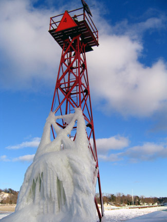

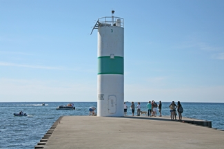
Photo Gallery


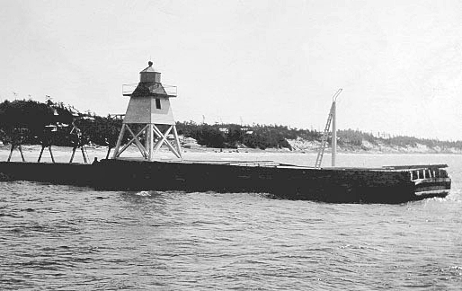

Photo Gallery
Photo Gallery
In 1836, Charles and his brothers decided to try their luck out west in Michigan and initially settled in Paw Paw, where they ran a general merchandise store. The following year, the Mears brothers, accompanied by two other men, sailed north along the shore of Lake Michigan scouting out sites for lumber mills to process the untouched stands of pine trees. Charles Mears built his first lumber mill on White Lake in 1837, and over the next twenty-five years he constructed another fifteen mills and built five harbors along the eastern shore of Lake Michigan.
|
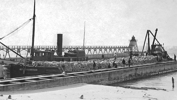
A square, open-frame wooden tower with an enclosed upper portion was built at the outer end of the south pier at Pentwater in 1873. An octagonal lantern room housing a sixth-order lens topped the white, thirty-three-foot tower, and the fixed red light was first placed in operation on June 20th of that year. The tower was twelve foot square at its base and diminished to eight feet at the lantern room. An elevated walkway was built so the keeper could access the tower in any weather condition, but no keepers dwelling was provided. To correct this problem, the Lighthouse Board requested an appropriation of $5,000 in 1873, but a dwelling was apparently never built, as the Lighthouse Board requested funds for one as late as 1906.
The first keeper of Pentwater Lighthouse was Francis McGuire, and when he resigned in 1877, his wife Annie took charge of the light and served until being removed in 1885. Barney Evers was the third keeper, and his lengthy service at Pentwater spanned twenty-six years.
A post was put in place at the outer end of the south pier in 1890 to hold a tubular lantern that formed, with the main pierhead light, a range for entering the harbor. This new light was put in operation for the first time on August 15, 1890. A brick oil house with steel doors was added to the station in July 1913.
In 1919, the front and rear lights were changed from oil to acetylene, and the position of keeper was eliminated. No longer needed, the elevated walk was also removed at this time.
|
A 12,000-pound, thirty-foot-tall, prefabricated cylindrical tower, manufactured in Tulsa, Oklahoma and trucked to Ludington, was placed on the north pier by a National Guard Chinook helicopter on October 8, 1987. A large crowd, including the Pentwater High School Band, was on hand two days earlier to welcome the new lighthouse, but high winds forced the effort to be postponed after repeated efforts to land the tower failed. This new tower not only contained a light, but also a foghorn and radiobeacon. Pentwater Village President John Morris noted that the push for the new tower was a community project to obtain better aids to guide boaters into Pentwater Harbor during adverse weather.
The 1987 tower was designed by Jon Kiernan of the Coast Guards Ninth District Shore Maintenance Detachment in Cleveland and was modeled after the common D9 Tower, but was made taller and wider so it could house extra equipment and the necessary power sources.
Maynard Barrus, a former fishing charter captain and one who pushed for the new lighthouse, had plenty of first-hand knowledge of the need for improved navigational aids. Many times Ive been socked in in the fog out on the big lake and it would have been impossible to find the harbor had it not been for Coho Bob with a radio direction finder who could help guide boats into the harbor on foggy days, Barrus said. When Coho Bob wasnt available to guide mariners in, Maynard Barrus and others would drive to the waterfront and shine their lights and honk their horns to help the boaters find the harbor. A year before the tower was placed on the north pier, a boat went on the rocks trying to find the harbor entrance.
The disparate 1937 and 1987 towers continue to help mariners find their way to the piers and into Lake Pentwater.
Head Keepers: Francis McGuire (1873 1877), Annie McGuire (1877 1885), Barney Evers (1885 1911), Andrew J. Davenport (1911 1912), William P. Larson (1913 1915).
References