Grand Haven, MI 
Select a photograph to view a photo gallery

Photo Gallery


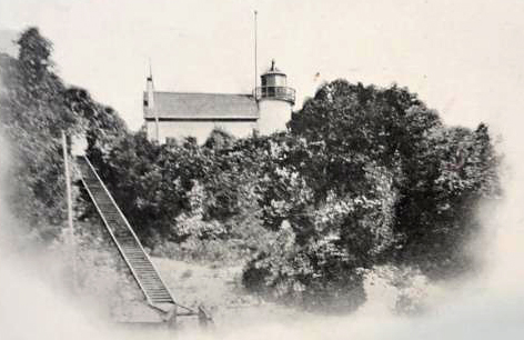
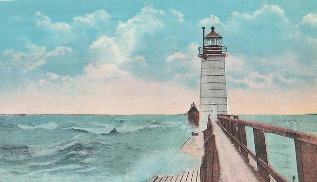
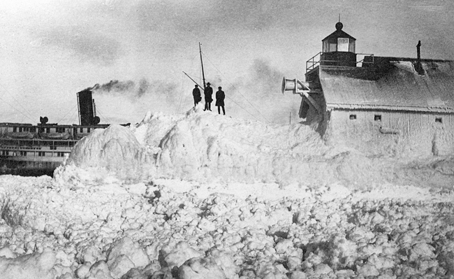
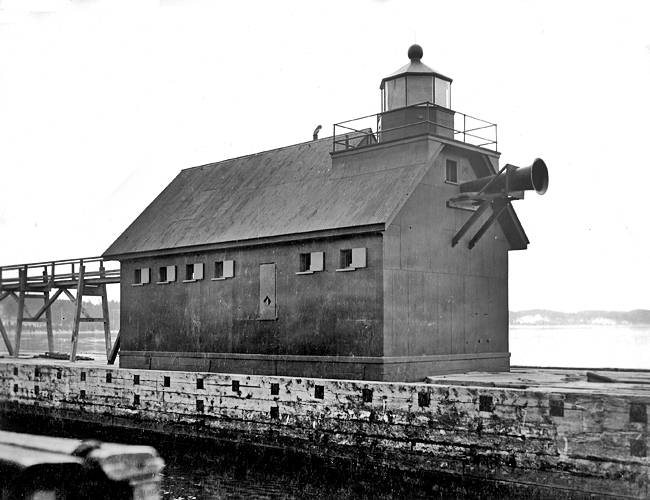
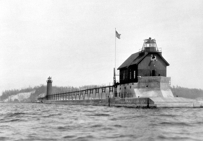

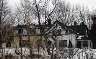
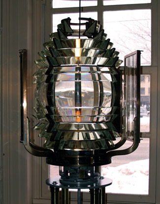

Photo Gallery
Photo Gallery
|
Grand river is 40 miles north of Kalamazoo. This is by far the largest river that empties into Lake Michigan, having no less than two fathoms water on the bar at its mouth. It is the only safe shelter for large vessels on the east shore south of the Manitou islands. Of course, I did not hesitate to report in favor of a light here. My examinations here were of a limited nature, but I am inclined to think a small amount would make this by far the best harbor on Lake Michigan. The channel at the mouth only requires to be straightened a little so as to render it more easy of entrance.
Messrs. Rogers and Burnett of Milwaukee were hired to construct a stone dwelling and lighthouse near the mouth of Grand River, and during the summer of 1838, Lieutenant James T. Homans called to visit the work. Homans reported to Stephen Pleasonton, the overseer for the countrys lighthouses, that inferior materials were being used, and the work was on par with the materials. Pleasonton sent Trueman H. Lyon to examine the lighthouse, and he found that Homans report was incorrect. Only the foundation of the dwelling had been finished during Homans visit, and the contractors were not present to explain that the material on site had been condemned as inferior.
The stone used to complete the dwelling and tower was quarried in Green Bay, while the stone steps came from Cleveland. Having heard of the unfavorable report of Lieutenant Homans, the leading citizens of Grand Haven sent a letter to Trueman Lyon in October, 1838, stating that the materials used were of good quality and the work was done in a very permanent and substantial manner. These citizens and Mr. Lyon noted, however, that much of the bank in front of the lighthouse had been washed away and that during storms the water came within thirty feet of the structures.
Nehemiah Merritt was hired as the lights first keeper in August 1839. The stone lighthouse stood thirty feet tall, and in 1848, four oil lamps, backed by fourteen-inch reflectors, were being used in its lantern room to produce a fixed white light.
|
Work on a replacement lighthouse commenced in 1854 on a bluff above the original site, and the light was placed in operation the following year. The lighthouse consisted of a circular tower attached to a six-room, one-and-a-half-story dwelling, both of which were built of rubblestone. The tower stood just over twenty-four feet tall, but the bluff gave the light a focal plane of seventy feet above the lake. A bulls-eye panel revolved around the fixed fourth-order lens in the lantern room to produce a white flash every ninety seconds.
In 1868, the tower was raised four feet and equipped with a new lantern room. This work was performed during the winter to avoid having to erect a temporary tower for the light.
The Detroit and Milwaukee Railroad established a line from Detroit to Grand Haven in 1858 to link with its ferry service providing cross-lake service to Milwaukee. To accommodate these ferries, the railroad company built a pier at Grand Haven on which it maintained its own light. After the federal government extended the pier between 1867 and 1870, the light was moved to the new pierhead, but it was later discontinued, as it could not be reached during heavy gales. The Lighthouse Board requested $8,000 in 1870 for a wooden tower, a bell, and 1,200 feet of elevated walkway for the pier, and these were put in place during 1871. A steam siren, installed in a fog signal house directly under the pierhead light, commenced operation in December 1875, replacing a fog bell that was rung by a hot-air engine.
A second assistant keeper was assigned to the station in 1876 to help with the added responsibility of running the steam fog signal. In 1883 and again in 1885, the light and fog signal were moved lakeward as the pier was extended. During a ferocious gale on December 9, 1886, the beacon was forced twelve feet backward, crushing the elevated walk behind it. The outer end of the crib settled so that it was below lake level, and the fog signal house was slightly damaged.
A tubular lantern light was established on November 30, 1889 to range with the existing light on the pier. An elevated conduit was added in 1894 so the keeper could run the lantern to and from the outer light from the safety of the inner light. On December 10, 1892 the period of the flash produced by the bluff-top lighthouse was reduced to sixty seconds from ninety seconds through the installation of an additional flash panel.
|
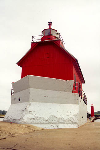
During 1904, a cylindrical metal tower was built atop a concrete foundation near the outer end of the south pier, and on January 12, 1905, the lens from the old bluff-top lighthouse, which was discontinued, was established in the new pierhead tower.
On April 28, 1906, a temporary red lens-lantern light was established shoreward of the metal pierhead tower to form a range. Over the next year, the cylindrical metal tower was moved from the pierhead to a new concrete foundation nearly 600 feet shoreward, and the fog signal building was relocated to the pierhead, where a lantern and lantern gallery were erected on its outer gable end. A sixth-order lens was used atop the fog signal building to produce a fixed red light, while the fourth-order lens in the cylindrical tower retained its characteristic of a fixed white light varied every sixty seconds by a white flash. On May 15, 1917, the rear light was changed from white to red and the front light was changed from red to white. The structures were painted to match the color of their light.
A lighthouse keeper at Grand Haven gave the following description of a meteor that fell from the sky over Lake Michigan on November 26, 1919. What looked like a ball of fire appeared to fall in the lake about fifteen miles south of me. I thought it to be a falling star. In its rush downward at terrific speed, I could clearly hear it whistle. When it seemed that it was striking the water, a flash of flame shot into the air and caused a great disturbance. The meteorite caused a deep and prolonged rumbling that shook houses in southwest Michigan and neighboring regions of Indiana and Illinois and caused residents to flee in panic.
The Bureau of Lighthouses requested $12,700 in its annual report of 1921 for needed improvements at Grand Haven:
The present air siren fog signal at Grand Haven has been the subject of constant complaint from the vessel interests using this port, which include important car ferry and line boats which enter the port 12 months in the year. It is proposed to replace the present equipment with the latest type of diaphone fog signal and operate same by electric power, which will place the equipment at this station above further criticism; also to place electric light in front lens.
|
In 1922, Keeper Charles Bavry and his two assistants, Rolla Paris and Carl Nafus, were commended for rescuing two young men whose canoe capsize near their station.
No longer needed, the tower was removed from the bluff-top lighthouse in 1910, and the dwelling was enlarged to provide improved quarters for the keepers of the pierhead lights. The dwelling was sold at auction in 1956 but remains standing to this day. The Fresnel lens, crafted in 1854 by Henry-Lepaute and used in the 1855 tower and the cylindrical pierhead tower, is on display in the Tri-Cities Historical Museums Train Depot Museum in Grand Haven.
On September 30, 1962, Admiral George H. Miller, commander of the Ninth Coast Guard District, awarded the gold lifesaving medal to twenty-three-year-old David E. Sparks for his heroism displayed on September 14, 1961. On that day, Sparks was on duty in the lighthouse at the end of the south pier when Jerry Busman, 18, and Ron Tipsword, 19, made their way out on the pier to view the waves that had been stirred up by the remnants of Hurricane Carla. On their way back, a large wave swept Busman into the water. Tipsword was able to avoid the same fate by clinging onto a stanchion supporting the catwalk. Seeing the incident, Sparks raced down the pier and threw a life ring toward Busman. When it was obvious Busman wouldn't reach the life ring, Sparks stripped off his pants and shoes and dove into the water to try to help Busman. The large waves thwarted the rescue attempt, and Sparks was forced to cling onto the life ring he had tossed into the water until members of the Coast Guard, called by Tipsword, arrived on the scene. Several days later, Busmans body was found a short distance from the pier. Earlier in 1961, Sparks rescued a person who had slipped on the ice at the end of the pier and fallen into the water. The following account of the attempted rescue was recorded in the light stations logbook:
Sighted man being washed off breakwall between front and rear range lights. Threw lifering to man in water. Man was unable to reach lifering and appeared to be drowning, so Sparks BM2 dove into water in attempt to save him. Sparks stated that he was about twenty feet from man when he went down. Sparks then submerged in an effort to recover man, but was unable to do so. Sparks then swam to lifering and drifted until picked up by lifeboat from Grand Haven Lifeboat Sta. Sparks BM2 should be commended for his actions in this matter and his utter disregard for his own personal safety in his attempt to save this man.
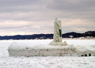
The outer end of the north pier is marked by a D9 tower.
In 2009, Grand Havens lighthouses, deemed excess by the Coast Guard, were offered at no cost to eligible entities, including federal, state, and local agencies, non-profit corporations, and educational organizations under the provisions of the National Historic Lighthouse Preservation Act of 2000. The City of Grand Haven was given a deed to the two pierhead lights in December 2012, and the Grand Haven Lighthouse Conservancy, a community group, was formed to care for the structures. The group held a public open house in the fog signal building on Labor Day, 2011, and is actively raising money to restore the lighthouses.
After the conservancy group had raised over $400,000 through brick sales, fun runs, T-shirt sales and streetlight post banner sales, the Grand Haven City Council approved the expenditure of $259,577 to paint the structures, inside and out. The work was carried out during the late spring and early summer of 2013.
Keepers:
References


