Verchères Traverse, PQ 


Select a photograph to view a photo gallery
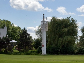
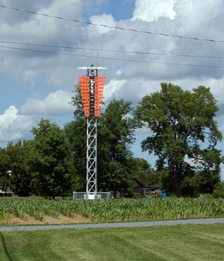
Photo Gallery


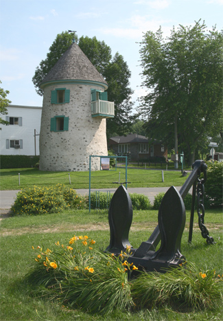
Photo Gallery
Photo Gallery
|
The front light erected on the south shore of the river 8,570 feet N 57° 50 E from Vercheres village church is fixed white catoptric elevated 36 feet above the summer level of the river visible eleven miles in and over a small arc on each side of the line of range and is shown from a square wooden tower with sloping sides surmounted by a square wooden lantern standing upon a cribwork pier.The pier and tower are white and the lantern roof red; the height of the tower from the pier to the ventilator on the lantern is 23 feet.
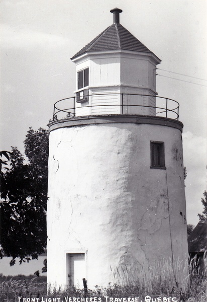
The back light distant 1,900 feet N 70° E from the front light is fixed white catoptric elevated 43 feet above the summer level of the river visible twelve miles in and over a small arc on each side of the line of range and is shown from an octagonal wooden lantern built on the summit of the second old stone windmill below Vercheres. The windmill is whitewashed and the lantern is painted white with red roof. The height of the building from the ground to the ventilator on the lantern is 41 feet.
The first keeper of the front light was F. Xav. Chicoine, and the first keeper of the rear light was Philèas Charbonneau. Both received an annual salary of $80.
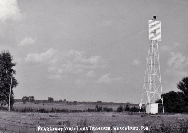
A new front tower was erected in 1909 in the form of an eleven-foot-tall, white, octagonal lantern that stood atop a sixteen-foot concrete pier. In 1946, the rear light, the former windmill, became the front light of the range, and a tall, skeletal tower was erected 533 yards along a bearing of 56° behind the front light to serve as the new rear light.
The present cylindrical tower that supports the front light was erected in 1967, and in 1972, a similar cylindrical tower replaced the 1946 rear range lighthouse. The present Traverse Verchères Rear Range Light is shown from a tall, square, skeletal tower with an orange daymark.
A windmill, similar to the one that served the Verchères Traverse Range, remains standing in Verchères. This structure was erected around 1700 and was home to a marine signal station from 1909 until 1909. Messages were relayed to vessels on the river via signals displayed on a tall mast near the lighthouse, and positions of the vessels were sent by telephone to either Montreal or Quebec City. The windmill is now open to tourists during the summer.
Keepers:
References