Cape Meares, OR 


Select a photograph to view a photo gallery
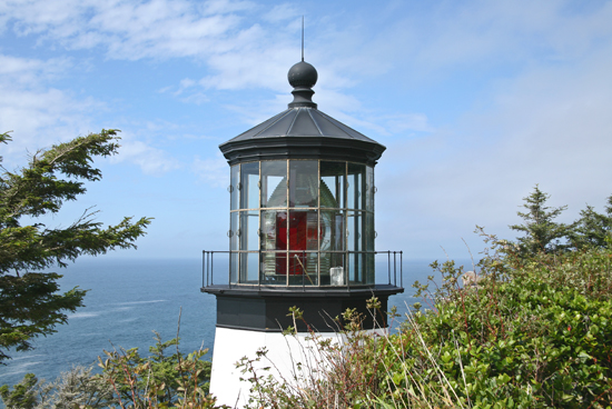
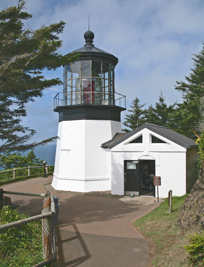

Photo Gallery


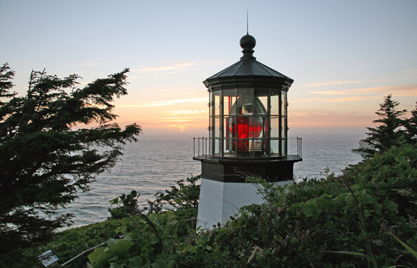
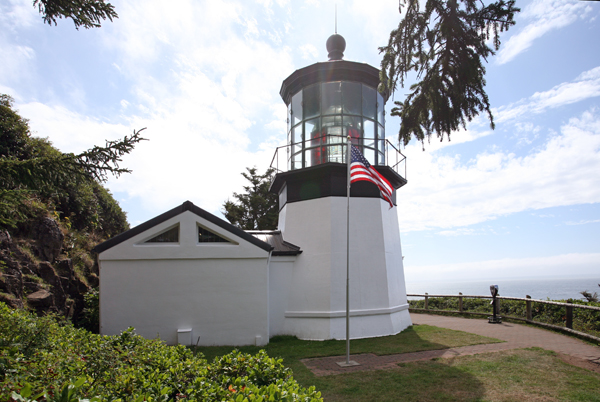
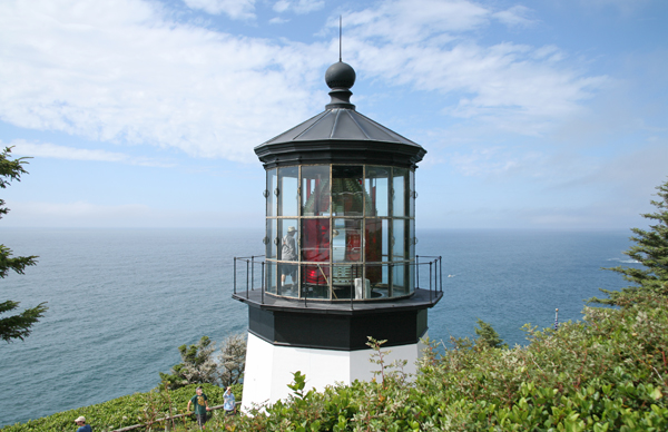
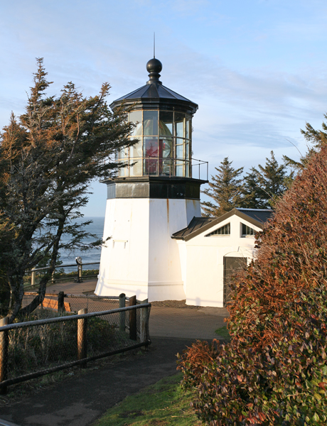

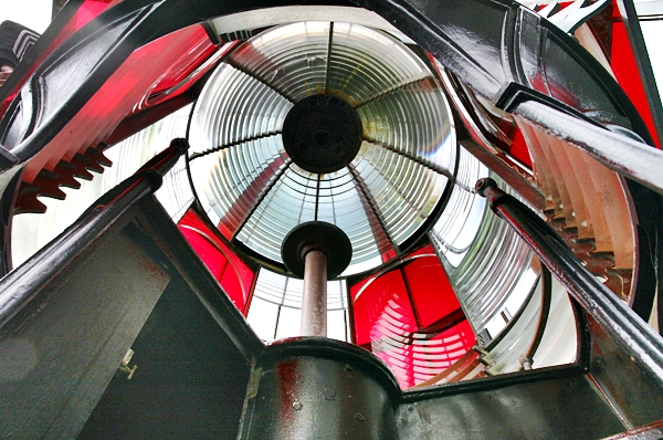
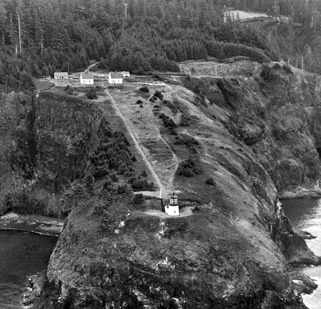
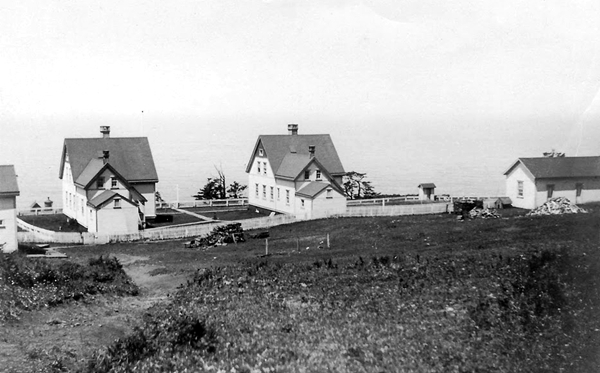

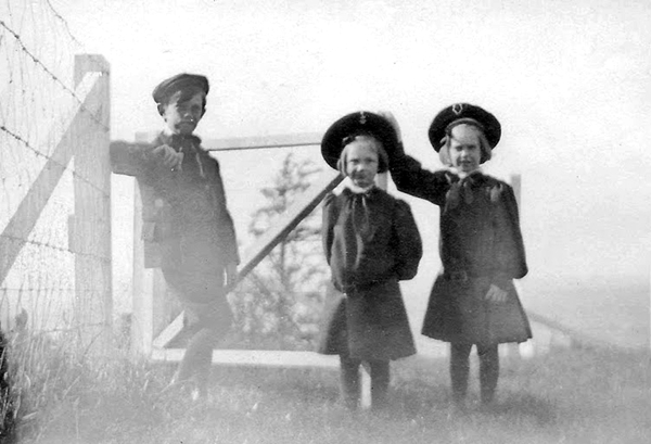
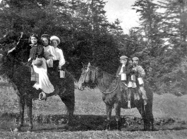


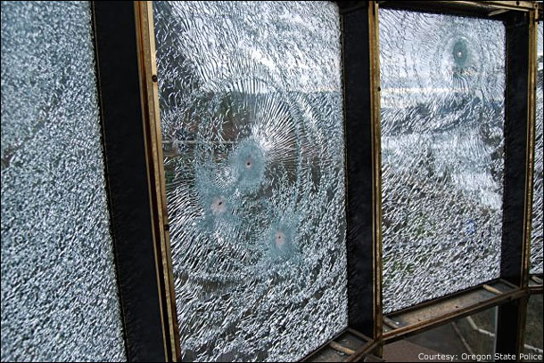
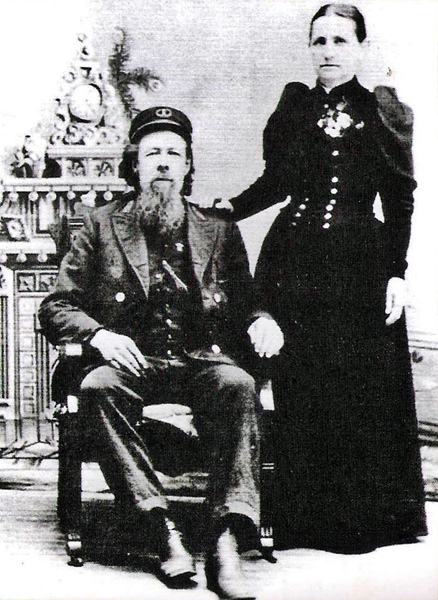
Photo Gallery
Photo Gallery
|
Perhaps because of this confusion, rumors have persisted over the years that the lighthouse was originally intended for Cape Lookout and was mistakenly built on Cape Meares. Surveys of both capes submitted in 1886, clearly show that there was no mistake. In them, J.S. Polhemus wrote, Cape Meares...affords nearly as good a site [as Cape Lookout] as far as the view from the sea is concerned, and being lower gives a better situation of light with reference to fogs; and besides would be much easier of construction on account of its accessibility from Tillamook Bay.
In January 1886, Congress approved $60,000 for construction of Cape Meares Lighthouse, and bids for building the light station were opened on August 30, 1888. Three separate contracts were awarded for the work: Richard Leaman of Portland was awarded a $26,000 for erecting two frame keepers dwellings, two brick oil houses, a barn, and cistern, and for draining and grading the grounds. Willamette Iron Work of Portland was given a $7,800 contact for supply the metalwork for the tower, and Charles B. Duhrkoop of Seattle received a $2,900 contract for erecting the tower.
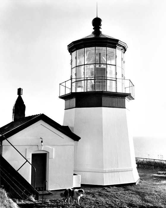
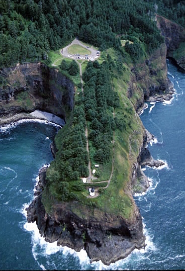
The dwellings and various outbuildings were finished on November 28, 1889, and the tower, with lens in place, was completed on December 23, 1889. The first-order, Fresnel lens, made in France by the Henry-Lepaute firm, was shipped around Cape Horn to Cape Meares, where a hand-operated crane made from local spruce trees was used to lift the crates containing the prisms of the one-ton lens up the 200 foot cliff to the tower. Made of sheet iron lined with bricks, the octagonal tower is the only one of its kind on the Oregon Coast and sits on a ledge cut from solid rock.
Anthony W. Miller, the stations first head keeper, exhibited the light for the first time on January 1, 1890, the date that had been fixed and publicized by the Lighthouse Board. Though the squatty lighthouse was only thirty-eight feet tall, the shortest in Oregon, thanks to the lofty cliff, the light had a focal plane of 223 feet and could be seen for twenty-one miles. The characteristic of the light was fixed white, punctuated by a red flash each minute. This was achieved by the giant lens completing a revolution once every four minutes. The white light had a candlepower of 18,500, while the focused red light had a candlepower of 160,000. Roughly every two hours, the keeper had to wind up a 200-pound weight that would power a clockwork mechanism responsible for turning the lens. The lens rested on brass chariot wheels and was equipped with four bulls-eye panels covered with ruby glass. A brick workroom abutting the tower was added in 1895.
|
George Hunt, the stations second head keeper, served from 1892 until July 1903, when he passed away at the lighthouse at the age of fifty-three. The stations logbook recorded the event. July 7, 1903: Attended to regular duties. Keeper sick with pneumonia. This entry was repeated daily until July 10, when Hunts death was tersely announced: Commenced haying. Keeper died at 6 p.m. Augusta Hunt served in her husbands placed for a few weeks until her departure on August 2: Keeper wife, Mrs. and children left station today.
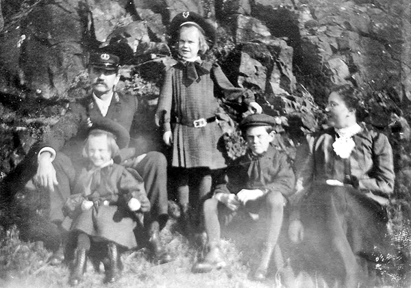
A few days later, Harry D. Mahler, the new head keeper, arrived with his wife and three children from Patos Island Lighthouse. Mahler had served as the first head keeper at Patos Island for a decade, and after four years at Cape Meares, he would continue his service back in Washington at West Point Lighthouse and Alki Point Lighthouse. With lunch pails in hand, the three Mahler children, Howard, Frances, and Margaret, would pile atop a horse and ride to a one-room schoolhouse located about a mile from the station. They were usually accompanied by Miss Endicott, their teacher, and the daughters of Assistant Keeper Samuel Morris on a second horse.
One day, young Margaret Mahler slipped and fell off a log just as her brother was swinging an axe. The blade struck Margaret in the forehead, forcing members of the family to set off on an all-night, horse and buggy ride to reach a doctor. Today, the drive to Tillamook takes just sixteen minutes.
In the early 1900s, the resort community of Bayocean was built on the southern spit of Tillamook Bay, where visitors enjoyed a splendid view of the both the ocean and bay. Uncommon for a town of its size, Bayocean boasted a hotel, 1,000-seat movie theater, a bowling alley, dance hall, and a heated natatorium with a wave generator. One of the favorite excursions from Bayocean was a hike to Cape Meares Lighthouse. Bears were occasionally spotted on the trail, and the keepers at the lighthouse had reportedly killed several and used their skins to adorn their premises. It wasnt uncommon for over fifty visitors to register at the lighthouse on a summer day, and once there, they would often throw morsels down to the sea lions that congregated at the base of the cliff.
Most visitors came to Bayocean as part of a three-day trip from Portland aboard the S.S. Bayocean. Entering the turbulent waters at the unprotected mouth of Tillamook Bay could be a frightening experience for passengers aboard the steamship, and in the 1910s, a jetty was built to reduce the waves at the entrance to the bay. While the jetty improved travel to and from Bayocean, it also had an unexpected and disastrous effect on the spit. Severe erosion soon began devouring the beach at Bayocean, and in 1932 the natatorium was destroyed by huge waves. The last remnants of the once-popular resort were washed away in 1971.
|
After the new light was installed, the Coast Guard talked of removing the old tower. The workroom was torn down, and the tower started rusting away. Local citizens opposed the destruction of the tower, and in 1964, the property was leased to Tillamook County.
With no resident caretakers, the tower and vacant dwellings were subjected to vandalism, and the four bulls-eye prisms were stolen from the Fresnel lens. In 1968, the property was leased to the Oregon Parks and Recreation Department, and the dilapidated keepers dwellings were razed. A replica of the workroom was rebuilt on the east side of the lighthouse in 1978, but it isnt an exact replica as its door is located on the south side of the workroom rather than on the north to better accommodate visitors. The lighthouse was opened to the public on Memorial Day, 1980.
In 1984, one of the four bulls-eyes from the Fresnel lens was recovered in a drug raid in Portland, Oregon. After a 1986 magazine article pleaded for the return of the others, the other three eventually found their way back. One was given to the Tillamook County Pioneer Museum, and another was anonymously left on the doorstep of a Cape Lookout assistant park ranger.
On the night of January 9, 2010, vandals once again struck Cape Meares Lighthouse. Several rounds were fired at the lantern room, breaking fifteen panes of glass in the lantern room and several prisms in the priceless Fresnel lens. The estimated damage was $500,000, and a $5,000 reward was offered for information leading to the arrest and conviction of the perpetrators. Twenty-six-year-old David Wilks, Jr. and twenty-three-year-old Zachary Pyle were arrested on February 10, just over a month after the incident, and charged with first-degree criminal mischief, a class C felony, and four misdemeanor charges. The following December, the case was resolved out of court, with the two men pleading guilty, agreeing to pay $100,000, and being required to spend two weeks in jail (between December 27th and January 11th) in 2010, 2011, and 2012. The judge, in handing down the sentence, said, Some people go to Hawaii for vacation and some people go to jail. The next three years will serve as a reminder, and you are going to get some time to contemplate that.
After receiving no comments on its proposed plan to discontinue the modern light at Cape Meares, the Coast Guard disconnected the beacon on June 25, 2014, 124 years after the cape was first illuminated. It was decommissioned and taken offline, said Petty Officer 1st Class David Mosley, of USCG Air Station Astoria. What were finding is with todays GPS and satellite systems and electronic charting, which can let you know where you are in the water within a few feet, the technology is getting so advanced that people arent utilizing the lights.
Today Cape Meares Lighthouse is part of Cape Meares State Scenic Viewpoint and is interpreted by Friends of Cape Meares Lighthouse.
Keepers:
References

