Bell Island, NF 
Select a photograph to view a photo gallery

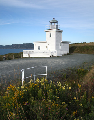
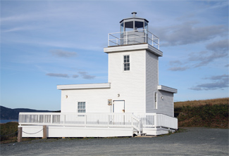
Photo Gallery
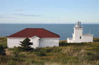


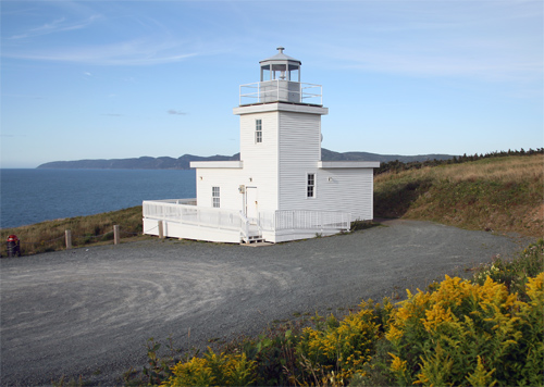
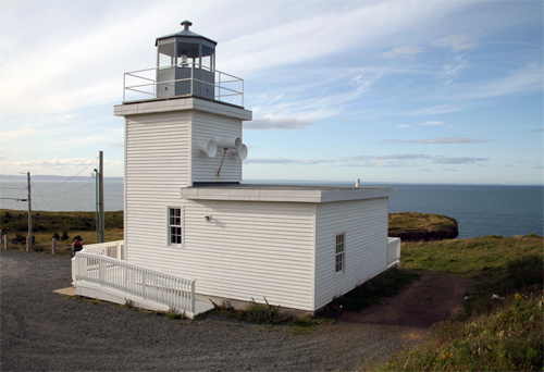

Photo Gallery
Photo Gallery
|
The mining operation led to a population boom on Bell Island. In 1901, the population had risen to 1,320 but by 1935 it was 6,157, making Bell Island the second largest centre in Newfoundland. In 1956, the population was 11,724. The mining started on the surface and then went underground. When the mines closed in 1966, miners were working up to five kilometres beneath the floor of Conception Bay. The islands population had fallen to below 3,000 in 2006.
In the early 1930s, the Dominion Steel Company (DOSCO), which was operating the islands mines at the time, asked the Newfoundland Government to establish a lighthouse on the island to serve the increase in shipping spawned by the successful iron ore mines. Construction on a light tower, a fog alarm building, and a keepers duplex began in 1939 on the eastern tip of the island, and the station commenced operation in 1940.
During World War II, German submarines torpedoed the islands iron ore pier and sunk four ore ships. A memorial to the sixty-nine men aboard the ships who lost their lives during the attack is located on the island at Lance Cove Beach.
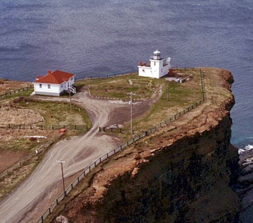
In 1966, land was acquired from the estate of William Jackman for an access road to the lighthouse. That same year, the original lighthouse was replaced by a combined lighthouse and fog alarm building in the form of a one-storey, flat-roofed, rectangular structure with a square tower rising from one of its corners. A single dwelling was added to the site, and when the station was reduced to a one-person operation in 1980, the old duplex was removed.
With erosion threatening the lighthouse, it along with the adjacent keepers dwelling were relocated roughly 200 metres to a safer position in 2004.
Bell Island Lighthouse was broken into and vandalized in early August, 2010. According to police, a computer and cupboards were destroyed, and some appliances were removed form the residential area portion of the lighthouse. A forensics team was called in to help with the investigation.
The lighthouse is still listed as a staffed station, but the keepers dwelling has been boarded up since the move as the keeper resides in his own home. Tourism Bell Island opened a visitor centre in the keepers dwelling in July 2014.
Besides making a trip to the lighthouse, visitors can also experience the mining history of the island, as a museum, which offers visitors a walking tour of some underground mining shafts, opened in 2000.
References