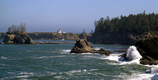
Cape Arago, OR
Select a photograph to view a photo gallery
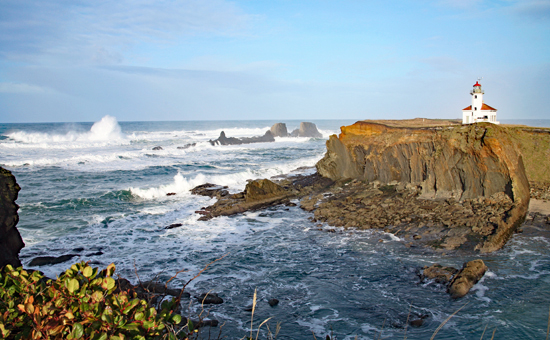


Photo Gallery

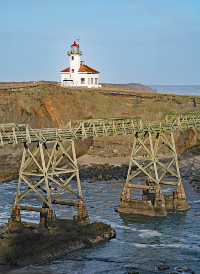
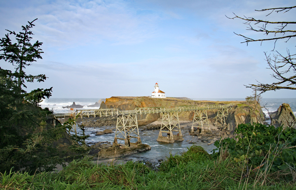
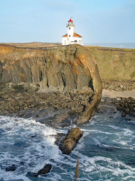
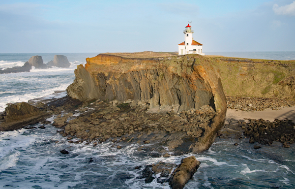
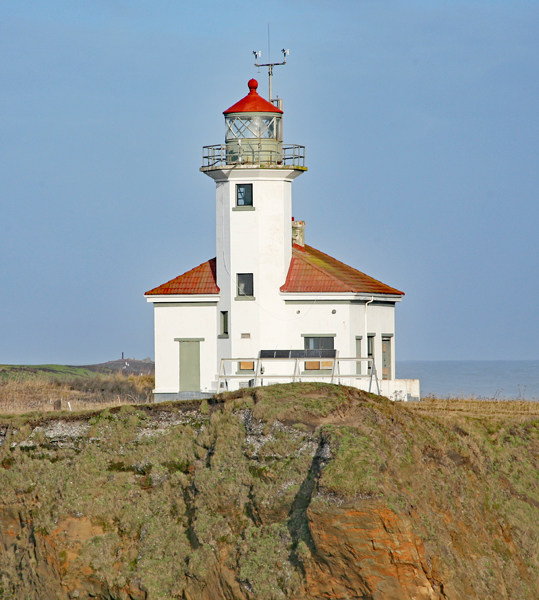
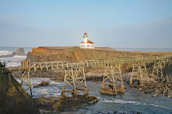
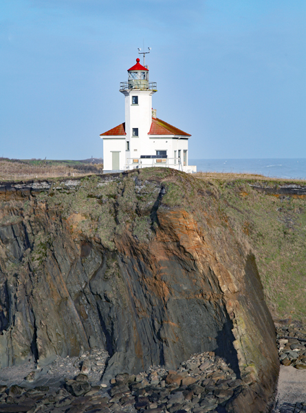
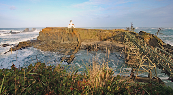
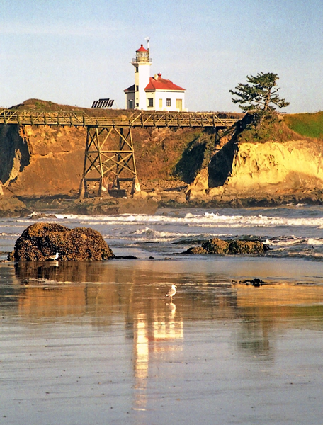


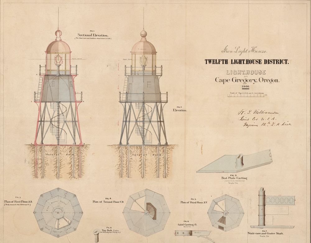


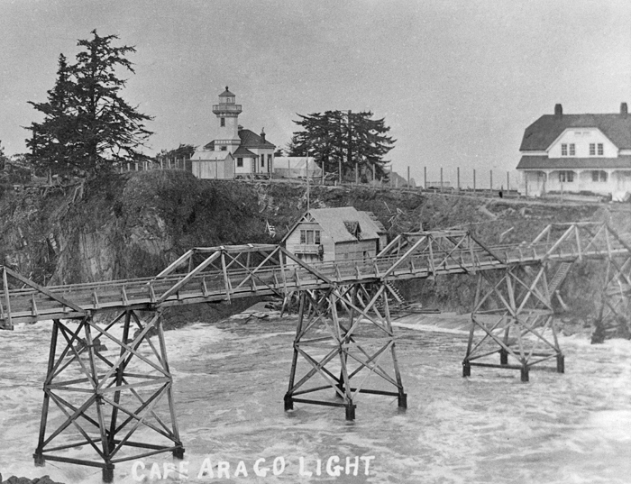


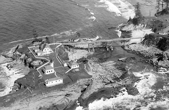

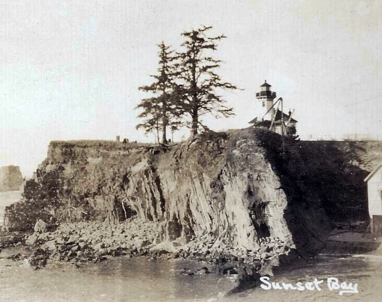
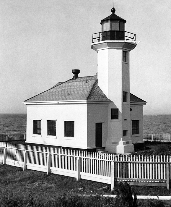


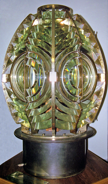
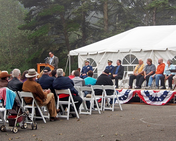
Photo Gallery
Photo Gallery
|
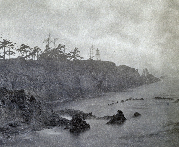
Oregons first lighthouse was built in 1855-1856 near the mouth of the Umpqua River, twenty-five miles north of Coos Bay, however, in 1863 the overflowing river undermined the brick tower, causing it to eventually topple. By this time, the Coos Bay area had surpassed the Umpqua River region in commercial importance, and it was decided that the interests of commerce would be better served by a new light at Cape Arago, rather than reconstructing the light at Umpqua River. Congress appropriated $15,000 on July 2, 1864 for the light, and the first Cape Arago Lighthouse was illuminated on November 1, 1866 by Leonard C. Hall, its first head keeper.
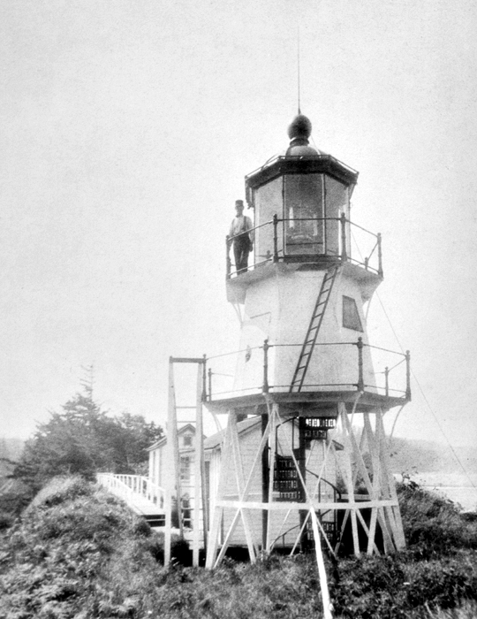
The upper portion of the octagonal, skeletal tower was enclosed with sheet iron to form a watchroom, and above this was a lantern room housing a fourth-order Fresnel lens. Located at the northern end of the island, the twenty-five-foot tower was linked via a 1,300-foot-long wooden walkway to a one-and-a-half-story wooden keepers dwelling, constructed near the southern end of the island. A panel, revolving around the outside of the fixed lens, punctuated the fixed white light with a flash every two minutes.
Rowboats were initially used to access the island, until a low bridge was constructed in 1876 to link the island with the mainland. High seas during a heavy gale in November 1877 cut short the bridges life and washed away the stations boathouse and a portion of the tramway for hoisting supplies from the beach to the lighthouse. Rowboats were a necessity once again until a new bridge was built.
Mineral oil lamps replaced the previously used lard oil lamps in the lighthouse in July 1881, and a frame storehouse was built near the tower to store the more volatile mineral oil.
A lifesaving station was established on the island in 1878, and three years later, Thomas Brown, the keeper of the station, was returning to the island from Empire City on Coos Bay, when he was caught in a storm and blown northward. Ironically, the lifesaving keeper was now in need of his own stations service. After a three-day battle during which he subsisted on a can of oysters, a beet, and a sack of onions, Brown was finally able to land his craft near Florence, roughly ninety miles north of his intended destination. The lifesaving station was moved to the mainland in 1891, where it would be more accessible.
|
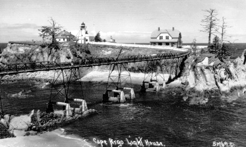
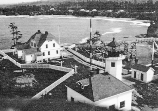
After the low bridge to the island was repeatedly washed away, bids were solicited in 1889 for the construction of a more robust high bridge to link the island to the mainland. All of the submitted bids were deemed exorbitant, and a cable tramway was built instead in 1891. Two frame towers, one on the island and one on the mainland, supported a 400-foot-long cable, the ends of which were anchored in concrete.
This new means of accessing the island proved to be perilous. Just over a month before a high bridge was finally completed in July 1898, Assistant Keeper Thomas Wyman, his daughter, Joseph Yonker from the lifesaving station, and John Caldwell were being winched across the inlet in the cage suspended below the tramways cable, when the cable snapped, plunging the passengers into the rocky surf some sixty feet below. Three of the party fell into deep water and suffered just slight injuries, but Keeper Wyman struck the rocks, badly breaking his foot and ankle. The tender Columbine happened to be at the station delivering material for the new high bride and took the injured to town. One of Wymans legs was so severely injured that it had to be amputated, but he remained an assistant keeper at the station until 1906. Wymans son Francis was hired as an additional keeper to help out while his father recuperated.
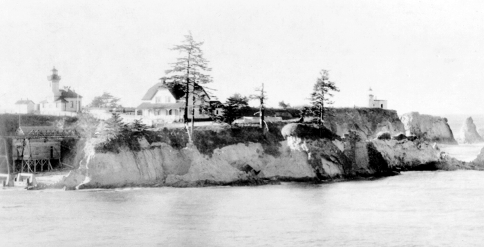
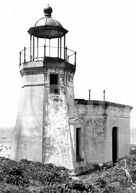
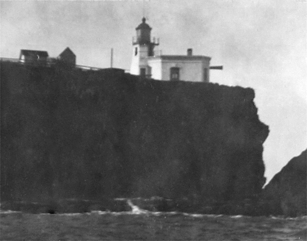
In 1893, the Lighthouse Board noted that commerce at Coos Bay would be greatly benefited by a fog signal and that the keepers dwelling at Cape Arago was old and decayed and on the verge of collapse. The Board requested permission to use $15,500 remaining from the $50,000 appropriation for a light and fog signal at Coquille River to cover this work and received permission to do so in 1894. The work took longer than expected due to the difficulty of landing supplies at the station and the wreck of a schooner load of building materials, but the contractor was able to finish the project in May 1896, just four-months behind schedule. As part of the improvements, the existing light tower was encased in bricks and covered with stucco, a brick fog building housing a Daboll trumpet was constructed adjacent to the tower, and a new duplex, modeled after the ones at Turn Point and Patos Island in Washington, was built for the keepers. To supply water for the fog signal, a 5,000-gallon redwood water tank was erected on the south side of the fog signal building.
|
Ira Albee, son-in-law of Assistant Keeper Thomas Wyman, started serving as keeper of the inside and entrance range lights at Coos Bay in 1907. On January 20, 1912, eighteen-year-old Thomas Wyman Albee was out lighting the lights for his father, when he saw the North Star steamer drift over the bar and capsize. Ira Albee was one of six passengers that perished in the accident, and his body was never recovered. Five days after the tragedy, the Marshfield Chamber of Commerce and the Coos Bay Port Commission united in requesting that the Lighthouse Service appoint Wyman Albee to fill his fathers position.
Wyman served as keeper of the range lights at Coos Bay until 1918, when he was transferred, along with his recent bride, to Destruction Island. After several months on the island, the couple was briefly assigned to Point Robinson Lighthouse, before Wyman Albee returned to Coos Bay in 1919 as assistant keeper of Cape Arago Lighthouse the same position his grandfather had held. Albee was promoted to head keeper in 1925.
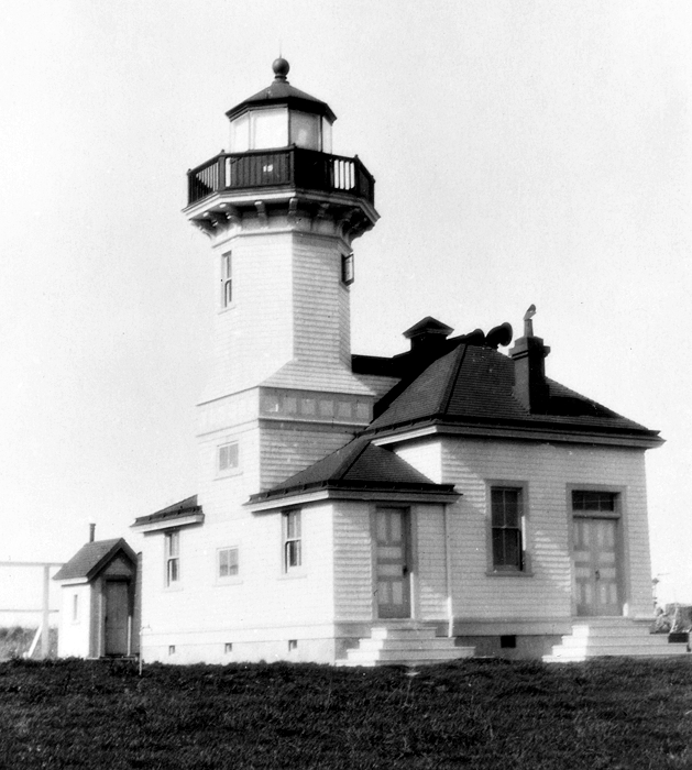
After Keeper Albee recommend improvements to the stations lighthouse in 1932, the old wooden lighthouse was moved a short distance to serve as the keepers office in 1934, and Jake Hillstrom, a Coos Bay contractor, constructed Cape Aragos third lighthouse. Perhaps seeking a more durable structure, the new lighthouse was constructed of concrete, using the plans from Washingtons Point Robinson Lighthouse.
With a moderate southwest gale blowing and in heavy seas, the crab fishing boat New River of Umpqua hove to in the lee of the island on November 3, 1938 and requested assistance from the lighthouse keepers as the vessels batteries were dead and its fuel supply was very low. Since the New Rivers anchor would not hold and it was too rough to launch the lighthouse boat, the Coast Guard cutter Pulaski, which had been searching for the boat for two days, was radioed for assistance. The Pulaski provided two anchors and line to the New River and returned to sea. During the night, the boats anchors started dragging after the wind and seas picked up. The Coast Guard station was called, and a Lyle gun was brought in. After three attempts, a three-inch hawser was successfully shot out to the New River and made fast. The Pulaski returned the next day and removed the two men from the New River, leaving the lighthouse keepers to stand watch over the boat. The New River managed to ride out the heavy seas at the end of the line secured to the island until conditions improved on December 3rd and allowed the lifeboat to cross the bar and take the New River in tow. Keeper Joseph A. Harris and Ralph D. Barker, his assistant, were commended for the assistance they rendered in the emergency.
|
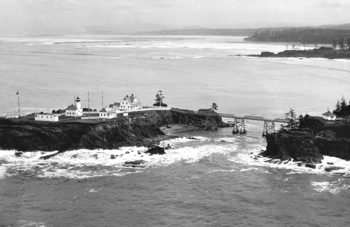
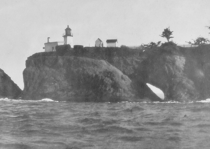
The only surviving structure on the island today is the third lighthouse. The original lighthouse was blown up with dynamite in 1936, the keepers duplex was razed in 1957, and the second lighthouse met the same fate in the 1960s.
A single-story, cinder-block four-plex, which had been built on the mainland opposite the lighthouse, was home to Coast Guard personnel who cared for the lighthouse until it was automated in 1966. The station consisted of the three-acre island plus nearly forty-three acres on the adjacent mainland that were partially cleared and were home to a garden, livestock, and a barn.
The Coast Guard removed the Fresnel lens from the tower in 1993 and placed it on display at Coast Guard Air Station North Bend. George Collins, a historian at the Yaquina Head and Yaquina Bay Lighthouses, pointed out that a plaque at the station indicates the lens was the one used in the 1866 tower, but since the lens was manufactured by Barbier, Benard, and Turenne, which wasnt formed until 1901, this couldnt be the case. The fact that the lens has three bulls-eye panels and would not have produced the original signature also disproved the information on the plaque. Turns out the lens was manufactured in 1908 and was the original equipment installed in the 1909 Cape Arago Lighthouse.
Knowing that many of their ancestors had lived and were buried there, the Coos Indians continued to have a strong connection to Chiefs Island and the nearby mainland, even after it had been reserved for nearly a century as a light station. After tribesman Henry M. Brainard drowned near the lighthouse in 1948, his widow sought permission to place a marker on the station grounds, but it was only after securing the assistance of Senator Wayne Morse that she succeeded in overcoming resistance to her proposal.
|
In mid-October 2005, the Coast Guard sent out a notice stating that Cape Arago Lighthouse would be deactivated, and when no comments to speak of were received, the light was switched off on January 1, 2006. Of course, others besides mariners are interested in keeping the light active, and the deactivation sparked a debate that some hoped would lead not only to reactivating the light but also to making the lighthouse accessible to the public.
In 2007, Senator Gordon Smith submitted a provision as part of the Coast Guard Authorization Act for Fiscal Year 2008 that would transfer Cape Arago Lighthouse to the Confederated Tribes of the Coos, Lower Umpqua and Siuslaw Indians. This bill was not approved, but in 2008 Representative Peter DeFazio sponsored a bill covering just the transfer of Cape Arago, and this was passed by the House and Senate in September and signed by President George W. Bush on October 8, 2008. According to the legislation, the tribes must make the light station available to the general public for educational, park, recreational, cultural, or historic preservation purposes at times and under conditions determined to be reasonable by the Secretary of the Interior.
In preparation for turning the lighthouse over to the Confederated Tribes in 2013, the Coast Guard patched damaged concrete walls, removed mold and corroded metal, and painted the structure, both inside and out, in November 2012. In addition, the high bridge leading to the lighthouse was removed in order to prevent unauthorized access to the island and to return the shoreline to a more natural condition. During a ceremony held on August 3, 2013, Captain Mark Reynolds, Commander of Coast Guard Sector North Bend, signed over approximately twenty-four acres of land including Gregory Point and Chiefs Island to the Confederated Tribes.
Keepers:
References


