Pointe à Jérôme Range Front, NB 
Select a photograph to view a photo gallery
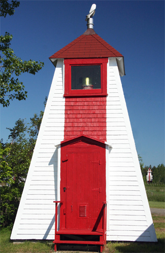

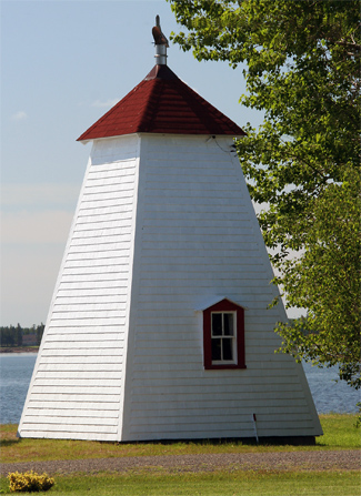
Photo Gallery
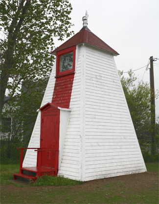


Photo Gallery
Photo Gallery
A set of range lights was established on Dixon Point in 1881 to guide vessels to the entrance of Bouctouche Harbour, which lies between Dixon Point and a lengthy sand dune that shelters most of the harbour. Two years later, a second set of range lights was constructed at Pointe à Jérôme, which was also known as Church Point or Indian Point. The 1883 Annual Report of the Department of Marine and Fisheries provides details on the original range lights on the point.
Two range lights were established during the past season upon Church or Indian Point, on the north side of Buctouche Harbour, on the Straits of Northumberland. Both lights are fixed white catoptric, and shown from small square wooden towers 23 feet high, the front light being visible in the line of range for 9 miles and the back light for a distance of 12 miles. The lights are 660 yards apart and in range lead into the harbour through the deepest channel, clear of all obstructions, from the line of range of the Dixon Point Lights to the point where the channel turns abruptly to the westward to enter the Buctouche River.
Dosithee O. Maillet was appointed first keeper of the range lights at an annual salary of $150. When the lights were electrified in 1963, Gerald Maillet was serving as their keeper at an annual salary of $750. As an official keeper was no longer needed after electrification of the lights, Gerald Maillets title was changed to caretaker and his salary reduced to just $100.
In 2013, Pointe à Jérôme Range Lights consisted of a 20.7-foot-tall, square, pyramidal front tower and a 44.6-foot tall, skeletal rear tower with an enclosed upper portion. Both towers have a red, vertical stripe on the range line. The range lights were discontinued in 2014, after the Canadian Coast Guard published a notice of its intent to extinguish the range and gave mariners and other interested parties three months to comment.
Pointe à Jérôme Rear Range Lighthouse was demolished in 2022.
Keepers: Dosithee O. Maillet (1883 1921), J. D. Mailett (1921 1922), Henry Argartine Cormier (1922 1955), Gerald Maillet (1955 1963).
References