Black Point, NB 
Select a photograph to view a photo gallery

Photo Gallery
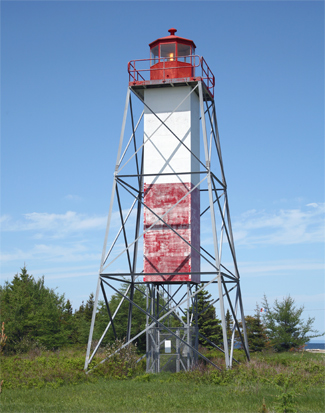
Photo Gallery
Photo Gallery
Formerly, the middle third of the square, central column was painted red, with the upper and lower thirds painted white. However, in 2009, the bottom third of the columns enclosure was missing.
The tower is 17.7 m (58 feet) tall and displays a yellow light that has the following characteristic: 4 s on, 2 s off, 2 s on, 2 s off.
