Caraquet Range Rear, NB 
Select a photograph to view a photo gallery
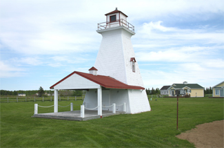

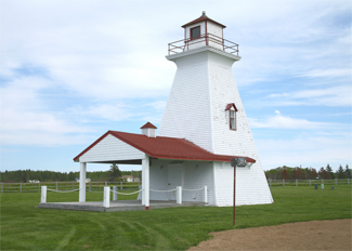
Photo Gallery

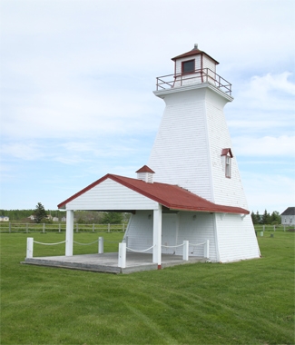

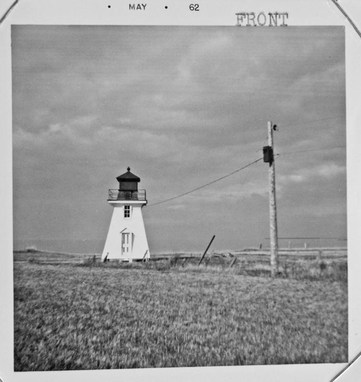
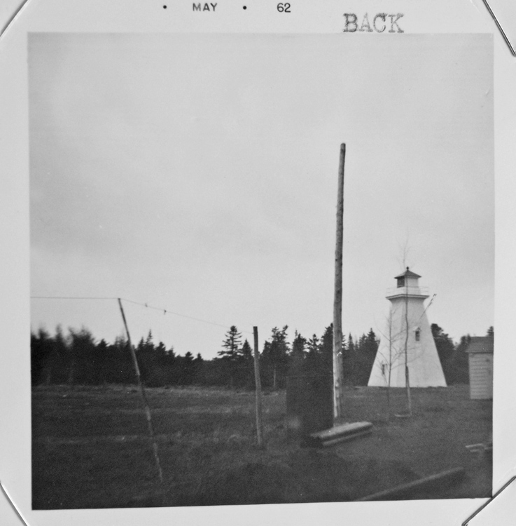
Photo Gallery
Photo Gallery
Both lighthouses are enclosed wooden towers, square in plan, with sloping sides and surmounted by square, wooden lanterns. The front tower stands close to the shore, measures thirty feet from its base to the top of the ventilator on its lantern, and originally displayed a fixed white light from a seventh-order lens at a focal plane of thirty-one feet. The rear tower, placed 3,800 feet from the front tower, measures forty-five feet from its base to the top of its ventilator and displayed a fixed white catoptric light at a focal plane of seventy feet. When established, the Caraquet Range Lights were visible for up to ten miles along the line of range.
Fred F. Doucett, Jr. was hired as first keeper of the front range light, while Patrice L. Legere was the first keeper of the rear light.
In 2000, the Canadian Coast Guard erected a thirty-seven-foot-tall skeletal tower to serve as the Caraquet Rear Range Light, and the 1903 tower was given to the Town of Bas-Caraquet. The old wooden rear tower was relocated to a municipal park, 1.3 km (0.8 miles) to the east, where it was refurbished, and a roofed patio area was added to one side of the tower.
Today, the Carquet Range Lights show fixed yellow lights.
Keepers:
Front Range: Fred F. Doucett, Jr. (1903 1912), J.O. Chaisson (1912 at least 1923), Theodore DeGrace (1925 1961).
Back Range: Patrice L. Legere (1903 1913), P.A. Lantaigne (1913 at least 1923).
References
