Lennard Island, BC 

Select a photograph to view a photo gallery


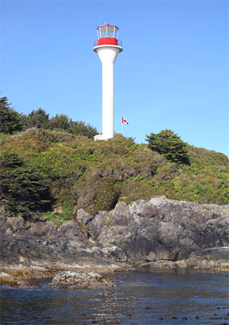
Photo Gallery
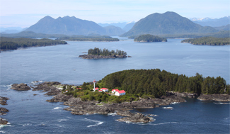
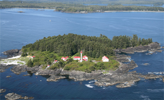

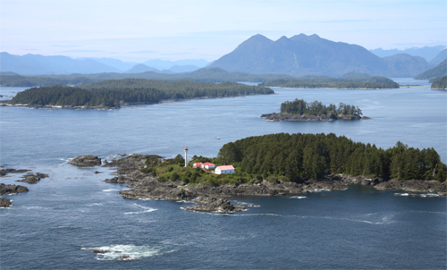
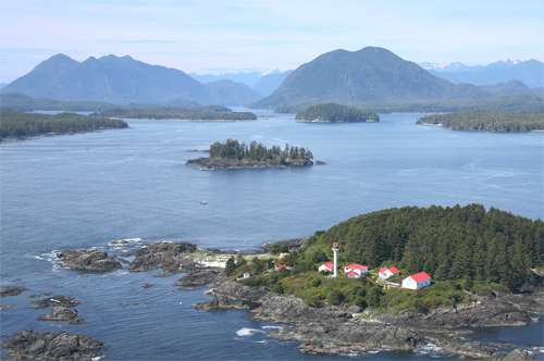
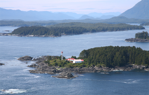
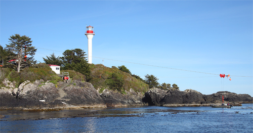
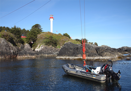
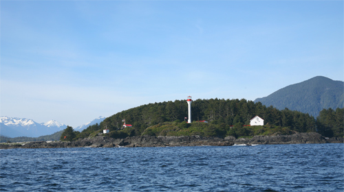
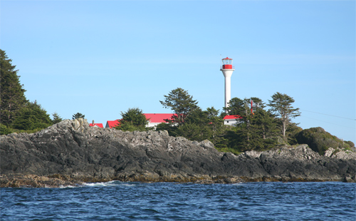
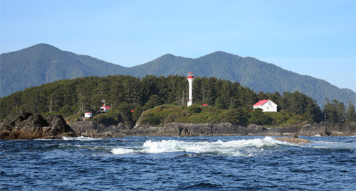


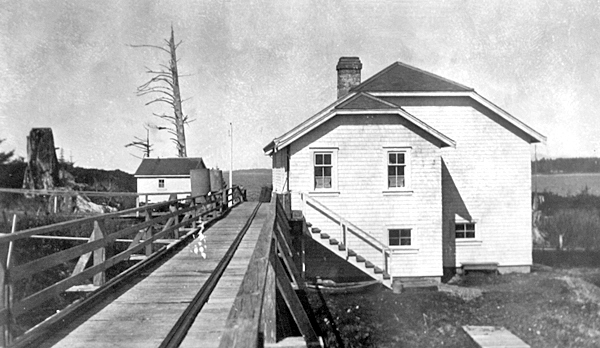
Photo Gallery
Photo Gallery
In 1902, Colonel William P. Anderson, chief engineer of the Department of Marine and Fisheries, inspected the lighthouses in British Columbia and selected sites for several new lights, including one on Lennard Island, which would serve local mariners entering Clayoquot Sound as well as mariners picking up the [Vancouver] Island coast after completing a voyage over the great circle route from the Far East.
To prepare the site for the lighthouse, ten men cleared ten acres on the island in 1903 and burned the fallen trees at a cost of $1,120. In April 1904, the Dominion steamer Quadra set sail for Lennard Island, loaded with building material for the new lighthouse. Equipped with a first-order Fresnel lens from Brimingham, England, Lennard Island Lighthouse was placed in operation on November 1, 1904, and the following notice was published to advise mariners of the new light:
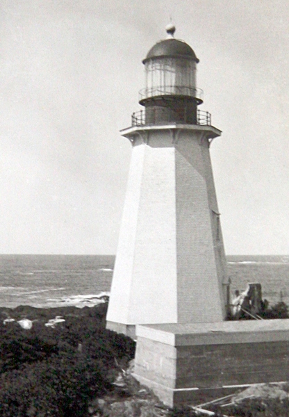
The lighthouse stands on the summit of the southwest point of the island, where the rock rises about 35 feet above high water mark. It is a wooden building, octagonal in plan, with sloping sides, painted white, surmounted by a metal lantern, circular in plan, painted red. It is 80 feet high from its base to the vane on the lantern. A white wooden lightkeepers dwelling and outbuildings have also been erected on the island.The stations buildings were erected by day labourers under the foremanship of George Frost at a cost of $10,955.69.The light is a flashing white light, giving a flash every eleven and a quarter seconds. It is elevated 115 feet above high water mark, and should be visible 16 miles from all points of approach, except where obscured by trees on Lennard island. The illuminating apparatus is dioptric, of the first order, and the illuminant petroleum vapour, burned under an incandescent mantle.
|
During the summer of 1905, a construction crew, again directed by George Frost, returned to Lennard Island and built a rectangular wooden fog alarm building south of the lighthouse. A three-inch steam diaphone fog signal, supplied by the Canadian Fog Signal Company of Toronto, was installed in duplicate, and a boat landing was blasted out of the rocky island. With the completion of the fog alarm in December 1905, Robert Pollock was hired as an assistant to help run the station.
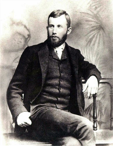
While Lilly, the oldest of the Garrards children, worked as an au pair in Victoria so she could attend school, Ethel, Noel, and Olive Garrard were enrolled in Tofino. Each Monday, the children would row over to Tofino and stay with friends during the week before returning to the island Friday afternoon. Keeper Garrard would meet the children halfway to help them return to the island. On once such occasion, Keeper Garrard watched in horror from the distance as the canoe capsized after its oarlocks had broken and the children had tried to rig a sail. Keeper Garrard later wrote about the incident:
When we arrived, we found Noel had managed to get on the upturned canoe, Ethel was holding herself up by having one arm across the bottom of the canoe, which having no keel made it a very precarious hold, between them they were holding Olive so that her head was well out of the water, they had at first when the Canoe upset lost track of her & she could not at that time swim, Ethel and Noel could a little, and had managed to get a hold of her & as I said were holding her up between them when we reached the upset canoe, we ran alongside on the opposite side and pulled them into the boat over the bottom of the canoe.That was the end of the canoe trips. After they reached the island, Keeper Garrard sawed the canoe in half and made feed troughs for his cows. Besides the cattle, the Garrards raised goats, ducks, and chickens, and had seventeen cats on the island.
In November 1906, Annie Garrard gave birth in Tofino to Edward, the couples seventh child. Shortly after Christmas 1907, the Garrards learned that the Quadra was headed to the station with supplies. Gordon Halkett, the superintendent of lights, was aboard, and Keeper Garrard was not going to be caught off guard this year. The previous year, Halkett had arrived unexpectedly and issued a blistering report: the lamps were in a filthy condition and had not been polished for a long time, in fact [it] looked as if they had not been properly cleaned since the lighthouse was established.
Keeper Garrard set to work cleaning the lighthouse, while the rest of the family worked on the dwelling, scrubbing walls and floors with lye, beating carpets, and wiping salt spray off the windows. Burdett, the second-oldest, was holding one-year-old Edward, when the infant picked up some sugar from the kitchen table and swallowed it. Shortly thereafter, Edward began shrieking, but it was only after he had been crying for some time & Annie noticed his little fingers were burnt that they realized the gravity of the situation.
Noel ran to the tower to get his father, who administered some sweet oil to make Edward vomit up the toxic lye. Even though the seas were rough, Keeper Garrard took Edward to Tofino to see Dr. Raynor, who gave the baby white of egg to make him vomit again. After this, Edward seemed to improve and was able to sleep and take nourishment, but the three trips the burning lye had taken to and from his stomach had burned holes in his esophagus, and Edward passed away on January 17, 1908. After a few more months at the station, the Garrards decided they could no longer expose their children to the element of danger that came with living on the island, and Keeper Garrard mailed off his resignation.
On June 24, 1927, Joe Nesbit, the stations assistant keeper, kindled a fired in the kitchen range, and a short while later, Violet McPhee, daughter of head keeper Donald McPhee, open the door to the kitchen and found herself confronted with smoke and flame. Violet promptly notified the keepers and rushed to the telephone to call the lifesaving station in Tofino a new submarine telephone cable had been run from the island to Tofino in 1925. By the time the lifeboat, loaded with fire extinguishers, reached the island, the keepers dwelling had burned to the ground, and the fire had reached the oil house, where hundreds of gallons of oil were stored. With a portion of the oil house ablaze, Keeper McPhee tore off burning shingles while the other men bombarded the fire with chemicals and buckets of water until the flames were out. The lighthouse and fog alarm building escaped serious damage, but Keeper McPhee was forced to live in an unpretentious shack near the base of the lighthouse until a new dwelling was built the following year.
During the winter months, storms would often prevent anyone from leaving or reaching Lennard Island for weeks on end. As Christmas approached in 1932, such a series of storms threatened to prevent Keeper Thomas McNab and his assistant R. Guppy and their wives and families from receiving their Christmas mail and dinner. The lifeboat crew from Tofino attempted to make a landing on Christmas Eve but was forced back by huge seas. As Christmas morning dawned with a storm still raging, the residents of Lennard Island must certainly have abandoned any hope of receiving their Christmas fare. What happened next was reported in Victorias Time Colonist:
It was then that the 3 young fishermen, Bjarne Arnet, Trygve Arnet and Mickey Nicholson, having a fellow-feeling for the lightkeeper who so often, by constant attention to his light and his foghorn had been the means of aiding them, as well as hundreds of other fishermen and sailors in from the fishing banks in bad weather, determined that they would get the dinner to them if possible.In the small but seaworthy salmon troller Pete, they loaded the supplies and mail, and to the accompaniment of cheers from those assembled on the Tofino boat landing, headed straight into the raging seas toward the lighthouse. Notwithstanding the heavy seas breaking over their craft, the 3 Samaritans forged ahead until at last Lennard Island was reached, when their seamanship capabilities were tested to the utmost in navigating around the treacherous rocky shoreline in search of some partially sheltered hole-in-the-wall where they could manoeuvre their craft close enough to effect a landing.
By this time the lightkeeper and his assistant, who had been watching the approach of the boat, made their way over the rocks and helped direct them to a somewhat sheltered spot, when in a favourable lull in the storm Guppy was able to launch his small boat and come out to the launch, when not a second was lost in loading him up, and before the next squall could strike, the Xmas supplies were landed. On arrival back at Tofino, the trio was welcomed by a host of anxious friends, and old-time fishermen acclaimed their feat as one of the most outstanding and daring displays of seamanship and courage displayed in many years.
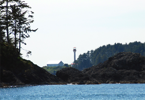
In 1959, Oakes & Wilson was contracted to build two single dwellings at Lennard Island and demolish two existing dwellings. In 1968, a 4,600-pound, fifty-five-foot-tall, fibreglass tower was airlifted to Lennard Island by helicopter and lowered onto a waiting circle of bolts protruding from a concrete pad. This modern tower replaced the original wooden octagonal lighthouse and was originally equipped with an exposed, rotating beacon. Ten days before the tower was installed on the island, a private airplane went out of control at Tofino airport and collided with the waiting tower, causing minor damage.
The embedded video shown here is entitled Beautiful Lennard Island and features Stephen Thomas Holland, a perceptive and articulate ten-year-old boy, who, though confined to the island, published a newspaper, conducted chemistry experiments, and played on a four-person cricket team. Keeper Anthony Holland, Stephens father, had a paper route as a boy in Victoria and would row out to deliver the news to a light keeper. These visits inspired Anthony to become a keeper himself, and he spent twenty-two years as keeper at Lennard Island, longer than anyone else. After watching the video, you probably wont be surprised to learn that Stephen Holland went on to get a PhD from the University of British Columbia and subsequently worked for NASA and the Space Telescope Science Institute.
Head Keepers: Francis C. Garrard (1904 1908), Robert Pollock (1908 1922), George Grandon (1922), Donald Bertram McPhee (1922 1929), Sydney Walter Blackmore (1929 1930), Thomas A. McNabb (1930 1944), Hjalmer Hansen (1944), William Holmes (1944 1945), Arthur Ernest Kelly (1945 1947), W.E. Freeman (1947 1948), William Stout (1948 1951), Douglas Howard Franklin (1951 1957), William Stout (1957 1960), Jack Reddy (1960 1961), D. Loudon (1961 1963), Chris W. Slater (1963), J. Alan Tully (1963 1964), James W. Bruton (1964 1968), Arthur Britton (1968 1970), H. Ivan Olsen (1970 1974), Anthony Holland (1974 1996), Gerry Warmenhoven (1996), Andrew Findlay (1996 1997), Gerry Warmenhoven (1997), Iain Colquhoun (1998 2008), Tony Greenall (2008 2017), Jeff George (2017 at least 2021), Martin Mountford (at least 2024).
References
