Pulteney Point, BC 
Select a photograph to view a photo gallery

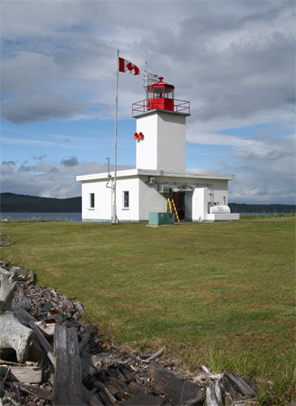

Photo Gallery
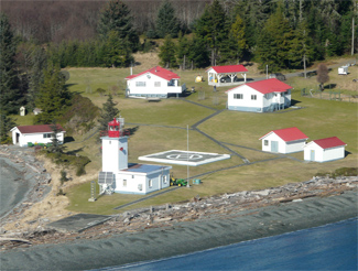

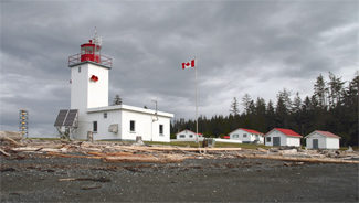
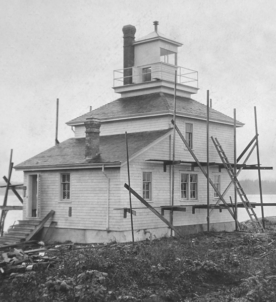

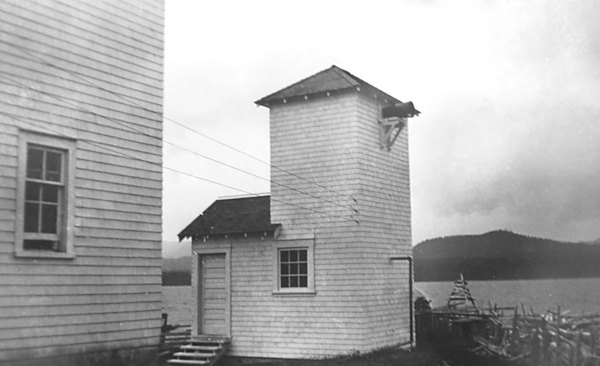
Photo Gallery
Photo Gallery
|
The island was largely uninhabited in 1900, when Finnish immigrant coal miners in Nanaimo petitioned the Dominion of Canada for a piece of land to escape their miserable working conditions and start a Utopia where they could live in a community where everyone shared, participated, and was treated equally. The Finns were given Malcolm Island, and they called their community established there Kalevan Kansa. The name of islands main town, Sointula, is a Finnish word meaning a place of harmony. Concurrent with the arrival of the Finns, mariners petitioned for a light to be built at Pulteney Point to serve the growing shipping traffic.
Construction of Pulteney Point Lighthouse began as Kalevan Kansa was falling apart. After four years of hard economic times, rains, and a fire that killed some of their members, the community sold its assets and gave the land back to the government. A few of the Finns stayed in Sointula and took up commercial fishing. One of the communitys leaders, August Bernhard Makela, anglicized his name to Austin McKela, and became the first lightkeeper at Pulteney Point.
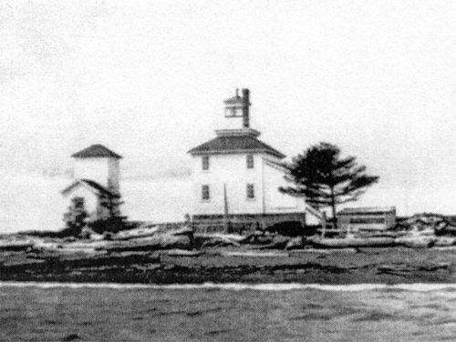
Pulteney Point Lighthouse, a square, wooden building with a square lantern rising from the center of its roof, exhibited a light at a height of thirty-eight feet above high water. The fixed white seventh-order dioptric light was lit for the first time on September 12, 1905. A hand foghorn, to be sounded during thick weather in response to the steamers fog whistles, was given to Keeper McKela in 1906.
McKela and his wife, Elli, kept the light until 1913, saving it from a wildfire in 1911 that consumed the boathouse. McKela left the light under the charge of Toivo Aro, a fellow Finnish settler, who was hired full-time in 1915 the same year a mechanical fog bell replaced the hand horn.
When Aros lighthouse bachelor pad received poor marks for tidiness by the inspector, he responded by writing, . . I honestly confess that I have been sometimes tired to keep allways very rigid order in the house. Aro knew the place needed a womans touch, but complained that there has been no women around here of proper age, and I have had no time to go seek further. . . Such women I like, for instance, the lady who was with you here, are not easily found.
The right lady, Kyllikki Jaakola, landed in Sointula in 1922 and they were married soon after. Their son, Vic, was born a year later. Vic recalled life growing up at the light, If I was alone and the weather was good, I would prowl the beaches and woods with my border collie who was my constant companion. It was probably there that I became interested in marine life, which ultimately led to me becoming a fisheries biologist.
|
And while the driftwood beaches havent changed much in over a half century, the lighthouse has.
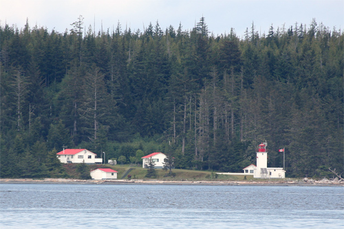
In 1930, the Aro family left the station in the care of another Finn, Sula Wartie, to be closer to town for Vics education. Wartie served until June 1931, when Oliver Shorty Maisonville came on as the permanent keeper. Under Maisonvilles watch, a diesel air compressor operating a powerful diaphone horn was added in 1931, and around 1943, the original lighthouse was replaced by the current thirty-foot-tall square concrete tower that is attached to a corner of a one-story fog signal building.
Maisonville was also on hand when the Alaska Steamship Co.s Columbia ran aground at the point in 1942. After the shelling of Estevan Lighthouse in June of that year, the lights along the West Coast were ordered extinguished. With no light to guide her, the Columbia hit the spit in the dark, running a third of her length onto the point. There she stayed, right next to the lighthouse, for three weeks until tugs were able to pull her off during high tide.
Maisonville served until 1945, when he was replaced by Jonathan Fleming. Walter Tansky was keeper from 1963 - 1985.
Pulteney Point is a great family station. Only seven miles from town, lighthouse children attend elementary school in Sointula and ride the ferry to Port McNeil for middle and high school. Lightkeepers assigned to Pulteney tend to stay put for a long time.
Ted Ashe, Lynaes father, moved onto the lights in 1979, when the Ashes had two small children. An unassuming man, with a twinkle in his eye, he left the coast guard for the lights so that his family could work together and improve family ties. His wife, Karen, homeschooled the children through correspondence courses, while they were stationed at isolated locations like Langara and Pachena Point. They snagged the Pulteney lightkeeper position in 1985 and have been there ever since, raising five children on the light. In 2001, Ashe was awarded the Golden Jubilee Medal of Queen Elizabeth II for his lengthy service.
When the fog horn isnt blaring and boats arent cruising by, the sounds of lapping water and the wind through the cedar trees fill the air at Pulteney Point. Eagles dive for fish, and sometimes seals and orcas surface from the cold blue water. Visitors occasionally frequent the point and comb the beach for treasures amongst the driftwood just as many lighthouse children have done through the years.
Keepers: Austin McKela (1905 1913), Toivo Aro (1913 1930), Sula Wartie (1930 1931), Francis Oliver Maisonville (1931 1945), Jonathan Allardice Fleming (1946 - ), Walter Tansky (1963 1985), Edward J. Ashe (1985 at least 2016), Deb Waslewski (2019 2022), Doug Kerr (2022 at least 2024).
References

