Grays Harbor (Westport), WA 


Select a photograph to view a photo gallery


Photo Gallery
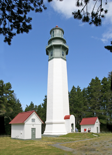
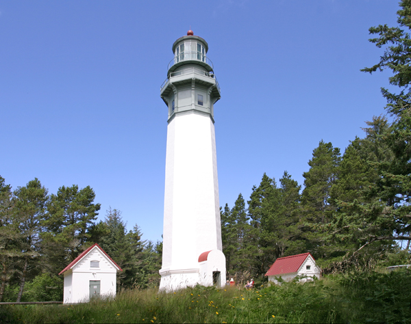
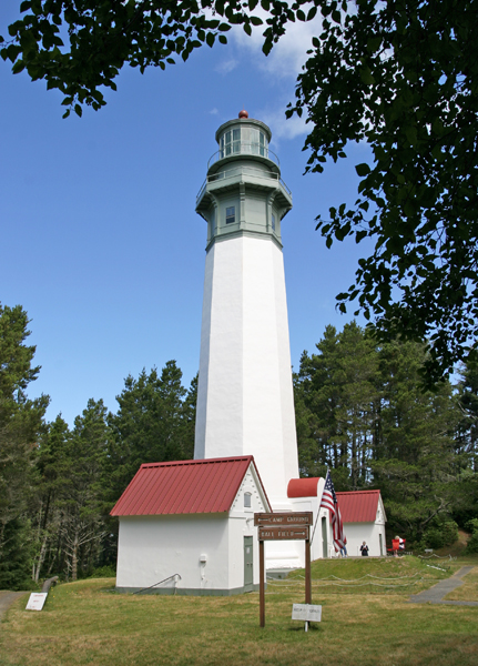
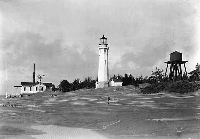
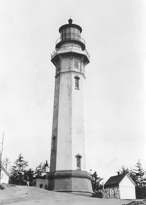


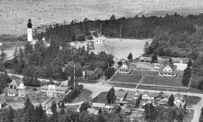
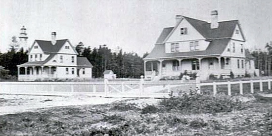


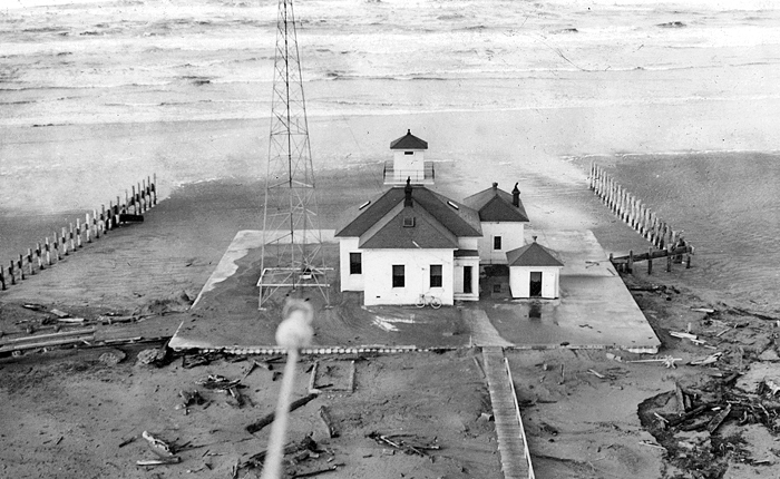
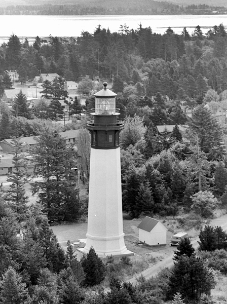
Photo Gallery
Photo Gallery
|
Grays Harbor is the only [harbor] of importance south of Cape Flattery, at the entrance of the Straits of Juan de Fuca, and above the mouth of the Columbia. This has a narrow opening, however, with dangerous breakers on either side, and though it immediately opens out, it is filled with mudflats, which confine the anchorage within narrow limits.Grays Harbor is named after Captain Robert Gray, a Boston fur trader, who discovered it in May 1792. He actually christened it Bullfinch Harbor to honor the owner of one of his ships, but Lieutenant Joseph Whidbey, of Captain George Vancouvers British expedition, visited the harbor a few months later and identified it on his charts as Grays Harbor.
The Westport area had become a major logging port in the late nineteenth century. In 1890, there were thirteen sawmills at Grays Harbor that exported sixty million board feet of lumber, and the harbors shipyards built nine steamers and three sailing vessels that year.
Congress approved $15,500 on July 7, 1884 for establishing a light at Grays Harbor, and a five-acre tract on Point Brown, the northern side of the entrance to Grays Harbor, was selected for the lighthouse. While negotiations for a five-acre tract of land were underway, the Lighthouse Board realized that a small harbor light would be inadequate for meeting the needs of mariners along this part of the Pacific Coast. In a meeting held February 3, 1886, the Board ordered that steps be taken to have $60,000 added to the existing appropriation to enable the erection of a first-order light in the vicinity.
The Lighthouse Board repeated its request for an additional $60,000 each year, until Congress finally approved an act on March 3, 1893 that added $20,000 to the project and allowed a contract for the work to be made at a total cost not to exceed $75,000. Congress provided an additional $39,500 for the lighthouse on March 2, 1895, and efforts were made that year to obtain title to the desired parcel on Point Chehalis, at the southern side of the entrance to Grays Harbor. The property owners were unwilling to sell, and condemnation proceedings had to be initiated. The circuit court decreed that $500 would be a fair price, and this amount was paid by the government on December 16, 1895.
|
Reverend J.R. Thompson laid the cornerstone of the lighthouse during a ceremony on August 23, 1897 and was one of several men to address the large crowd gathered for the occasion.
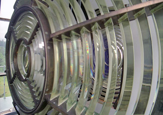
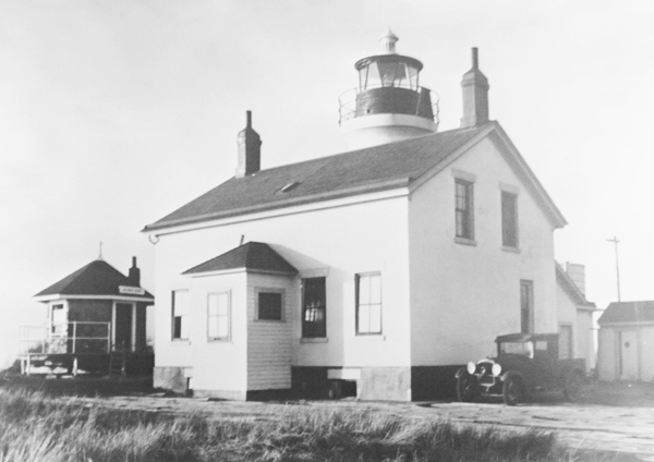
Architect Carl W. Leick considered Grays Harbor Lighthouse his masterpiece. Standing 107 feet tall, the octagonal tower is the tallest lighthouse in Washington, and the third tallest on the West Coast. The base of the lighthouse rests on a twelve-foot-thick foundation of sandstone. The lighthouse walls, which are four feet thick at the base, are made of brick with a coating of cement on the exterior. A series of 135 metal steps, bolted to the towers walls, lead to the lantern room. Windows originally provided light for the interior of the tower, but to cut down on maintenance, they were cemented over when the station was electrified. A third-order, bivalve lens was installed atop the tower on June 10, 1898, and it went into commission a few weeks later on June 30.
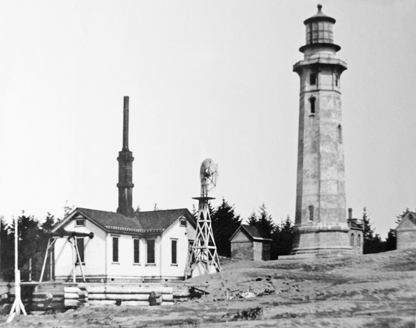
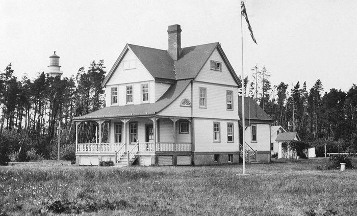
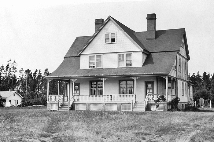
Besides the lighthouse, the station was also equipped with a windmill, a water tank, a well, two keepers dwellings, two oil houses, and a fog signal building. The fog signal apparatus, previously used elsewhere, was not received from the general lighthouse depot until August 23, 1898, and then it was found to be eaten with rust and in need of such extensive repairs that new equipment had to be ordered. The new sirens and engines were received on February 15, 1899, and the signal commenced operation on March 8, 1899. The fog signal was typically in operation for about 500 hours each year, or six percent of the time, but in 1905, it logged 881 hours and consumed about sixty-seven tons of coal.
To produce the necessary steam for the fog signal, the windmill pumped water to the building where a coal fire converted the water to steam. Roughly 200 pounds of coal were consumed to produce the steam needed for just one hour of fog. The smokestack of the fog signal building extended upward almost half as high as the lighthouse itself.
The light originally shone from a unique third-order clamshell Fresnel lens manufactured by Henry-Lepaute of Paris in 1895 and had a signature of alternating red and white flashes separated by five seconds. Red glass, placed on one side of the light source, cut the light transmission significantly. To overcome this reduction, the bulls-eye with the red glass was much larger than the bulls-eye that produced the white flash. With this compensation, both the white and red flashes could be seen up to sixteen miles at sea.
The Fresnel lens assembly originally floated in a trough of mercury. This setup provided near frictionless movement and allowed the lens to be rotated by a weight that hung inside the tower. When the station was electrified in 1931, a one-sixth horsepower motor was used to turn the giant lens, and a 300-watt lamp was installed as the light source.
|
Christian Zauner, who had served for nine years as the first keeper of Destruction Island Lighthouse, was transferred to Grays Harbor in 1898 to serve as its first keeper. Accompanying Keeper Zauner to his new station were Hermine, his wife, and two daughters. Zauner spent twenty-seven years at the station, retiring at the end of July 1925. No other keeper served longer at Grays Harbor.
Keeper Zauner reported feeling shocks from the earthquake that devastated San Francisco on April 18, 1906. Shortly after 5 a.m. that morning, Zauner said the large weight, suspended in the tower to rotate the lens, started swinging from east to west like a pendulum, and the cotton rope used to hoist up oil containers was set in violent motion.
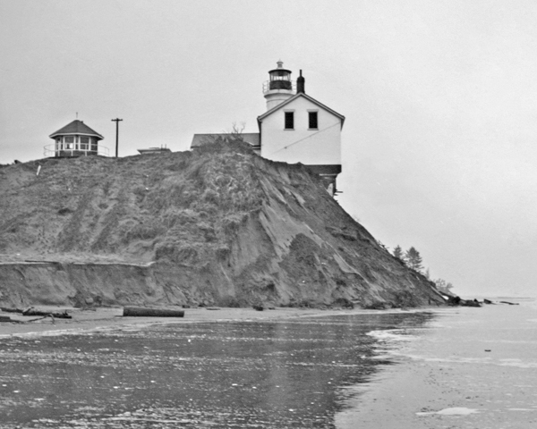
When first built, the lighthouse stood 400 feet from the high tide line, but massive amounts of accretion, due in large part to the jetty system put in place at the entrance to Grays Harbor, have since built up, and the lighthouse currently stands approximately 3,000 feet from the shore.
In 1926, a new concrete fog signal building was built about a half mile seaward from the original one. A type F diaphone, actuated by air compressed to thirty pounds by fifteen-horsepower Mietz Charter gas engines and compressors, was installed in the new building. Cooling water was obtained from a well and stored in a cistern. Today, an automatic fog signal is located at the end of the south jetty in Westhaven State Park. To further aid mariners, a radiobeacon went into service at the station on November 2, 1926.
In August 1992, the Fresnel lens was turned off, and in its place, a smaller light, manufactured in New Zealand, was mounted on the lantern room balcony. Amazingly, the new light operates on a thirty-five watt bulb and can been seen nineteen miles with the white sector, and seventeen miles with the red sector. The lantern room still holds the original Fresnel lens.
During the 1990s, health concerns arose over the mercury-filled drum, and the tower, called the Westport Lighthouse by locals, was closed to the public. In 1998, one hundred years after the lighthouses dedication ceremony, the Westport-South Beach Historical Society negotiated a lease agreement with the Coast Guard and began cleaning up the tower. In 2001, the building was deemed safe, and public tours resumed. The Westport-South Beach Historical Society was granted ownership of Grays Harbor Lighthouse in 2004 under the National Historic Lighthouse Preservation Act, and it soon enacted a five-year plan to restore the lighthouse and its third-order Fresnel lens.
In 2015, the Coast Guard gave permission for the Fresnel lens to be lighted on special occasions, although the lens is now fixed so that it shines only north and south, parallel to the coast. The first relighting was held on June 30, 2015.
Keepers:
References


