Robertson Point, NB 
Select a photograph to view a photo gallery
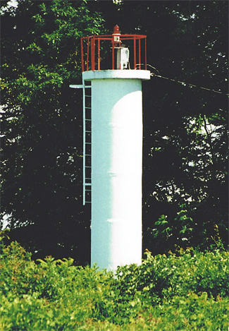
Photo Gallery

Photo Gallery
Photo Gallery
|
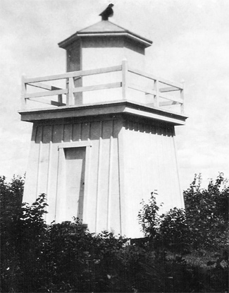
Charles Macpherson built wooden towers, each of which measured sixteen feet from base to the vane on the lantern room, at Fanjoys Point and Robertson Point, and the lights were placed into operation on October 1, 1873. It wasnt uncommon for landowners to have points named after them or for landowners to be placed in charge of lighthouses built on their land, and such was the case for the lights on Grand Lake, as John Robertson and William Fanjoy were appointed keepers of the two lake lights established in 1873. (Note that early spellings of the names were Robertsons Point and Fanjoys Point, which more clearly captured the fact that the points were named after people.)
In 1898, Charles Robertson, who was keeper of the light, cut down trees on his land that were obscuring the light from being seen up the lake. Robertson Point Light was improved in 1905 when a seventh-order lens and lamp were substituted for the reflectors and lamps previously in use.
The original Robertson Point Lighthouse has been replaced by a cylindrical tower topped by a red light.
Keepers: John Robertson (1873 1874), Samuel W. Robertson (1874 1895), Joseph Stevens (1895), Charles M. Robertson (1896 1912), C. W. Dean (1912 at least 1923).
References