Sand Point, NB 
Select a photograph to view a photo gallery


Photo Gallery
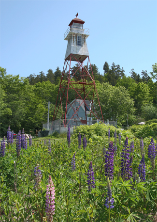
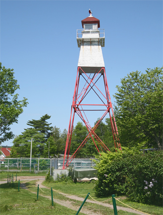
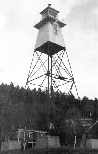
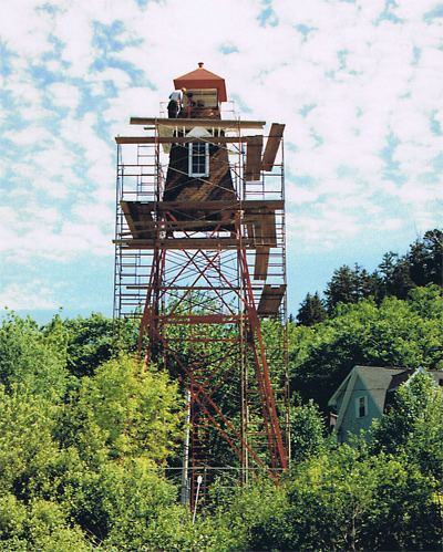
Photo Gallery
Photo Gallery
|
On August 20, 1869, six beacon lights were put into operation on the Saint John River to aid the steamships operating between Saint John and Fredericton. These lights were located from south to north at Swift Point, Sand Point, Oak Point, No Mans Friend, Oromocto Shoal, and Wilmot Bluff. For $1,044, John Duffy erected all six lights, which were rather crude, consisting of a lantern on a mast or a lantern on a mast atop an open framework. The total cost for the six lights, including construction, superintendence, and lighting apparatuses, was $2,342, and it was anticipated that another $600 would be spent to acquire the sites.
J. Cauldfield was the first keeper of Sand Point Light, and he, along with the other five keepers hired on the Saint John River in 1869, were paid an annual salary of $80.
In 1895, a survey of the site at Sand Point was made in order to acquire land for the construction of a new enclosed tower to replace the original open-framed structure. The purchase of the property proved to be complicated as the owner was outside Canada.
A new Sand Point Lighthouse was completed in 1898, and the Annual Report of the Department of Marine for that year provides detailed information on it.
The mast on an open framework, from which the light was shown at Sand Point, on the River St. John, has been removed and replaced by a square skeleton framed steel tower, with sloping sides, surmounted by an enclosed wooden light room and by a square wooden lantern.The new lighthouse stands on the site of the old mast, about 150 feet back from high water mark, on the most prominent part of the point. The lantern and iron-work are painted red, and the enclosed upper part of the tower is painted white. The height of the building, from the base to the ventilator on the lantern is 58 feet.
The light shown from the new building is a seventh order dioptric, fixed white light, elevated 60 feet above high water mark, and should be visible 13 miles from all points of approach by water.
The work was done by Mr. G. W. Palmer, [of] Kars, his contract price being $699.
At the opening of navigation in 1901, the entire superstructure above the iron framework, including the lantern room, was painted white to serve as a more conspicuous daymark against the background of dark fir trees.
Sand Point Lighthouse is the tallest lighthouse on the St. John River. In 1991, the tower underwent a thorough renovation.
The house adjacent to the tower belongs to Don Morrison whose father was a keeper of the Sand Point Lighthouse.
Keepers: J. Cauldfield (1869 1873), James Clarke (1873 1875), Robert Clarke (1876 1883), Richard Wagner (1883 1913), J.F. McCloskey (1913 1921), J.W. Wagner (1921 at least 1923).
References

