Bayswater, NB 
Select a photograph to view a photo gallery
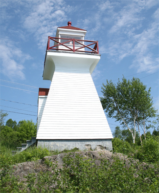

Photo Gallery

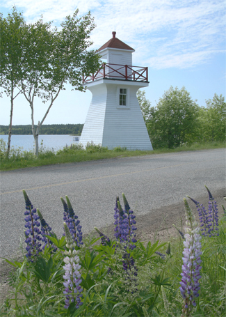

Photo Gallery
Photo Gallery
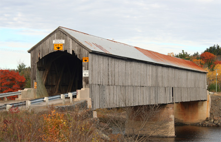
Bayswater Lighthouse was deactivated in 2005. Besides the tower, Bayswater also has an interesting covered bridge, dating from 1920, that spans nearby Milkish Creek.
In 2010, a local community group was given a two-year lease on the lighthouse. They quickly erected scaffolding and painted the tower, and then landscaped the area in 2011.
The group began the process of obtaining the tower in 2012 under the Heritage Lighthouse Protection Act and paid roughly $500 a year to insure the lighthouse. In October 2016, the Department of Fisheries and Oceans (DFO) Canada removed the shingles from the lighthouse and discovered some of the beams in the structure had rotted through in some places. The DFO felt that removing the lighthouse was the only option it had but decided to preserve the lantern and foundation in case the community decided to rebuild the lighthouse. The local community protested the decision to remove the lighthouse and convinced the DFO to salvage the lighthouse. In 2018, the Government of Canada designated Bayswater Lighthouse a Heritage Lighthouse.
More than just beacons for navigation, heritage lighthouses are an integral part of the maritime identity of Canadians, said Alaina Lockhart, Member of Parliament. The Bayswater Lighthouse has been in the community since 1914 and I am delighted with the fact that it is now designated a heritage lighthouse. The lighthouse served traffic along the beautiful Saint John River including a ferry, recreational, fishing and touring vessels and I am happy that our community will continue to protect an important piece of Canadas cultural maritime heritage.
After the federal government provided $80,000 for renovations and maintenance, some internal beams were replaced during the summer of 2019, and the tower was given a fresh coat of paint.
Keepers: F. E. Currie (1913 at least 1923).
References
