Presqu'île Point, ON 

Select a photograph to view a photo gallery
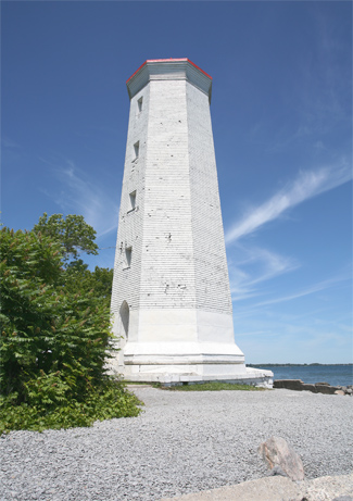
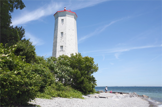

Photo Gallery


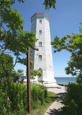

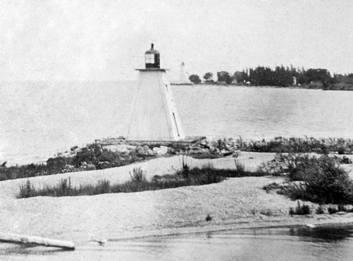

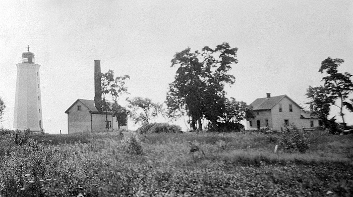

Photo Gallery
Photo Gallery
|
Nichol Baird visited the lighthouse on April 5, 1839 and gave the following report on its state:
To complete the building, there still remains to be done the railing of the stairs two coats of plastering glazing the sashes replacing the main door with one in terms of specification some re-pointing, and levelling-off properly around the building, together with the completion of the clearing and burning-off the quantity of land required per agreement.In addition to this, the lantern room still had to be finished and installed atop the tower.
The sixty-three-foot-tall, octagonal, stone lighthouse was placed in operation in 1840 with William Swetman serving as its keeper. No keepers dwelling was provided in the original contract, but one was finally built in 1846. Keeper Swetman served for thirty years before retiring in 1870 at the age of eighty-five, and he was succeeded by George B. Simpson, his son-in-law, and William J. Swetman, his grandson.
In 1871, the Department of Marine received complaints that timber on the peninsula was rapidly being cut, destroying the natural windbreak that it provided for vessels seeking refuge in Presquile Bay. The department discovered that the peninsula was owned by the government of Ontario and succeeded in having the land transferred to it so the remaining timber could be protected. Keeper Simpson was paid an annual salary of $700 in 1873 for looking after Presquile Point Lighthouse and the range lights on Salt Point, which were erected across the mouth of Presquile Bay in 1851 as a guide for entering the bay, and also for serving as a guardian of the timber on the peninsula.
|
The following description of Presquile Point Lighthouse was given in 1876, while Keeper Sherwood was in charge:
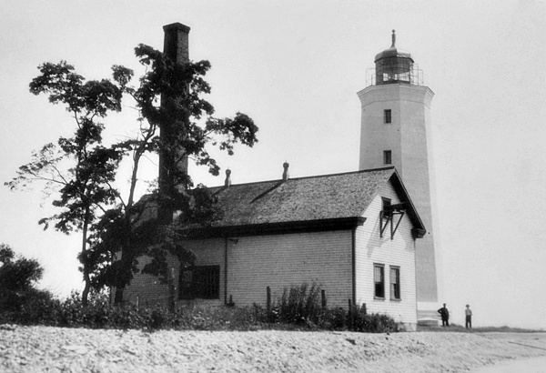
There are ten base-burner fountain lamps on two circles, four on the upper and six on the lower one, and ten 14-inch reflectors. The lantern is of iron, nine feet in diameter with glass 10 1/2 x 13 inches. The light-house is an octagonal stone building, whitewashed, and 66 feet high from the ground to top, of tower, and was put in good repair last fall. It will require whitewashing, however, this season. The pier around the lighthouse requires some repairs. The duties of the station are very well carried out.
Construction of a canal to link the Bay of Quinte with Presquile Bay was proposed as early as 1796, but Welland Canal and Rideau Canal were viewed as more important, and it wasnt until 1882 that work on Murray Canal began. The narrow piece of land that connects Prince Edward County to the mainland has a community called Carrying Place, which is the site were early travelers would portage their vessels between the Bay of Quinte and Lake Ontario.
When the eight-kilometre-long Murray Canal opened to traffic in 1889, navigational aids were needed to marks its entrances and approaches. Three new range lights were established in Presquile Bay in September 1891 to mark the western approach to the canal, and square, pyramidal, open-frame towers were erected on the north pier at both the west and east canal entrances. The new range lights replaced those formerly displayed near Salt Point.
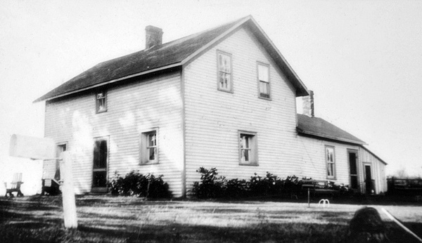
Due to poor stone and workmanship, Presquile Point Lighthouse developed cracks over time, making it necessary in 1893 to place iron bands, planking, and shingling on the tower to prevent water from entering the stonework. At this same time, repairs were made to the keepers dwelling, which was unhealthy and hadnt been occupied for some years. The dwellings cellar was filled up to ground level to prevent the accumulation of water, and the stone residence was lined with ceiling boards and received a full second storey. The amount expended on the dwelling was $1,457.97, while $159 was spent on repairing the cribwork breakwater that protected the tower.
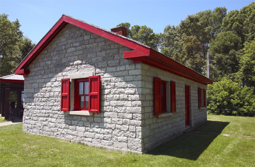
A rectangular, frame fog alarm building, measuring fifty-six-feet-six-inches by twenty-one-feet-three-inches was completed on the point in November 1906, and the following year, a three-inch diaphone plant, provided by the Canadian Fog Signal Company, was installed in it. Powered by compressed air from two air tanks and two compressors, the fog alarm sounded a six-second blast each minute when necessary. William B. Ainsworth was hired as the first fog alarm engineer, and the superintendence of the lighthouse and fog alarm was performed by two men until Ross Carnrite was placed in charge of both in 1927.In 1935, Presquile Point Lighthouse was electrified and the fog signal discontinued, eliminating the need for a full-time keeper. James H. Grimes, keeper of the range lights in Presquile Bay at the time, was given the extra duty of turning Presquile Point Lighthouse on and off. The towers lantern room was removed in 1965, greatly reducing the lighthouses stateliness. Most of the property on the peninsula was transferred from the federal government to the province in 1920, but Presquile Provincial Park was not formally created until 1954. To create a visitor centre, the keepers dwelling was remodeled and expanded, and as part of this work the second storey was removed. Presquile Point Lighthouse Preservation Society was formed in 2012 to repair and refurbish the tower and possibly install a new lantern room.
Keepers: William Swetman, Sr. (1840 1870), George B. Simpson (1870 1871), William J. Swetman (1871 1873), George B. Simpson (1873 1874), William Henry Sherwood (1874 1898), Hugh E. Smith (1898 1912), Fred T. Cornwall (1912 1926), Ross Carnrite (1927 1935).
Fog Alarm: William B. Ainsworth (1907 1914), Hugh C. McColl (1914), James William McColl (1914 1925), Ross Carnrite (1925 1927).
Range Lights (Presquile and Brighton): William Swetman, Jr. (1850 1863), James Cummins (1863 1867), William J. Swetman (1867 1871), George B. Simpson (1871 1887), Hedley V. Simpson (1887 1922), L. McDonald (1922), J. McLagan (1922 1924), H. Gunyo (1925 1927), James H. Grimes (1927 1963).
References


