Mohawk Island, ON 
Select a photograph to view a photo gallery
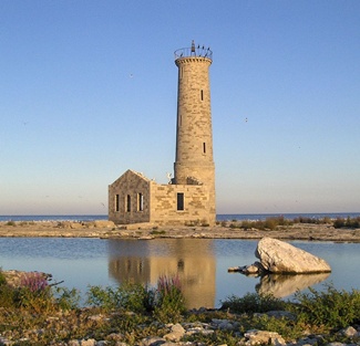


Photo Gallery

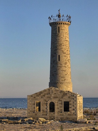
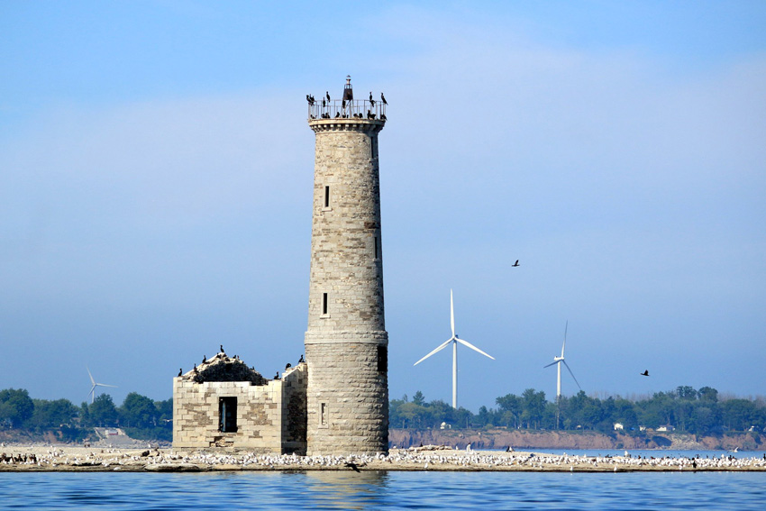
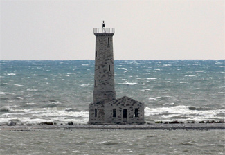
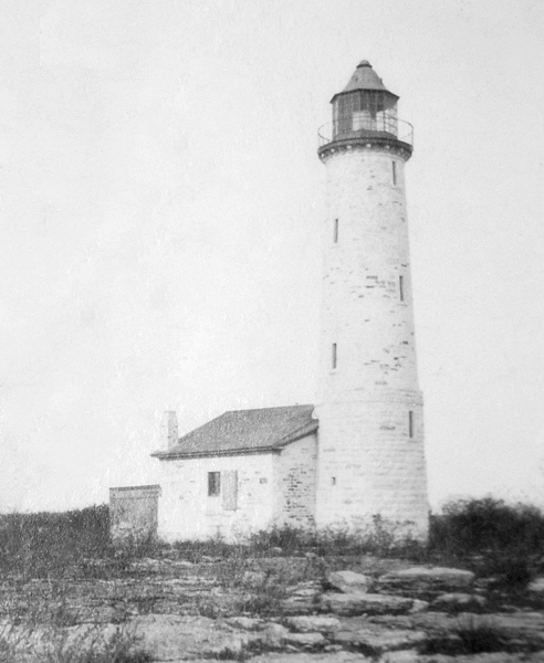
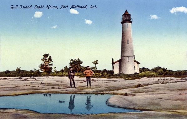
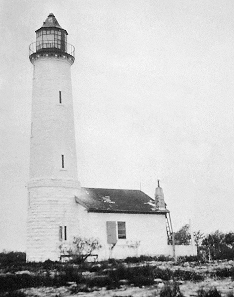

Photo Gallery
Photo Gallery
|
A first class Light on Mohawk Island is now indispensable, from its proximity to Port Maitland at the mouth of the Grand River, which, next spring, will be the outlet to the whole trade up the Welland Canal. It would also be of infinite advantage to vessels plying between Port Colborne, Port Maitland, &c., and Port Dover, or any of the Ports on that part of the Lake, as it may be said to lie in their direct course, and a very long and dangerous reef extends from the Island, upon which a vast deal of property has been lost. Such a Light, with the Pier Light at Port Maitland, would add greatly to the safety of navigating that part of the Lake.
A contract for the construction of Mohawk Island Lighthouse was awarded in 1846 to John Brown, a Scotsman who had worked on the stone locks for the Erie Barge Canal and Welland Canal. Construction of the lighthouse commenced in the spring of 1847, using limestone shipped from Browns quarry in Queenston to Port Maitland via the Welland Canal. The lighthouse was completed in 1847, but due to the late arrival of the lighting apparatus from England, its light could not be placed in operation until the spring of 1848.
After successful completion of the lighthouse on Mohawk Island, Brown was tasked in the 1850s with building what are now known as the six Imperial Towers on Lake Huron as well as a similar tower at Burlington on Lake Ontario.
Mohawk Island Lighthouse originally consisted of a sixty-foot-tall stone tower attached to a one-story dwelling that contained a kitchen, sitting room, a single bedroom, and a central hallway that led from the dwellings entrance to the tower. John Burgess, a farmer from Burgess Point, now Rock Point Provincial Park, was hired as the first keeper of the light at an annual salary of £65. The towers lighting apparatus was equipped with ten lamps, each set in a parabolic reflector, and was revolved by a clockwork mechanism that was powered by a weight suspended in the tower. Every few hours, Keeper Burgess would have to ascend the towers six flights of wooden stairs to wind up the weight and check on the light. One evening the revolving mechanism failed, forcing Keeper Burgess and his son to use a blanket to produce the lights proper flashing pattern.
Sperm oil was originally burned in the lighthouses lamps, but as the demand for the oil exceeded the annual catch, its price became prohibitive, and alternatives were sought. After experiments demonstrated that it had illuminating qualities that matched or exceeded that of sperm oil, coal oil was introduced at the more accessible lighthouses in Canada starting in 1860. The lamps at Mohawk Island were adapted to the use of coal oil in 1864.
|
John Burgess retired in November 1872, and his son was placed in temporary charge of the light until Richard H. Smithers took over the following spring. After keeping the light for twenty-three years, Smithers retired in 1896, and his son, Richard O. Smithers, was appointed keeper. The younger Smithers served on the island for twenty-five years before Richard Foster was placed in charge of the light in 1921.
After having lived in Newfoundland and Nova Scotia, Richard Foster moved to Dunnville in 1915, and shortly thereafter, he enlisted in the 114th Haldimand Battalion and was went overseas to fight in the Great War. The position of lightkeeper was often awarded to veterans and so it was that Foster began his service on Mohawk Island in 1921 at the age of fifty.
An unwatched Aga light was installed at Mohawk Island in 1929 to be used during the winter months, which explains Keeper Fosters logbook entry made at 7:45 a.m. on December 14, 1932: summer light put out and winter light left burning. Keeper Foster typically remained on the island for one day after activating the winter light to ensure it was functioning properly, so he and his twenty-five-year-old son James likely closed up the station and set off in a small skiff for the mile-and-a-half trip to the mainland on December 15.
When the men handt made it home a few days after the steady winter light was seen burning in place of the stations flashing light, friends and family members onshore became concerned. Richard Foster, Jr. and Ovide Charette rowed over to the island and found that the keepers personal belongings were gone along with the stations boat. After returning to Dunnville, the men reported the missing keeper and his son to the Ontario Provincial Police. A search was launched to cover the area between Port Maitland and Port Colborne, but fifteen-foot piles of slush ice along the shore and ice floes in the lake hampered the effort. Despite the efforts of many, the father and son were not found until December 31, when their frozen bodies were discovered on the beach near Point Abino.
|
With the marks on the shore indicating an heroic fight to reach help, only to fail when within hailing distance of a farmhouse and drop back on the sand, exhausted from his fight with the elements and hunger, the body of James Foster was discovered about 200 yards from the waters edge, about three miles east of Port Colborne late Saturday afternoon by a Buffalo lady who had spent the day looking after her cottage. The body was in a good state of preservation with only a slight tear in one trouser leg, and one rubber missing from his feet.With the hope revived that the body of the father might be discovered, crowds gathered on the shore in an extensive search all day Saturday...Ovide Charette, a friend of the family, discovered the body lying in the water and close to the beach about 100 yards from where the body of the son had been found. ...
As there was no water in the lungs of either man, it is now quite certain that they had drifted down the lake 29 miles to where the bodies were found and that the boat went to pieces throwing them into the lake quite near the waters edge. The father may have perished in the boat before it broke up, but it is thought that James struggled to shore in his exhausted condition in a valiant attempt to get help only to fall exhausted after struggling 200 yards from the waters edge.
A second newspaper offered its version of the Jims final moments:
the boat hit ice close enough for Jim, in whom a final spark of life was still burning, to crawl slowly, painfully over the ice hummocks towards safety. He probably shouted feebly, trying to attract attention from a farmhouse faintly visible in the gathering dusk.Frantically he fought to make the top of a sand bank, its sides showing the signs of the terrific struggle, only to collapse at last, and die, face down in the sand, with a happy Canadian home, with welcome and warmth, less than two minutes walk away.
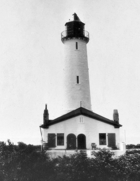
Following this tragedy, Mohawk Island Lighthouse was converted to an unstaffed station, but a caretaker still had to make occasional visits to the island to care for the battery-operated light. Mohawk Island Light was active until 1969, when vandals landed on the island, scaled the tower, and smashed the beacon. A lighted buoy was established offshore to replace the lighthouse, and eight years later, the Department of Transport announced plans to demolish the abandoned lighthouse due to liability concerns. Commercial fishermen, boaters, and lakeshore residents protested the plan, citing the historic value of the lighthouse and its usefulness as a reference point in navigating the area.
With no human residents, Mohawk Island became an important nesting site for terns, ring-billed gulls, and herring gulls, and in 1977, Mohawk Island National Wildlife Area was created. Public access to the island is prohibited during nesting season, which runs from April 1 to July 31.
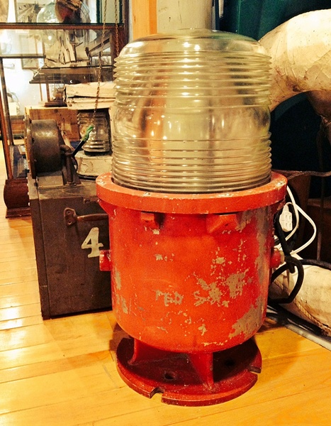
The Mohawk Lighthouse Preservation Association was formed in 1990 to restore and protect the endangered lighthouse, but it appears little visible progress has been made. This beacon, which was reportedly used at Mohawk Island Lighthouse, is on display at the Port Dover Harbour Museum.
Keepers: John Burgess (1848 1872), J.L. Burgess (1872 1873), Richard H. Smithers (1873 1896), Richard O. Smithers (1896 - 1921), Richard Foster (1921 1932).
References

