Queens Wharf, ON 
Select a photograph to view a photo gallery

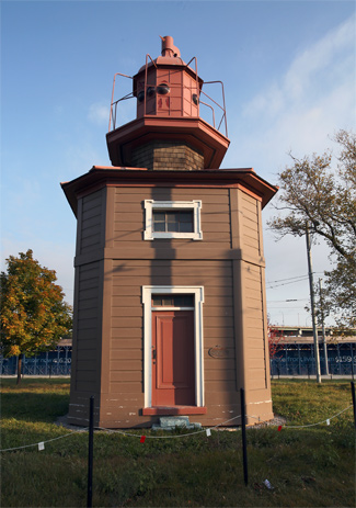

Photo Gallery
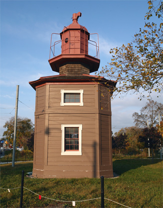

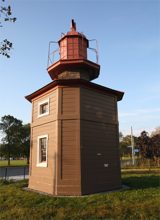

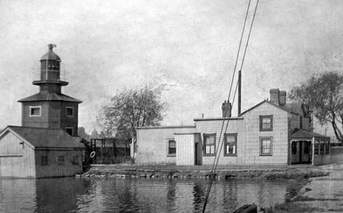


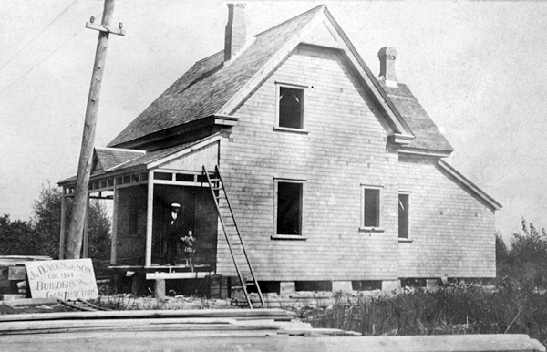
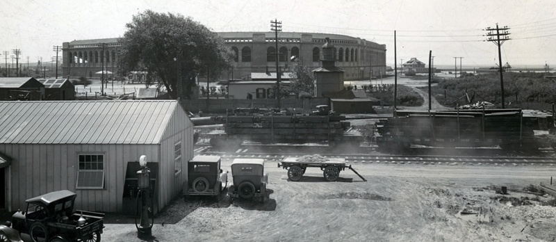

Photo Gallery
Photo Gallery
|
In 1838, a square, wooden tower, which stood sixteen feet tall, was placed on Queens Wharf as a guide for vessels entering Toronto Harbour. A second taller lighthouse, the one now known as Queens Wharf Lighthouse, was erected in 1861 to form a set of range lights that more accurately defined the approach. Kivas Tully, a noted architect, designed the 1861 lighthouse and an accompanying keepers dwelling for the Commissioners of the Harbour of Toronto, who were responsible for Queens Wharf. Tenders for constructing the lighthouse and dwelling were invited through advertisements published in all the provincial papers in May and June of 1861, and the structures were completed later that year. The 1861 lighthouse is a square, wooden structure, whose corners are trimmed to give it an octagonal shape. A Light List from 1878 indicates that the taller tower stood on the western part of the wharf, while the shorter one was located on the arm of pier.
In their annual reports, the Harbour Commissioners responsible for Queens Wharf called the front range lighthouse the White Lighthouse and the rear range lighthouse the Red Lighthouse. This helps understand the following excerpt from their report for 1901:
The White Lighthouse indicating the direction of the range course when in line with Red Lighthouse, was moved about 30 feet to the north-west corner of the Queens Wharf, the new bearing being north 29' 30" east. This change was made to avoid dredging on the north-west point of the shoal, which has extended 400 feet in ten years and is steadily increasing.
|
Early in the morning of November 21, 1906, the steam barge Resolute and its partner schooner P.B. Locke arrived at Toronto Harbour laden with coal from Erie, Pennsylvania for the Toronto Electric Company. As stormy weather prevented the ships from entering the harbour through the east gap, they sought shelter near the western entrance to the harbour, which was too shallow for them to use. While waiting for the weather to improve, the Resolute began taking on water and its cargo shifted. Two lifeboats were launched, but one quickly capsized, sending its five occupants to a watery grave.
Following this tragedy, The Globe, A Toronto newspaper, called for improvements at the western gap:
It will be a standing disgrace to the government of Canada and to the city of Toronto if the work necessary to make this a harbour of refuge is not undertaken at once and completed with all practicable speed. As there is nothing but dredging and pier building to be done the work may be carried on with great rapidity. The wreck of the Resolute, with its attendant loss of life, is a warning that cannot be ignored. A similar tragedy might happen any time during the season of navigation. At present there is no harbour of refuge on the north shore of the lake between Wellers bay and Burlington bay a state of affairs for which the Dominion government and parliament will have to bear a full share of responsibility.
In 1908, a contract was awarded to R. Weddell & Co. to build a new western channel for entering Toronto Harbour. Work on the project commenced that July, and when completed in 1911, it consisted of parallel piers spaced 400 feet apart that were 1,000 feet farther south than the previous entrance. A new location was chosen for the western entrance as deepening the former one would have required blasting through solid rock.
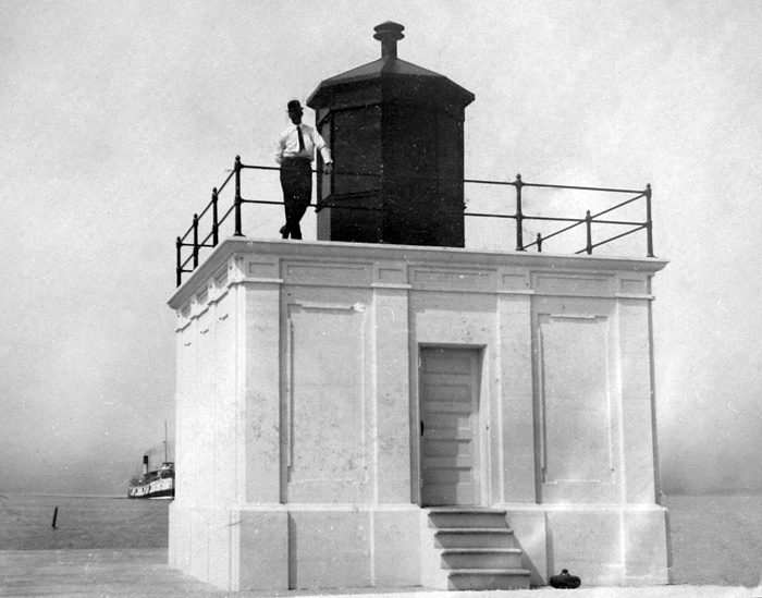
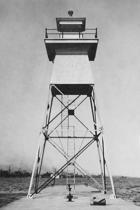
During 1912, a reinforced concrete tower was constructed on the outer end of the south pier to serve as a front light and a two-section, steel, skeletal tower surmounted by a wooden watchroom and lantern room was placed toward the inner end of the south pier to form a set of range lights for entering the new western entrance. A dwelling was also built for the keeper of the new range lights.
While preparations were being made for a new western entrance, the lights used to mark the old one were nearly lost. In its report for 1908, the Harbour Commissioners noted: On July 8 a fire broke out at the Queens wharf, consuming the boat house and contents, and threatening total destruction to all the Commissioner property. By strenuous efforts, the lighthouses and the dwelling house were saved, but more or less injury was done to both. A new iron boat-house, of more convenient proportions, has been erected, the amount of insurance being almost sufficient for the outlay.No longer needed after the opening of the new western entrance, the range lights on Queens Wharf were discontinued at the end of the 1911 shipping season. For many years, Torontos three major railway companies had been filling in the harbour around Queens Wharf to create land for their yards and harbour facilities, and by the time its range lights were discontinued, the wharf was only a stub.
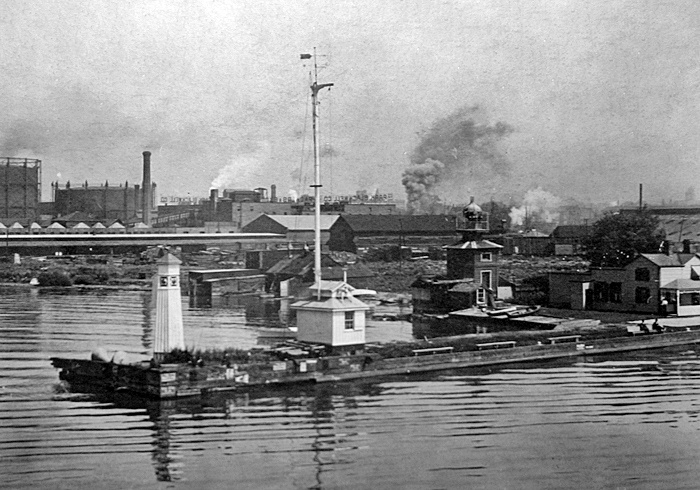
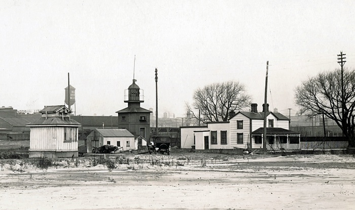
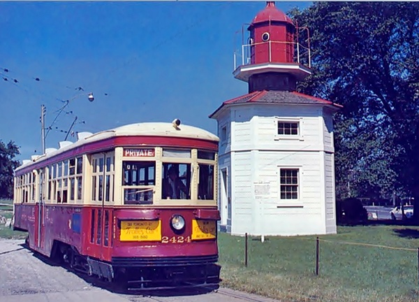
On September 1, 1918, the abandoned front range light on Queens Wharf was destroyed by fire, and in 1929, the Toronto Harbour Commission transferred ownership of the remaining lighthouse to the City of Toronto. In late 1929, the lighthouse was placed atop wooden rollers and pulled roughly 450 metres west to its present location. The distance from the lighthouse to the water gives an indication of just how much the harbour was filled in over the years. Queens Wharf Lighthouse was painted white for some time in its new location, but it is now a more historically accurate reddish brown.
Keepers:
Queens Wharf: Henry Smith ( 1843), James Hickman (at least 1849 at least 1850), Captain Archibald Taylor (1877 1896), Captain William Hall (1896 1907), John Mead Allan (1907 1911).
West Gap: Fred Ward (1912 1917), J. B. Larder (1917 at least 1937).
References

