Point Edward Range, ON 
Select a photograph to view a photo gallery
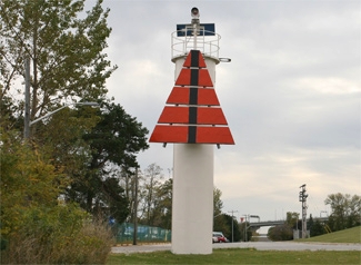


Photo Gallery

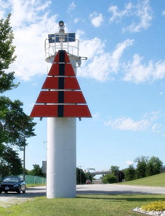
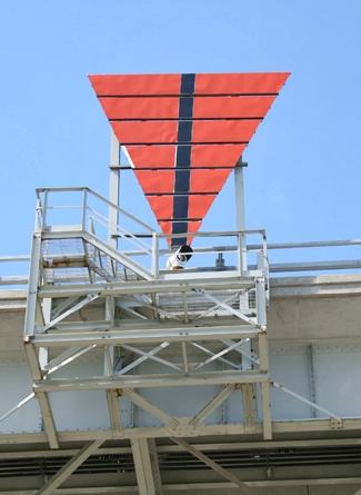

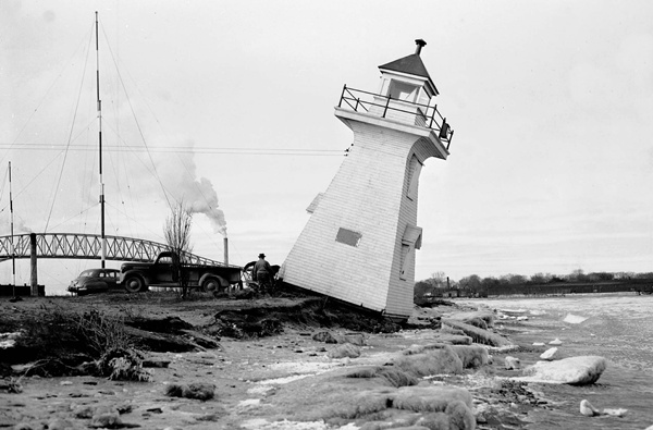
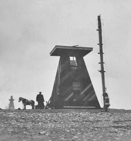
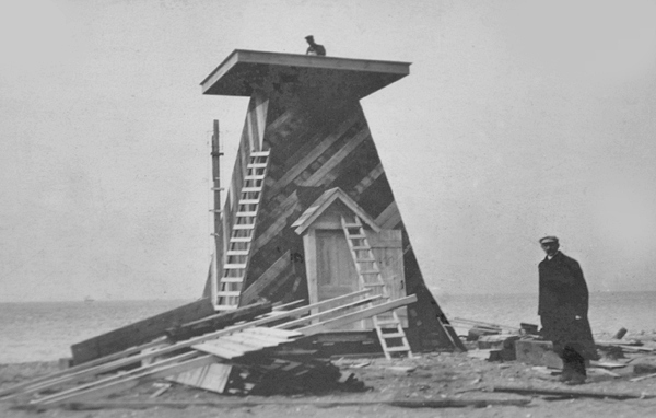
Photo Gallery
Photo Gallery
|
The towers are wooden structures, square in plan, with sloping sides, surmounted by square wooden lanterns, the whole painted white.The front tower stands on the beach. 107 feet back from the waters edge. The height of the tower from its base to the top of the ventilator on the lantern is 34 feet. The light a fixed red light, elevated 35 feet above the level of the lake, should be visible 7 miles from all points of approach by water. The illuminating apparatus is dioptric of the seventh order.
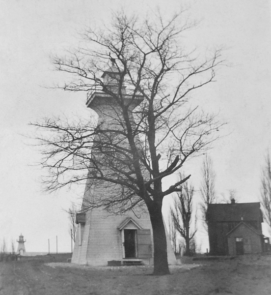
The back tower stands on the same beach, 579 feet from the front tower. The height of the tower from its base to the top of the ventilator on the lantern is 54 feet. The light is a fixed red light, elevated 58 feet above the level of the lake and should be visible 8 miles in the line of range. The illuminating apparatus is catoptric.
The buildings were erected by days labour, under the supervision of Mr. W. K. Morris, of Ottawa, and cost $2,119.86.
A fifth-order French lens was placed in the front range tower in 1909, but on April 18th of the following year, the wooden lighthouse was struck by lightning and destroyed. A temporary light was shown from a lantern hoisted atop a pole until the Department of Marine had a new tower in place about a month later.
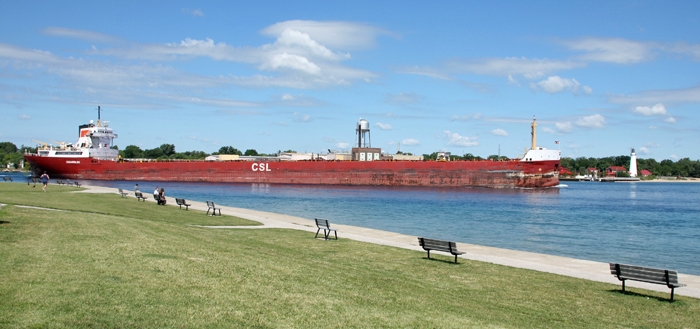
In 1939, the back range light was established on the new International Bridge between Sarnia and Port Huron, where it was 2,266 feet from the front light. The current cylindrical concrete tower used for the front light was erected in 1959.
Head Keepers: Thomas K. Shaw (1903 1907), Louis Knauff (1908 at least 1923).
References